File:Slovakia borders1947.png
Jump to navigation
Jump to search

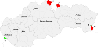
Size of this preview: 800 × 390 pixels. Other resolutions: 320 × 156 pixels | 640 × 312 pixels | 1,000 × 488 pixels.
Original file (1,000 × 488 pixels, file size: 138 KB, MIME type: image/png)
Captions
Captions
Add a one-line explanation of what this file represents
Summary
[edit]
| Description |
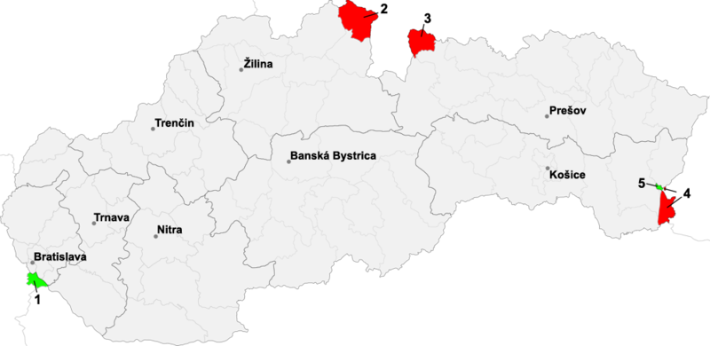
English: Map of Slovakia with border-changes until 1947
|
| Date | 14 April 2006 (original upload date) |
| Source | No machine-readable source provided. Own work assumed (based on copyright claims). |
| Author | No machine-readable author provided. Murli assumed (based on copyright claims). |
Licensing
[edit]
I, the copyright holder of this work, hereby publish it under the following licenses:

|
Permission is granted to copy, distribute and/or modify this document under the terms of the GNU Free Documentation License, Version 1.2 or any later version published by the Free Software Foundation; with no Invariant Sections, no Front-Cover Texts, and no Back-Cover Texts. A copy of the license is included in the section entitled GNU Free Documentation License. |
| This file is licensed under the Creative Commons Attribution-Share Alike 3.0 Unported license. | ||
| ||
| This licensing tag was added to this file as part of the GFDL licensing update. |
This file is licensed under the Creative Commons Attribution-Share Alike 2.5 Generic, 2.0 Generic and 1.0 Generic license.
- You are free:
- to share – to copy, distribute and transmit the work
- to remix – to adapt the work
- Under the following conditions:
- attribution – You must give appropriate credit, provide a link to the license, and indicate if changes were made. You may do so in any reasonable manner, but not in any way that suggests the licensor endorses you or your use.
- share alike – If you remix, transform, or build upon the material, you must distribute your contributions under the same or compatible license as the original.
You may select the license of your choice.
File history
Click on a date/time to view the file as it appeared at that time.
| Date/Time | Thumbnail | Dimensions | User | Comment | |
|---|---|---|---|---|---|
| current | 14:05, 15 April 2006 | | 1,000 × 488 (138 KB) | Murli (talk | contribs) | minor border corrections |
| 16:49, 14 April 2006 |  | 1,000 × 488 (136 KB) | Murli (talk | contribs) | *map of Slovakia with border-changes until 1947 *selfprovided on April 14th, 2006 *1 - Bratislava bridgehead, 1947 from Hungary (confer de:Bratislavaer Brückenkopf for more information) *2 - Jablonka territories, from 1918-1939 and after 1945 to Pol |
You cannot overwrite this file.
File usage on Commons
The following page uses this file:
File usage on other wikis
The following other wikis use this file:
- Usage on de.wikipedia.org
- Usage on en.wikipedia.org
- Usage on eo.wikipedia.org
- Usage on it.wikipedia.org
- Usage on sk.wikipedia.org
- Usage on tr.wikipedia.org