File:Sodom School PA 2.jpg
Jump to navigation
Jump to search
Size of this preview: 800 × 600 pixels. Other resolutions: 320 × 240 pixels | 640 × 480 pixels | 1,024 × 768 pixels | 1,280 × 960 pixels | 2,563 × 1,922 pixels.
Original file (2,563 × 1,922 pixels, file size: 1.81 MB, MIME type: image/jpeg)
Captions
Captions
Add a one-line explanation of what this file represents
Summary
[edit]
| Description |
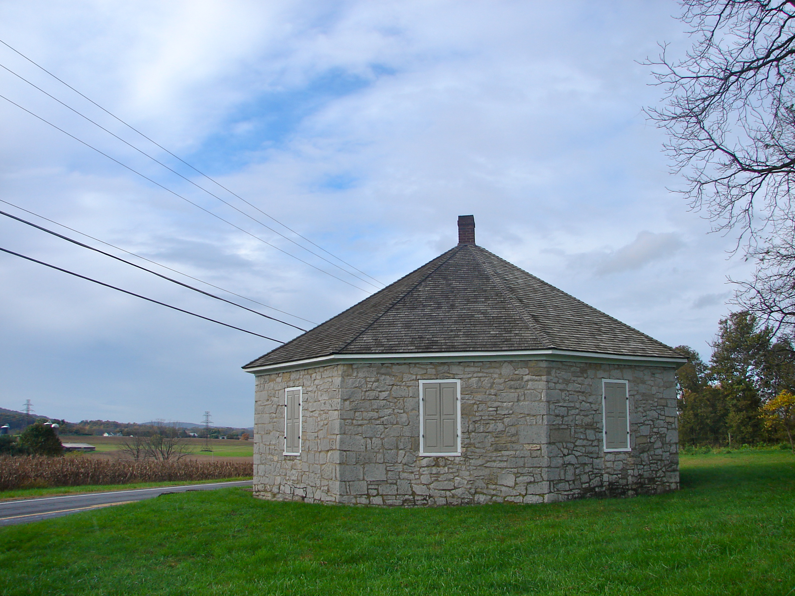
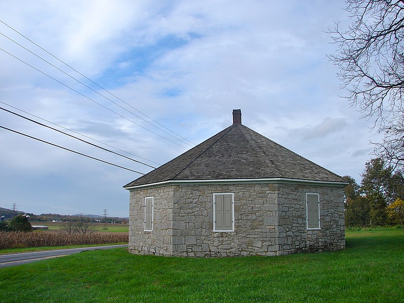
English: Sodom Schoolhouse, from the north northwest, on the NRHP since February 12, 1974. East of Lewisburg and Montandon on Pennsylvania Route 45, in West Chillisquaque Township, Northumberland County, Pennsylvania |
| Date | |
| Source | Own work |
| Author | Smallbones |
| Camera location | | View this and other nearby images on: OpenStreetMap |
|---|
|
This is an image of a place or building that is listed on the National Register of Historic Places in the United States of America. Its reference number is 74001799. |
Licensing
[edit]
I, the copyright holder of this work, hereby publish it under the following license:
| This file is made available under the Creative Commons CC0 1.0 Universal Public Domain Dedication. | |
| The person who associated a work with this deed has dedicated the work to the public domain by waiving all of their rights to the work worldwide under copyright law, including all related and neighboring rights, to the extent allowed by law. You can copy, modify, distribute and perform the work, even for commercial purposes, all without asking permission.
|
File history
Click on a date/time to view the file as it appeared at that time.
| Date/Time | Thumbnail | Dimensions | User | Comment | |
|---|---|---|---|---|---|
| current | 04:30, 20 October 2011 | | 2,563 × 1,922 (1.81 MB) | Smallbones (talk | contribs) |
You cannot overwrite this file.
File usage on Commons
There are no pages that use this file.
File usage on other wikis
The following other wikis use this file:
Metadata
Categories:
- National Register of Historic Places in Northumberland County, Pennsylvania
- Schools on the National Register of Historic Places in Pennsylvania
- Octagonal buildings in the United States
- Former schoolhouses in Pennsylvania
- Built in Pennsylvania in 1835
- Stone buildings in Pennsylvania
- Buildings in Northumberland County, Pennsylvania