File:Soldiers, Tomb of Ahmose, Amarna.jpg
Original file (2,560 × 1,920 pixels, file size: 2 MB, MIME type: image/jpeg)
Captions
Captions
Summary[edit]
| Description |
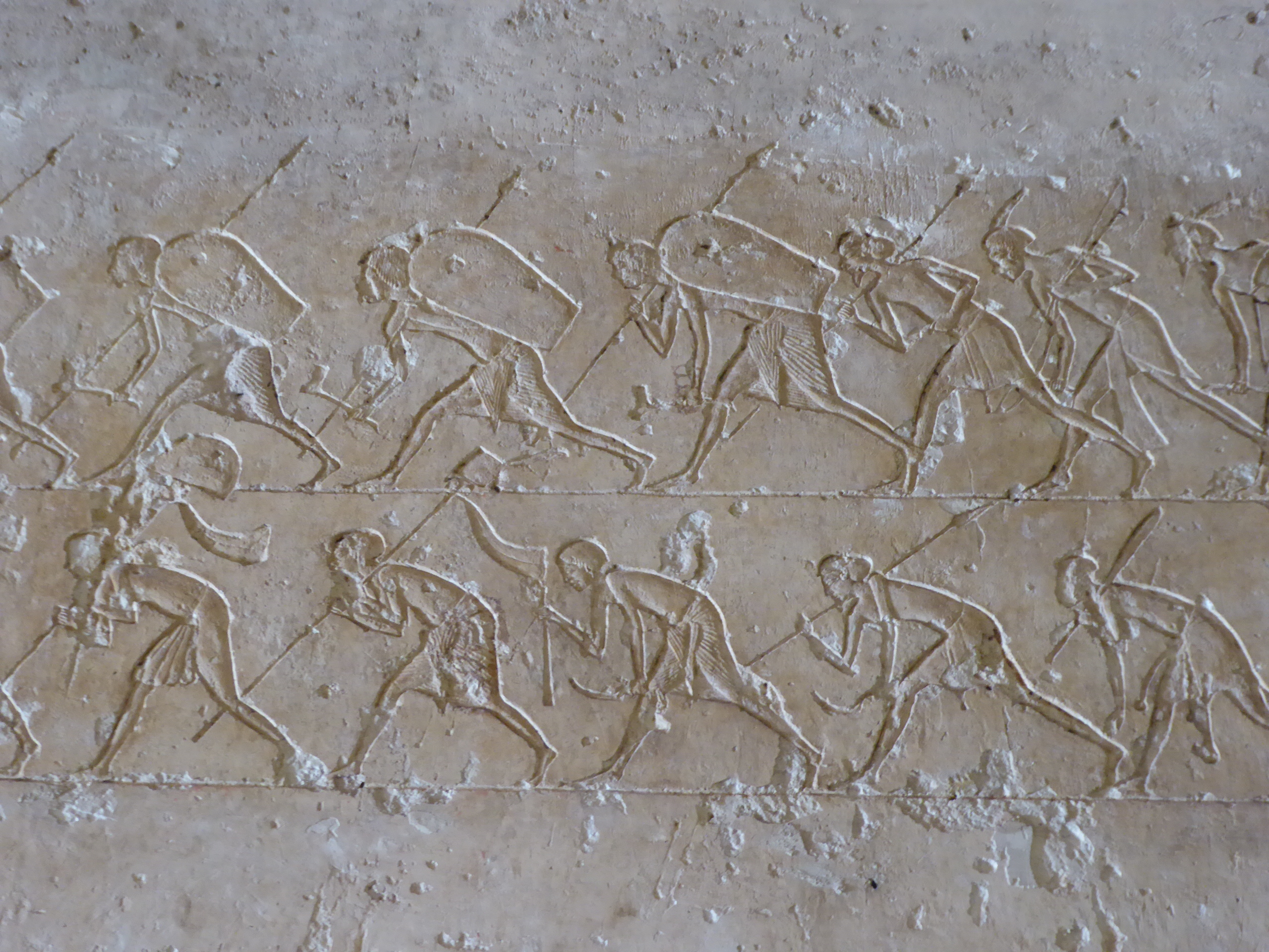
English: Soldiers, Tomb of Ahmose, Amarna
The Nobles' Tombs in the northern cliffs of Amarna are some of the best preserved and most rewarding features surviving at the site of Akhetaten. The decoration is better preserved on the whole and reveals much about life during the Amarnan revolution. Tell el Amarna is the site of something unique in Egypt's history, the brand new capital city by the 'heretic' pharaoh Amenophis IV, better known by the name Akhenaten. Today little remains of the ancient city beyond its foundations (largely hidden amidst the sand dunes), but its significance makes it one of the country's most important archaeological sites. Akhenaten's reign is marked by a radical break with Egypt's ancient religion, the pharaoh abandoned the multitude of traditional gods in favour of a single deity, the Aten, the life giving sun-disc. A new city was built on a desert site, chosen for its proximity to a geographical feature that appeared to enfold the rising sun, and established to cement Egypt's revolution away from the priests and cult centre of Thebes. The city was named 'Akhetaten' and served as the cult centre of the pharoah's new religion with himself as the chief intermediary of the new god. Akhenaten is often celebrated as one of history's earliest monotheistic rulers. The city had a short life, as did Akhenaten's new religion, with the traditional order and power base restored following his death under the reign of his son Tutankhaten (better known as Tutankhamun, the name he adopted after abandoning the Atenist religion). The site was plundered for materials over the following decades and little remains visible beyond the tombs carved into the nearby cliffs. The palaces and the once great temple of Aten have all but disappeared, though two columns of the nearby small temple have been reconstructed in recent years. The desolate nature of the site has however preserved much of the city's layout, since unlike most ancient Egyptian settlements it remained uninhabited over the millennia. For more on this intriguing site see below:- en.wikipedia.org/wiki/Amarna |
| Date | |
| Source | https://www.flickr.com/photos/amthomson/40079860195/ |
| Author | Aidan McRae Thomson |
| Camera location | | View this and other nearby images on: OpenStreetMap |
|---|
Licensing[edit]
- You are free:
- to share – to copy, distribute and transmit the work
- to remix – to adapt the work
- Under the following conditions:
- attribution – You must give appropriate credit, provide a link to the license, and indicate if changes were made. You may do so in any reasonable manner, but not in any way that suggests the licensor endorses you or your use.
- share alike – If you remix, transform, or build upon the material, you must distribute your contributions under the same or compatible license as the original.
| This image was originally posted to Flickr by Aidan McRae Thomson at https://flickr.com/photos/24141292@N02/40079860195. It was reviewed on 16 June 2020 by FlickreviewR 2 and was confirmed to be licensed under the terms of the cc-by-sa-2.0. |
File history
Click on a date/time to view the file as it appeared at that time.
| Date/Time | Thumbnail | Dimensions | User | Comment | |
|---|---|---|---|---|---|
| current | 11:20, 16 June 2020 | | 2,560 × 1,920 (2 MB) | पाटलिपुत्र (talk | contribs) | Uploaded a work by Aidan McRae Thomson from https://www.flickr.com/photos/amthomson/40079860195/ with UploadWizard |
You cannot overwrite this file.
File usage on Commons
There are no pages that use this file.
File usage on other wikis
The following other wikis use this file:
- Usage on he.wikipedia.org