File:Solomon Islands 1989.jpg
跳至導覽
跳至搜尋
預覽大小:750 × 600 像素。 其他解析度:300 × 240 像素 | 600 × 480 像素 | 961 × 768 像素 | 1,203 × 962 像素。
原始檔案 (1,203 × 962 像素,檔案大小:131 KB,MIME 類型:image/jpeg)
說明
說明
添加單行說明來描述出檔案所代表的內容
摘要
[編輯]
| 描述 |
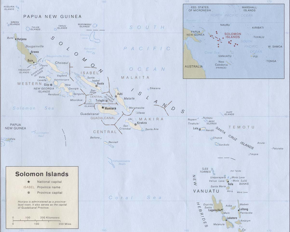
English: Map of the Solomon Islands as of 1989. Province names are included, except for two new provinces as of 1995: the Rennell and Bellona Province (formerly part of Central Province) and the Choiseul Province (formerly part of Western Province). |
| 日期 | |
| 來源 | Solomon Islands (Political) 1989 from Perry-Castañeda Library Map Collection: Solomon Islands Maps. Cropped to remove white space from edges of map. |
| 作者 | U.S. Central Intelligence Agency |
| 授權許可 (重用此檔案) |
Public domain |
授權條款
[編輯]
| 本圖像是中央情報局僱員的職務作品。作為美國聯邦政府的作品,本圖像或媒體屬於公有領域。
|

|
檔案歷史
點選日期/時間以檢視該時間的檔案版本。
| 日期/時間 | 縮圖 | 尺寸 | 使用者 | 備註 | |
|---|---|---|---|---|---|
| 目前 | 2009年8月25日 (二) 19:27 | | 1,203 × 962(131 KB) | Zyxw(留言 | 貢獻) | == {{int:filedesc}} == {{Information | description = {{en|Map of the Solomon Islands as of 1989. Province names are included, except for two new provinces as of 1995: the [[:en:Rennell and B |
無法覆蓋此檔案。
檔案用途
沒有使用此檔案的頁面。
全域檔案使用狀況
以下其他 wiki 使用了這個檔案:
- af.wikipedia.org 的使用狀況
- ar.wikipedia.org 的使用狀況
- az.wiktionary.org 的使用狀況
- bg.wikipedia.org 的使用狀況
- br.wikipedia.org 的使用狀況
- ca.wikipedia.org 的使用狀況
- cs.wikipedia.org 的使用狀況
- en.wikipedia.org 的使用狀況
- es.wikipedia.org 的使用狀況
- eu.wikipedia.org 的使用狀況
- fr.wikipedia.org 的使用狀況
- gl.wikipedia.org 的使用狀況
- hr.wikipedia.org 的使用狀況
- hu.wikipedia.org 的使用狀況
- hy.wikipedia.org 的使用狀況
- id.wikipedia.org 的使用狀況
- pa.wikipedia.org 的使用狀況
- pl.wikipedia.org 的使用狀況
- pl.wiktionary.org 的使用狀況
- pt.wikipedia.org 的使用狀況
- ro.wikipedia.org 的使用狀況
- ru.wikipedia.org 的使用狀況
- sco.wikipedia.org 的使用狀況
- simple.wikipedia.org 的使用狀況
- su.wikipedia.org 的使用狀況
- tpi.wikipedia.org 的使用狀況
- tr.wikipedia.org 的使用狀況
- uk.wikipedia.org 的使用狀況
檢視此檔案的更多全域使用狀況。