File:SouthAmericaLocation.svg
Jump to navigation
Jump to search

Size of this PNG preview of this SVG file: 463 × 236 pixels. Other resolutions: 320 × 163 pixels | 640 × 326 pixels | 1,024 × 522 pixels | 1,280 × 652 pixels | 2,560 × 1,305 pixels.
Original file (SVG file, nominally 463 × 236 pixels, file size: 290 KB)
Captions
Captions
Add a one-line explanation of what this file represents
Summary[edit]
| Description |
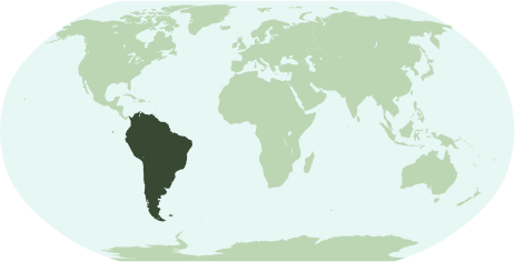
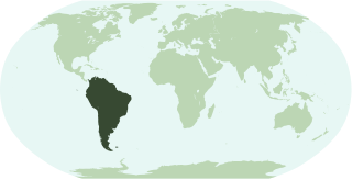
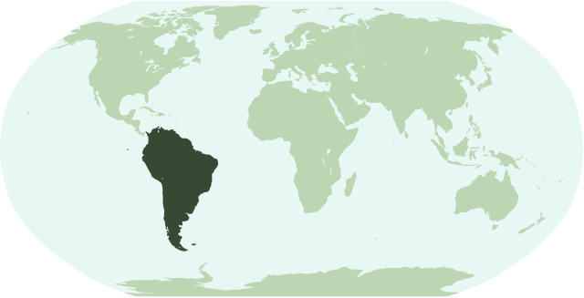
English: Map showing the location of the continent of South America.
Français : Une carte pour démontrer la location du continent de l'Amérique du Sud.
Interlingua: Un Mapa monstrante le location del continente de America del Sud. |
| Date | |
| Source | Own work |
| Author | Notscott |
Licensing[edit]
| I, the copyright holder of this work, release this work into the public domain. This applies worldwide. In some countries this may not be legally possible; if so: I grant anyone the right to use this work for any purpose, without any conditions, unless such conditions are required by law. |
File history
Click on a date/time to view the file as it appeared at that time.
| Date/Time | Thumbnail | Dimensions | User | Comment | |
|---|---|---|---|---|---|
| current | 01:49, 15 January 2007 | | 463 × 236 (290 KB) | Notscott (talk | contribs) | |
| 01:43, 15 January 2007 |  | 463 × 236 (290 KB) | Notscott (talk | contribs) | == Summary == {{en|Map showing the location of the continent of South America.}} {{fr|Une carte pour démontrer la location du continent de l'Amérique du Sud.}} {{ia|Un Mapa monstrante le location del continente de America del Sud.}} == Licensing == {{P |
You cannot overwrite this file.
File usage on Commons
There are no pages that use this file.
File usage on other wikis
The following other wikis use this file:
- Usage on arc.wikipedia.org
- Usage on arz.wikipedia.org
- برازيل
- امريكا الجنوبيه
- ارجنتين
- سورينام
- بيرو
- كولومبيا
- جزر فوكلاند
- جيانا الفرنساويه
- قالب:امريكا الجنوبيه
- قالب:امريكا الجنوبية/شرح
- قالب:شرح استعمال قوالب القارات
- تشيلى
- اروبا
- اكوادور
- جزر جورجيا و ساندويتش الجنوبيه
- ترينيداد و توباجو
- فالبارايسو
- نشيد الاكوادور الوطنى
- نشيد السلفادور الوطنى
- نشيد باراجواى الوطنى
- نشيد جواتيمالا الوطنى
- قالب:اناشيد دول امريكا الجنوبيه
- قالب:جامعات امريكا الجنوبيه
- جزر الانتيل الهولنديه
- Usage on bi.wikipedia.org
- Usage on bpy.wikipedia.org
- Usage on ckb.wikipedia.org
- Usage on en.wikipedia.org
- Usage on es.wikipedia.org
- Usage on glk.wikipedia.org
- Usage on ia.wikipedia.org
View more global usage of this file.