File:South Tottenham Stroll (15409066219).jpg
Original file (3,000 × 2,251 pixels, file size: 1.78 MB, MIME type: image/jpeg)
Captions
Captions
Summary
[edit].jpg&action=edit§ion=1)
| Description |
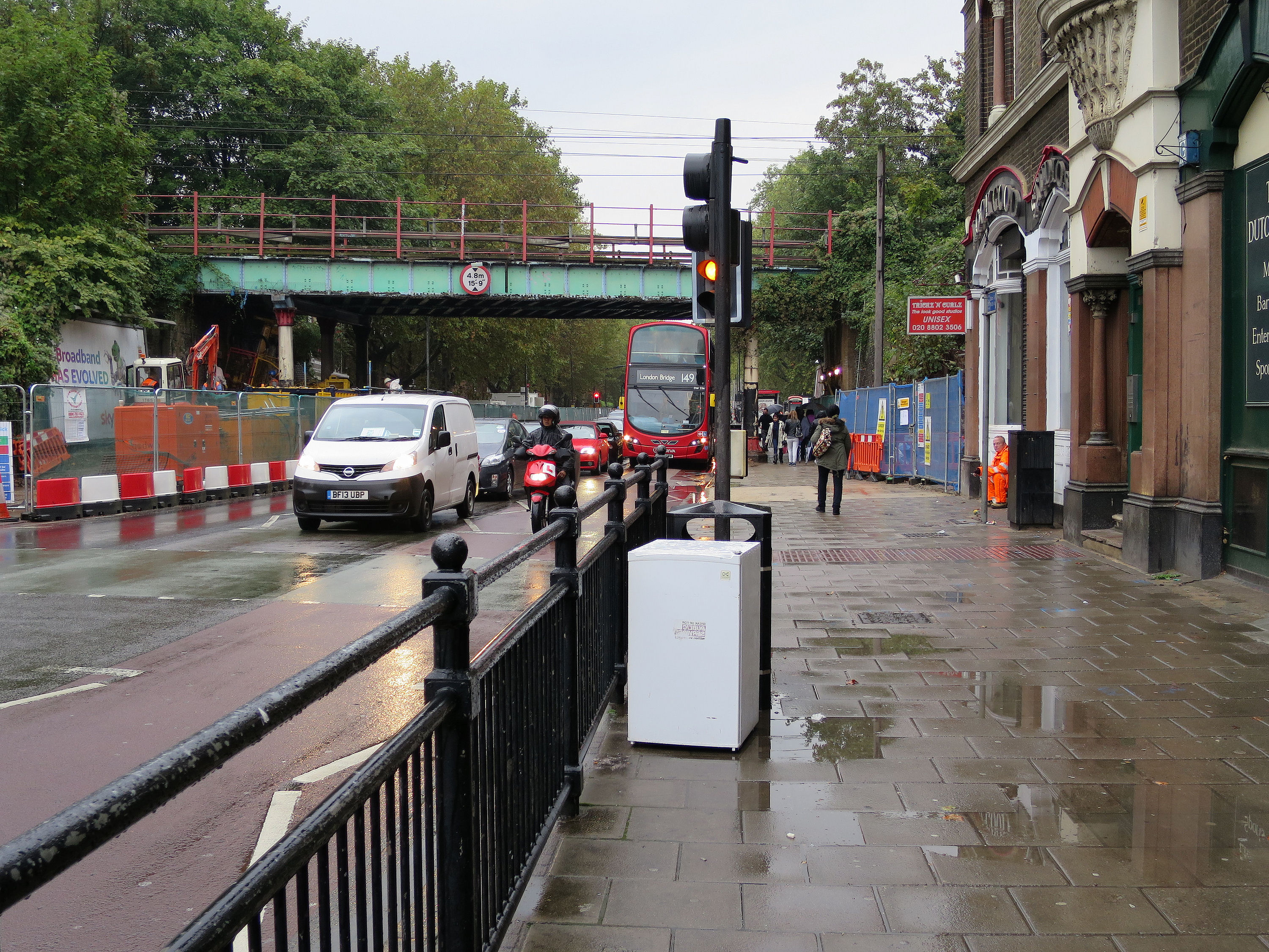
Seems to me there's always something new dumped near this crossing in High Road Tottenham, just south of the railway bridge at South Tottenham Station. New but not always fresh. But on 8 October 2014, works were underway and the pavement was closed on the western side of the road. So there was no room for the regular, huge and smelly pile of rubbish bags which were often there. I think of these, jokingly, as Mount Kober. Because, when walking past, my thoughts would turn to Cllr Claire Kober, the Dear Leader of Haringey Council. Not only is this area part of Seven Sisters ward - which she represents - but in May 2014 Claire publicly proclaimed her touching belief that: "our streets are now among the cleanest in London". . On 8 October, the detritus display (garbage gallery?) began with a dumped fridge. As I strolled further along the High Road and in a few of the streets nearby, I saw various items of rubbish arranged on pavements. Now recorded in <a href="https://www.flickr.com/photos/alanstanton/sets/72157646947586553">a little photo album</a>. ____________________________ § To be be fair, it wasn't in the same class of crud as Martin Ball's 26 September 2014 evening <a href="http://www.tottenhamjournal.co.uk/news/features_2_4558/comment_after_a_walk_home_like_this_haringey_council_must_stop_being_rubbish_with_rubbish_1_3802300" rel="noreferrer nofollow">Walk of Shame</a> north from Seven Sisters tube station. § Nor was it in the same league of leftovers as the dumping spots highlighted by @NoelPark22 - a group of Haringey residents are <a href="https://mobile.twitter.com/NoelParkN22/status/524618676566491138?p=p" rel="noreferrer nofollow">"tired of living in a rubbish tip"</a>. Find and follow them them and their photos on Twitter at: <a href="https://twitter.com/hashtag/litterpix" rel="noreferrer nofollow">twitter.com/hashtag/litterpix</a> |
| Date | |
| Source | South Tottenham Stroll |
| Author | Alan Stanton |
| Camera location | | View this and other nearby images on: OpenStreetMap |
|---|
.jpg¶ms=051.579956_N_-000.072675_E_globe:Earth_type:camera_source:Flickr_&language=en)
Licensing
[edit].jpg&action=edit§ion=2)
- You are free:
- to share – to copy, distribute and transmit the work
- to remix – to adapt the work
- Under the following conditions:
- attribution – You must give appropriate credit, provide a link to the license, and indicate if changes were made. You may do so in any reasonable manner, but not in any way that suggests the licensor endorses you or your use.
- share alike – If you remix, transform, or build upon the material, you must distribute your contributions under the same or compatible license as the original.
| This image was originally posted to Flickr by Alan Stanton at https://flickr.com/photos/53921762@N00/15409066219. It was reviewed on 7 December 2020 by FlickreviewR 2 and was confirmed to be licensed under the terms of the cc-by-sa-2.0. |
File history
Click on a date/time to view the file as it appeared at that time.
| Date/Time | Thumbnail | Dimensions | User | Comment | |
|---|---|---|---|---|---|
| current | 09:08, 7 December 2020 | | 3,000 × 2,251 (1.78 MB) | TheImaCow (talk | contribs) | Transferred from Flickr via #flickr2commons |
You cannot overwrite this file.
File usage on Commons
There are no pages that use this file.
.jpg&oldid=822964259)