File:Soviet Caucasus map.svg
ナビゲーションに移動
検索に移動

この SVG ファイルのこの PNG プレビューのサイズ: 712 × 600 ピクセル. その他の解像度: 285 × 240 ピクセル | 570 × 480 ピクセル | 912 × 768 ピクセル | 1,216 × 1,024 ピクセル | 2,432 × 2,048 ピクセル | 747 × 629 ピクセル。
元のファイル (SVG ファイル、747 × 629 ピクセル、ファイルサイズ: 731キロバイト)
キャプション
キャプション
このファイルの内容を1行で記述してください
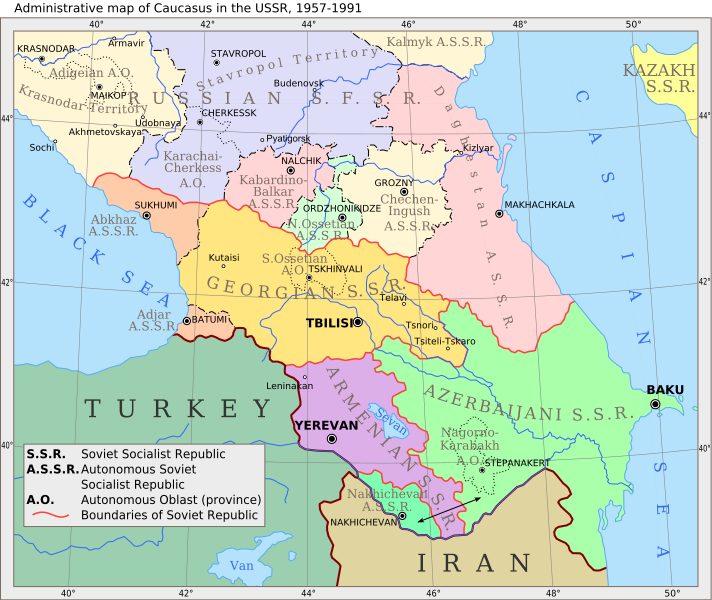
Administrative Map of the Caucasus in the USSR, 1957-1991
概要
[編集]
| 解説 |
English: Administrative map of Caucasus in USSR, 1957-1991 |
| 日付 | (UTC) |
| 原典 | |
| 作者 |
|
| その他のバージョン |
 |
この画像には画像編集が施されています。原本に対して次のデジタル的な変更が行われました。
|
ライセンス
[編集]
この作品の著作権者である私は、この作品を以下のライセンスで提供します。
| このファイルはクリエイティブ・コモンズ 表示-継承 3.0 非移植ライセンスのもとに利用を許諾されています。 | ||
| ||
| このライセンスのテンプレートは、GFDLのライセンス・アップデートによりこのファイルに追加されたものです。 |

|
この文書は、フリーソフトウェア財団発行のGNUフリー文書利用許諾書 (GNU Free Documentation License) 1.2またはそれ以降のバージョンの規約に基づき、複製や再配布、改変が許可されます。不可変更部分、表紙、背表紙はありません。このライセンスの複製は、GNUフリー文書利用許諾書という章に含まれています。 |
あなたは上記のライセンスから、どれか一つ以上を選択できます。
元のアップロードログ
[編集]
This image is a derivative work of the following images:
- File:Caucasiamapussr.gif licensed with Cc-by-sa-3.0-migrated, GFDL
- 2011-03-27T04:49:14Z Hellerick 700x590 (82529 Bytes) The earlier changes were correct.
- 2011-01-16T19:12:39Z Geagea 700x590 (60613 Bytes) Reverted to version as of 10:16, 24 February 2007. To the uploader's last version
- 2011-01-16T18:38:27Z Nicolay Sidorov 700x590 (82529 Bytes) Adygea to Krasnodar, Karachay-Cherkess to Stavropol.
- 2011-01-16T18:31:42Z Nicolay Sidorov 700x590 (82116 Bytes) The Chechen-Ingush republic was restored on January 9, 1957
- 2007-02-24T10:16:08Z Hardscarf 700x590 (60613 Bytes) {{Information |Description=Administrative map of [[:en:Caucasus]] in USSR, 1952-1991 |Source=Armenica.org {{ConfirmationImageOTRS|source=http://armenica.org/|otrs=2007010210006387}} Originally from [http://en.wikipedia.org en
Uploaded with derivativeFX
ファイルの履歴
過去の版のファイルを表示するには、その版の日時をクリックしてください。
| 日付と時刻 | サムネイル | 寸法 | 利用者 | コメント | |
|---|---|---|---|---|---|
| 現在の版 | 2017年6月14日 (水) 09:37 | | 747 × 629 (731キロバイト) | Hellerick (トーク | 投稿記録) | moved Grozny; replaced Prokhladni with Pyatigorsk |
| 2011年3月29日 (火) 11:08 |  | 700 × 590 (701キロバイト) | Hellerick (トーク | 投稿記録) | Still fixing font bug | |
| 2011年3月29日 (火) 11:05 |  | 700 × 590 (682キロバイト) | Hellerick (トーク | 投稿記録) | Still fixng font bug | |
| 2011年3月29日 (火) 11:02 |  | 700 × 590 (589キロバイト) | Hellerick (トーク | 投稿記録) | Fixed font bug | |
| 2011年3月29日 (火) 10:57 |  | 700 × 590 (152キロバイト) | Hellerick (トーク | 投稿記録) | Fexed external link bug | |
| 2011年3月29日 (火) 10:56 |  | 700 × 590 (181キロバイト) | Hellerick (トーク | 投稿記録) | {{Information |Description=Administrative map of en:Caucasus in USSR, 1957-1991 |Source=*File:Caucasiamapussr.gif |Date=2011-03-29 10:53 (UTC) |Author=*File:Caucasiamapussr.gif: Original uploader was Artaxiad at [htt |
このファイルは上書きできません。
ファイルの使用状況
以下の 5 ページがこのファイルを使用しています:
グローバルなファイル使用状況
以下に挙げる他のウィキがこの画像を使っています:
- ar.wikipedia.org での使用状況
- ast.wikipedia.org での使用状況
- av.wikipedia.org での使用状況
- azb.wikipedia.org での使用状況
- az.wikipedia.org での使用状況
- be.wikipedia.org での使用状況
- bg.wikipedia.org での使用状況
- bn.wikipedia.org での使用状況
- bs.wikipedia.org での使用状況
- ca.wikipedia.org での使用状況
- ce.wikipedia.org での使用状況
- ckb.wikipedia.org での使用状況
- cs.wikipedia.org での使用状況
このファイルのグローバル使用状況を表示する。
メタデータ
カテゴリ:
- Maps of the Armenian Soviet Socialist Republic
- Maps of the Azerbaijan Soviet Socialist Republic
- Maps of the Georgian Soviet Socialist Republic
- Maps of the Russian Soviet Federative Socialist Republic
- Maps of the Transcaucasian Socialist Federative Soviet Republic
- Maps of the history of Abkhazia
- Maps of the history of Adygea
- Maps of the history of Ajaria
- Maps of the history of Armenia
- Maps of the history of the Caucasus under Soviet rule
- Maps of the history of Chechnya
- Maps of the history of Dagestan
- Maps of the history of Georgia
- English-language SVG maps showing history