File:Spanish Florida Map 1803-es.svg
跳至導覽
跳至搜尋

此 SVG 檔案的 PNG 預覽的大小:619 × 448 像素。 其他解析度:320 × 232 像素 | 640 × 463 像素 | 1,024 × 741 像素 | 1,280 × 926 像素 | 2,560 × 1,853 像素。
原始檔案 (SVG 檔案,表面大小:619 × 448 像素,檔案大小:837 KB)
說明
說明
添加單行說明來描述出檔案所代表的內容
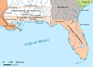
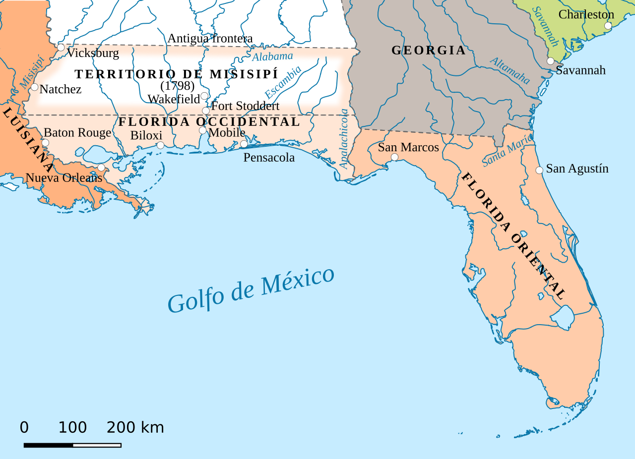
Map of the Spanish provinces of West Florida and East Florida in 1803
摘要
[編輯]
| 描述 |
English: Spanish Florida. Detail from map in Perry-Castañeda Library Map Collection. Español: Mapa de la Florida española en el periodo 1783-1810 |
| 來源 |
本檔案衍生自: Spanish Florida Map 1803.jpg “The United States, 1783-1803” Insets: The State of Franklin, 1784-1788. Early distribution of the Public Lands (Ohio). From The Historical Atlas by William R. Shepherd, 1923.
|
| 作者 | Jan Kronsell |
授權條款
[編輯]
此檔案採用共享創意 姓名標示-相同方式分享 4.0 國際授權條款。
- 您可以自由:
- 分享 – 複製、發佈和傳播本作品
- 重新修改 – 創作演繹作品
- 惟需遵照下列條件:
- 姓名標示 – 您必須指名出正確的製作者,和提供授權條款的連結,以及表示是否有對內容上做出變更。您可以用任何合理的方式來行動,但不得以任何方式表明授權條款是對您許可或是由您所使用。
- 相同方式分享 – 如果您利用本素材進行再混合、轉換或創作,您必須基於如同原先的相同或兼容的條款,來分布您的貢獻成品。
檔案歷史
點選日期/時間以檢視該時間的檔案版本。
| 日期/時間 | 縮圖 | 尺寸 | 用戶 | 備註 | |
|---|---|---|---|---|---|
| 目前 | 2019年8月8日 (四) 08:10 | | 619 × 448(837 KB) | Rowanwindwhistler(對話 | 貢獻) | frame removed |
| 2019年8月8日 (四) 08:04 |  | 619 × 448(837 KB) | Rowanwindwhistler(對話 | 貢獻) | Uploading a file from a free published source using File Upload Wizard |
無法覆蓋此檔案。
檔案用途
沒有使用此檔案的頁面。
全域檔案使用狀況
以下其他 wiki 使用了這個檔案:
- es.wikipedia.org 的使用狀況
- zh.wikipedia.org 的使用狀況
詮釋資料
分類:
- SVG maps of Florida
- Spanish-language SVG maps showing history of North America
- Maps of colonial North America
- Maps of former territories of the United States
- Maps of West Florida
- Maps of Spanish Florida
- 1803 maps of North America
- Pinckney's Treaty
- SVG maps of the Viceroyalty of New Spain
- Mississippi Territory