File:Spb 06-2017 img01 Spit of Vasilievsky Island.jpg
出自Wikimedia Commons
跳至導覽
跳至搜尋

預覽大小:800 × 533 像素。 其他解析度:320 × 213 像素 | 640 × 427 像素 | 1,024 × 683 像素 | 1,280 × 853 像素 | 2,560 × 1,707 像素 | 4,258 × 2,839 像素。
原始檔案 (4,258 × 2,839 像素,檔案大小:4.93 MB,MIME 類型:image/jpeg)
檔案資訊
結構化資料
說明
說明
添加單行說明來描述出檔案所代表的內容
| 描述Spb 06-2017 img01 Spit of Vasilievsky Island.jpg |
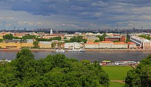
English: Aerial photo of the Vasilievsky Island Spit in Saint Petersburg (Russia).
Polski: Widok z lotu ptaka na wschodni cypel Wyspy Wasylewskiej (ros. Стрелка Васильевского острова) w Petersburgu, w Rosji.
Русский: Аэрофотосъёмка Стрелки Васильевского острова в Санкт-Петербурге (Россия).
Nederlands: Het Vasiljevski-eiland in de Russische stad Sint-Petersburg
|
| 日期 | |
| 來源 | 自己的作品 |
| 作者 | A.Savin |
| 授權許可 (重用此檔案) |
Just attribute the author: «A.Savin, Wikipedia»; if you have questions — Telegram, or e-mail to wikiphotospace@gmail.com.Просто укажите в качестве автора: «А.Савин, Википедия»; если есть вопрос — телеграм, или эл.почта на wikiphotospace@gmail.com.Kennzeichnen Sie einfach als Autor: «A.Savin, Wikipedia»; falls Sie Fragen haben — Telegram, oder E-Mail an wikiphotospace@gmail.com.
Thank you. |
| 拍攝地點 | 59° 56′ 38″ 北, 30° 18′ 40.9″ 東 | 位於此地的本圖片與其他圖片: OpenStreetMap |
|---|
|

|
This image was selected as picture of the day on Wikimedia Commons for 8 February 2019. It was captioned as follows: Other languages:
Nederlands: Het Vasiljevski-eiland in de Russische stad Sint-Petersburg Polski: Widok z lotu ptaka na wschodni cypel Wyspy Wasylewskiej (ros. Стрелка Васильевского острова) w Petersburgu, w Rosji. |
| 註解 InfoField | 該圖片含有註解:在維基媒體共享資源上查看註解 |
授權條款
[編輯]| 公共版權:本藝術作品是自由的,您可以依據自由藝術作品許可協議的條款傳播和/或修改本藝術作品。您可以在Copyleft Attitude網站或其他網站找到該許可協議的樣本。 http://artlibre.org/licence/lal/enFALFree Art Licensefalsetrue |
檔案歷史
點選日期/時間以檢視該時間的檔案版本。
| 日期/時間 | 縮圖 | 尺寸 | 用戶 | 備註 | |
|---|---|---|---|---|---|
| 目前 | 2017年8月12日 (六) 00:45 |  | 4,258 × 2,839(4.93 MB) | A.Savin(對話 | 貢獻) | {{User:A.Savin/F |Description= {{en|Aerial photo of the Vasilievsky Island Spit in Saint Petersburg (Russia).}} {{ru|Аэрофотосъёмка Стрелки Васильевского острова в Санкт-Петербурге (Россия)... |
無法覆蓋此檔案。
檔案用途
下列34個頁面有用到此檔案:
- Skylines
- Санкт-Петербург
- User:A.Savin/Archive/2017/3
- User:A.Savin/Archive/2021/1
- User:Bennylin/Cityscapes
- User:JWilz12345/Cities-Europe
- Commons:Featured picture candidates/File:Spb 06-2017 img01 Spit of Vasilievsky Island.jpg
- Commons:Featured picture candidates/Log/August 2017
- Commons:Featured pictures/Places/Architecture/Cityscapes
- Commons:Featured pictures/chronological/2017-B
- Commons:Picture of the Year/2017/Candidates
- Commons:Picture of the Year/2017/R1/Gallery/2017-B
- Commons:Picture of the Year/2017/R1/Gallery/ALL
- Commons:Picture of the Year/2017/R1/Gallery/M08
- Commons:Picture of the Year/2017/R1/Gallery/Settlements
- Commons:Picture of the Year/2017/R1/v/Spb 06-2017 img01 Spit of Vasilievsky Island.jpg
- Commons:Quality images/Subject/Architecture/Cityscapes
- Commons:Quality images candidates/Archives March 22 2021
- Commons:WikiProject Aviation/recent uploads/2017 August 12
- Template:Potd/2019-02
- Template:Potd/2019-02-08
- Template:Potd/2019-02-08 (cs)
- Template:Potd/2019-02-08 (en)
- Template:Potd/2019-02-08 (es)
- Template:Potd/2019-02-08 (hu)
- Template:Potd/2019-02-08 (mk)
- Template:Potd/2019-02-08 (nl)
- Template:Potd/2019-02-08 (pl)
- Template:Potd/2019-02-08 (pt)
- Template:Potd/2019-02-08 (pt-br)
- Template:Potd/2019-02-08 (ru)
- Category:Spit of the Vasilievsky Island
- Category:Vasileostrovsky District
- Category:Vasilievsky Island
全域檔案使用狀況
以下其他 wiki 使用了這個檔案:
- af.wikipedia.org 的使用狀況
- ar.wikipedia.org 的使用狀況
- azb.wikipedia.org 的使用狀況
- ba.wikipedia.org 的使用狀況
- be-tarask.wikipedia.org 的使用狀況
- be.wikipedia.org 的使用狀況
- bh.wikipedia.org 的使用狀況
- bn.wikipedia.org 的使用狀況
- bxr.wikipedia.org 的使用狀況
- ca.wikipedia.org 的使用狀況
- ceb.wikipedia.org 的使用狀況
- ckb.wikipedia.org 的使用狀況
- crh.wikipedia.org 的使用狀況
- cs.wikipedia.org 的使用狀況
- cv.wikipedia.org 的使用狀況
- de.wikipedia.org 的使用狀況
- el.wikipedia.org 的使用狀況
- en.wikipedia.org 的使用狀況
- Baltic Sea
- Geography of Russia
- Demographics of Russia
- Talk:Saint Petersburg
- Administrative divisions of Saint Petersburg
- Portal:Russia/Selected picture
- Vasilyevsky Island
- List of cities and towns in Russia by population
- Old Saint Petersburg Stock Exchange and Rostral Columns
- Municipal Okrug 7
- Wikipedia:Featured pictures/Places/Urban
- User talk:A.Savin
- Metropolis
- List of cities and towns around the Baltic Sea
- Eurasian Economic Union
- Wikipedia:WikiProject Russia/Physical geography of Russia task force
- Wikipedia:WikiProject Russia/Human geography of Russia task force
- User:Cote d'Azur/sandbox
- Wikipedia:WikiProject Russia/Recognized content
- Wikipedia:WikiProject Islands/Recognized content
- Outline of Saint Petersburg
檢視此檔案的更多全域使用狀況。
詮釋資料
此檔案中包含其他資訊,這些資訊可能是由數位相機或掃描器在建立或數位化過程中所新增的。若檔案自原始狀態已被修改,一些詳細資料可能無法完整反映出已修改的檔案。
| 相機製造商 | DJI |
|---|---|
| 相機型號 | FC6310 |
| 作者 | A.Savin |
| 曝光時間 | 1/400 秒 (0.0025) |
| 光圈值 | f/9 |
| ISO 速率 | 100 |
| 資料產生的日期時間 | 2017年6月2日 (五) 08:01 |
| 焦距 | 8.8毫米 |
| 緯度 | 59°56′38.04″N |
| 經度 | 30°18′40.93″E |
| 海拔 | 海拔 237.43 公尺 |
| 寬度 | 5,464 px |
| 高度 | 3,640 px |
| 每像素位元 |
|
| 像素合成 | RGB |
| 方位 | 標準 |
| 像素數量 | 3 |
| 水平解析度 | 300 dpi |
| 垂直解析度 | 300 dpi |
| 使用軟體 | Adobe Photoshop CC (Windows) |
| 檔案修改日期時間 | 2017年8月7日 (一) 02:13 |
| 曝光模式 | 手動 |
| Exif 版本 | 2.3 |
| 數位化的日期時間 | 2017年6月2日 (五) 08:01 |
| APEX 快門速度 | 8.643856 |
| APEX 光圈 | 6.33985 |
| APEX 曝光補償 | 0 |
| 最大陸地光圈 | 2.97 APEX(f/2.8) |
| 主體距離 | 0 尺 |
| 測光模式 | 中心加權平均 |
| 光源 | 不明 |
| 閃光燈 | 閃光燈未開啟、無閃光燈功能 |
| 色彩空間 | sRGB |
| 檔案來源 | 數位相機 |
| 場景類型 | 直接照像圖片 |
| 自訂影像處理 | 一般程序 |
| 曝光模式 | 手動曝光 |
| 白平衡 | 自動白平衡 |
| 數位變焦比率 | 0 |
| 35 毫米膠片焦距 | 24毫米 |
| 場景拍攝類型 | 標準 |
| 場景控制 | 無 |
| 對比度 | 標準 |
| 飽和度 | 標準 |
| 銳利度 | 標準 |
| 主體距離範圍 | 不明 |
| GPS 標籤版本 | 0.0.3.2 |
| 相機序號 | 6840927dc0c36c0d1c69152e57eb388f |
| 使用鏡頭 | 24.0 mm |
| 詮釋資料最後修改日期 | 2017年8月7日 (一) 04:13 |
| 原始文件唯一識別碼 | A3E65263BABDE46FE26312F47DB27D1A |
| IIM 版本 | 4 |
結構化資料
自由藝術作品授權條款 繁體中文 (已轉換拼寫)
共享資源質素評價 繁體中文 (已轉換拼寫)
維基共享資源特色圖片 中文 (已轉換拼寫)
維基共享資源品質形象 中文 (已轉換拼寫)
視角坐標 繁體中文 (已轉換拼寫)
59°56'38.000"N, 30°18'40.900"E
曝光時間 繁體中文 (已轉換拼寫)
0.0025 秒
9
8.8 毫米
ISO速度 繁體中文 (已轉換拼寫)
100
多媒體型式 繁體中文 (已轉換拼寫)
image/jpeg
分類:
隱藏分類:
- Photographs by A.Savin taken in 2017
- Photographs by A.Savin/Russia
- Files with coordinates missing SDC location of creation
- Featured pictures on Wikimedia Commons
- Quality images
- Featured pictures on Wikipedia, English
- Pictures of the day (2019)
- Images with annotations
- Images with 10+ annotations
- FAL
- Taken with DJI FC6310
- Russia photographs taken on 2017-06-02
- Quality images of cityscapes
- Quality images of rivers in Russia
- Quality images of Vasilievsky Island
- Featured pictures of cityscapes
- Featured pictures of islands
- Featured pictures of watercourses
- Featured pictures of clouds
- Featured pictures from unmanned aerial vehicles
- Featured pictures of Saint Petersburg
- Quality images from unmanned aerial vehicles


