File:Spezialkarte 5254 1937 grün mit Meldenetzraster rot.jpg
Jump to navigation
Jump to search

Size of this preview: 774 × 600 pixels. Other resolutions: 310 × 240 pixels | 619 × 480 pixels | 991 × 768 pixels | 1,280 × 992 pixels | 2,560 × 1,984 pixels | 7,044 × 5,460 pixels.
Original file (7,044 × 5,460 pixels, file size: 14.33 MB, MIME type: image/jpeg)
Captions
Captions
Add a one-line explanation of what this file represents
Summary
[edit]
| Description |
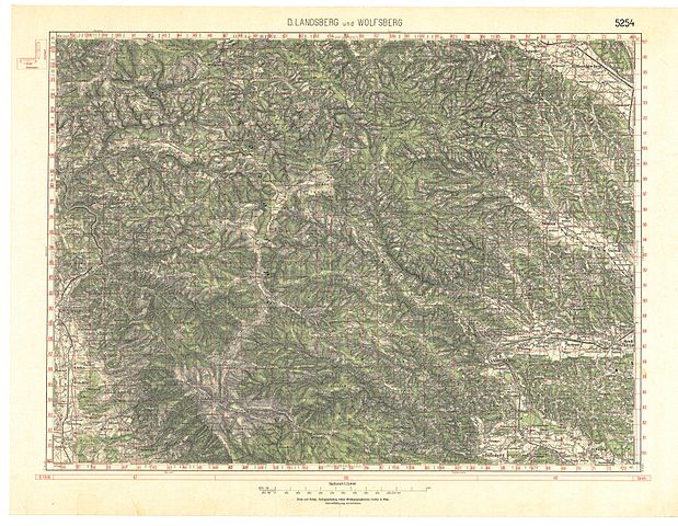
Deutsch: historische Landkarte: franzisco-josephinische (3.) Landesaufnahme der österreichisch-ungarischen Monarchie. Spezialkarte 1:75.000. Blatt D.Landsberg und Wolfsberg, Steiermark, Österreich. Nr. 5254 (Zone 18 Kolumne XII). Variante grüner Waldaufdruck und roter Raster des Meldenetzes. |
| Date | Basis 19. Jh, Stand ca. 1937. |
| Source | Österreichische Nationalbibliothek, Kartensammlung |
| Author | Geripp: Karthographisches, früher Militärgeographisches Institut |
| Permission (Reusing this file) |
historisches amtliches Werk aus dem 18. Jahrhundert, Neuauflage 1937, freies Werk |
Licensing
[edit]
|
This work is in the public domain in its country of origin and other countries and areas where the copyright term is the author's life plus 70 years or fewer. | |
| This file has been identified as being free of known restrictions under copyright law, including all related and neighboring rights. | |
File history
Click on a date/time to view the file as it appeared at that time.
| Date/Time | Thumbnail | Dimensions | User | Comment | |
|---|---|---|---|---|---|
| current | 08:36, 1 March 2009 | | 7,044 × 5,460 (14.33 MB) | Josef Moser (talk | contribs) | == Beschreibung == {{Information |Description=historische Landkarte: franzisco-josephinische (3.) Landesaufnahme der österreichisch-ungarischen Monarchie. Spezialkarte 1:75.000. Blatt D.Landsberg und Wolfsberg, Steiermark, Österreich. Nr. 5254 (Zone 18 |
You cannot overwrite this file.
File usage on Commons
There are no pages that use this file.
File usage on other wikis
The following other wikis use this file:
Metadata
Categories:
- Mountains of Styria
- Franzisco-Josephinische Landesaufnahme, Spezialkarte
- Historische Landkarten von Trahütten
- Historische Landkarten von Osterwitz
- Historische Landkarten von Kloster (Steiermark)
- Gressenberg
- Weineben
- Maps of Hebalm
- Historische Landkarten von Freiland bei Deutschlandsberg
- Historische Landkarten zur Stadt Deutschlandsberg
- Waldbahn Deutschlandsberg