File:SputnikSiteManitowocWI.jpg
跳转到导航
跳转到搜索

本预览的尺寸:800 × 499像素。 其他分辨率:320 × 200像素 | 640 × 399像素 | 1,024 × 638像素 | 1,280 × 798像素 | 2,560 × 1,596像素 | 3,902 × 2,433像素。
原始文件 (3,902 × 2,433像素,文件大小:3.74 MB,MIME类型:image/jpeg)
说明
说明
添加一行文字以描述该文件所表现的内容
摘要
[编辑]
| 描述 |
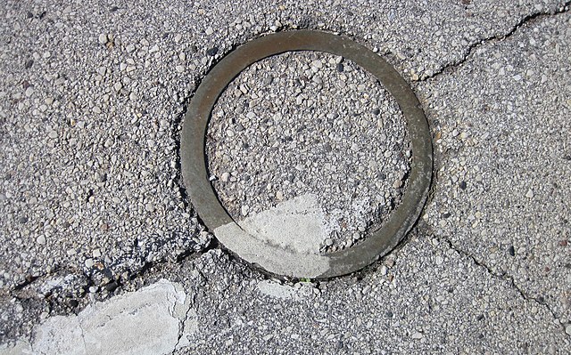
English: Round metal ring in the pavement of U.S. Highway 10 marking the landing place of Korabl-Sputnik 1 in Manitowoc, Wisconsin, United States
Español: El círculo señala el lugar del impacto del Sputnik 4
日本語: スプートニク4号の金属片が落下した路上にできた円形の跡
Polski: Dysk oznaczający miejsce upadku satelity Korabl-Sputnik 1
Русский: Отметка на месте падения спутника |
||
| 日期 | |||
| 来源 | 自己的作品 | ||
| 作者 | Jonathunder | ||
| 授权 (二次使用本文件) |
|
| 相机位置 | | 在以下服务上查看本图像和附近其他图像: OpenStreetMap |
|---|
许可协议
[编辑]

|
已授权您依据自由软件基金会发行的无固定段落及封面封底文字(Invariant Sections, Front-Cover Texts, and Back-Cover Texts)的GNU自由文件许可协议1.2版的条款,复制、传播和/或修改本文件。该协议的副本请见“GNU Free Documentation License”。 | 仅1.2版 |
文件历史
点击某个日期/时间查看对应时刻的文件。
| 日期/时间 | 缩略图 | 大小 | 用户 | 备注 | |
|---|---|---|---|---|---|
| 当前 | 2013年11月11日 (一) 05:13 | | 3,902 × 2,433(3.74 MB) | Jonathunder(留言 | 贡献) | {{Information |Description ={{en|1=Round metal ring in the pavement of U.S. Highway 10 marking the landing place of Korabl-Sputnik 1 in Manitowoc, Wisconsin, United States}} |Source =Own work |Author =Jonathunder... |
您不可以覆盖此文件。
文件用途
全域文件用途
以下其他wiki使用此文件:
- az.wikipedia.org上的用途
- en.wikipedia.org上的用途
- es.wikipedia.org上的用途
- fr.wikipedia.org上的用途
- ja.wikipedia.org上的用途
- pl.wikipedia.org上的用途
- pt.wikipedia.org上的用途
- zh.wikipedia.org上的用途