File:Stabkarte.JPG
Jump to navigation
Jump to search

Size of this preview: 800 × 497 pixels. Other resolutions: 320 × 199 pixels | 640 × 398 pixels | 1,024 × 636 pixels | 1,280 × 795 pixels | 2,388 × 1,484 pixels.
Original file (2,388 × 1,484 pixels, file size: 502 KB, MIME type: image/jpeg)
Captions
Captions
Add a one-line explanation of what this file represents
Summary
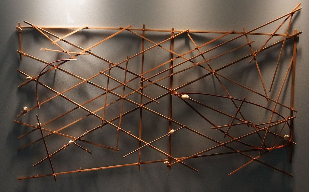
Object
| Micronesian stick chart
|
|||||||||||||||||||||||||||
|---|---|---|---|---|---|---|---|---|---|---|---|---|---|---|---|---|---|---|---|---|---|---|---|---|---|---|---|
| Artist |
|
 | |||||||||||||||||||||||||
| Title |
Micronesian stick chart |
||||||||||||||||||||||||||
| Object type |
Marshall Islands stick chart / map |
||||||||||||||||||||||||||
| Date |
19th century |
||||||||||||||||||||||||||
| Medium |
wood, seashell and plant fiber |
||||||||||||||||||||||||||
| Collection |
|
||||||||||||||||||||||||||
| Accession number |
BHM 1920.530.0032 (Historical Museum of Bern) |
||||||||||||||||||||||||||
| Place of discovery |
Micronesia |
||||||||||||||||||||||||||
| Object history |
|
||||||||||||||||||||||||||

Photograph
| Date | |
| Source | Own work |
| Author | NearEMPTiness |
| Permission (Reusing this file) |
I, the copyright holder of this work, hereby publish it under the following license: This file is licensed under the Creative Commons Attribution-Share Alike 4.0 International license.
|
File history
Click on a date/time to view the file as it appeared at that time.
| Date/Time | Thumbnail | Dimensions | User | Comment | |
|---|---|---|---|---|---|
| current | 19:48, 9 August 2015 | | 2,388 × 1,484 (502 KB) | NearEMPTiness (talk | contribs) | User created page with UploadWizard |
You cannot overwrite this file.
File usage on Commons
The following page uses this file: