File:Stary Targ (gmina) location map.png
Jump to navigation
Jump to search
Size of this preview: 531 × 599 pixels. Other resolutions: 213 × 240 pixels | 425 × 480 pixels | 652 × 736 pixels.
Original file (652 × 736 pixels, file size: 106 KB, MIME type: image/png)
Captions
Captions
Add a one-line explanation of what this file represents
| Description |
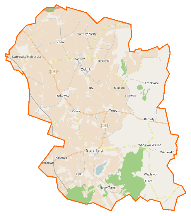
Polski: Mapa gminy Stary Targ, Polska
English: Map of Gmina Stary Targ, Poland |
|||||||||
| Date | ||||||||||
| Source | You may find a page on the OpenStreetMap wiki page for Stary Targ (gmina) | |||||||||
| Creator |
OpenStreetMap contributors OpenStreetMap contributors |
|||||||||
| Permission (Reusing this file) |
OpenStreetMap data is available under the Open Database License (details). Map tiles are licensed under the Creative Commons Attribution-ShareAlike 2.0 license (CC-BY-SA 2.0).
This file is licensed under the Creative Commons Attribution-Share Alike 2.0 Generic license.
|
|||||||||
| Geotemporal data | ||||||||||
| Bounding box |
|
|||||||||
| Georeferencing | If inappropriate please set warp_status = skip to hide. | |||||||||
File history
Click on a date/time to view the file as it appeared at that time.
| Date/Time | Thumbnail | Dimensions | User | Comment | |
|---|---|---|---|---|---|
| current | 09:18, 12 February 2015 | | 652 × 736 (106 KB) | VanWiel (talk | contribs) | {{OpenStreetMap | name = Stary Targ (gmina) | location = Stary Targ (gmina) | description = {{pl|Mapa gminy Stary Targ, Polska}} {{en|Map of Gmina Stary Targ, Poland}} | top = 54.0267 | bottom = 53.... |
You cannot overwrite this file.
File usage on Commons
There are no pages that use this file.
File usage on other wikis
The following other wikis use this file:
- Usage on pl.wikipedia.org
- Stary Targ (gmina)
- Dąbrówka Malborska
- Gintro
- Jordanki
- Kalwa (województwo pomorskie)
- Łoza (województwo pomorskie)
- Mleczewo
- Pozolia
- Szropy
- Stary Targ
- Trankwice
- Tropy Sztumskie
- Tulice
- Waplewo Wielkie
- Czerwony Dwór (województwo pomorskie)
- Jodłówka (województwo pomorskie)
- Jurkowice (województwo pomorskie)
- Kątki (powiat sztumski)
- Nowy Targ (województwo pomorskie)
- Ramoty (województwo pomorskie)
- Stary Dwór (powiat sztumski)
- Zielonki (województwo pomorskie)
- Bukowo (powiat sztumski)
- Klecewo (powiat sztumski)
- Szropy-Niziny
- Brzozówka (województwo pomorskie)
- Telkwice
- Dziewięć Włók (Kalwa)
- Waplewo-Osiedle
- Waplewko
- Igły (Jurkowice)
- Łabuń (Jurkowice)
- Grzymała (Dąbrówka Malborska)
- Krzyżówki (województwo pomorskie)
- Kościelec (Bukowo)
- Śledziówka
- Tulice Małe
- Malewo (Łoza)
- Olszak (Tulice)
- Lasy (województwo pomorskie)
- Pijaki
- Mleczewo (stacja kolejowa)
- Dąbrówka Malborska (przystanek kolejowy)
- Muzeum Tradycji Szlacheckiej w Waplewie Wielkim
- Parafia św. Maksymiliana Marii Kolbe w Waplewie Wielkim
- Parafia św. Szymona i św. Judy Tadeusza w Starym Targu
- Parafia św. Marii Magdaleny w Kalwie
- Parafia św. Mikołaja w Dąbrówce Malborskiej
- Szkoła Podstawowa im. Franciszka Jujki w Starym Targu
- Szropy (przystanek kolejowy)
View more global usage of this file.
_location_map.png)
_location_map.png&oldid=506745950)