File:State and union territories map.png
Jump to navigation
Jump to search
Size of this preview: 527 × 600 pixels. Other resolutions: 211 × 240 pixels | 422 × 480 pixels | 1,000 × 1,138 pixels.
Original file (1,000 × 1,138 pixels, file size: 71 KB, MIME type: image/png)
Captions
Captions
Add a one-line explanation of what this file represents
Summary[edit]
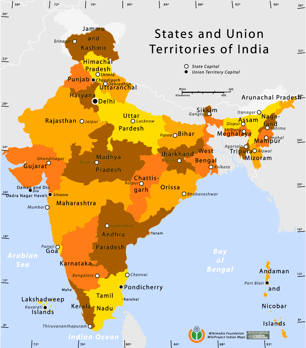
| Description | State and Union Territories map of India |
| Date | 12 January 2006 (original upload date) |
| Source | No machine-readable source provided. Own work assumed (based on copyright claims). |
| Author | No machine-readable author provided. Planemad assumed (based on copyright claims). |
Author[edit]
Comments and Suggestions[edit]
Please leave your suggestions or errors noted in the map below.
- Suggestion 1 : The color difference scale between oranges is hardly visible. For instance, the boundary between Kerala and Tamil Nadu is barely visible... Author : Pascal.Boulerie@laposte.net
Hi Pascal, hope you like this better. David Benfell benfell@parts-unknown.org
- Suggestion 2 : Please correct
  - "Uttar Pardesh" should be "Uttar Pradesh"
  - "Andhra Paradesh" should be "Andhra Pradesh"
Thanks
Licensing[edit]
I, the copyright holder of this work, hereby publish it under the following license:
This file is licensed under the Creative Commons Attribution-Share Alike 2.5 Generic license.
- You are free:
- to share – to copy, distribute and transmit the work
- to remix – to adapt the work
- Under the following conditions:
- attribution – You must give appropriate credit, provide a link to the license, and indicate if changes were made. You may do so in any reasonable manner, but not in any way that suggests the licensor endorses you or your use.
- share alike – If you remix, transform, or build upon the material, you must distribute your contributions under the same or compatible license as the original.
File history
Click on a date/time to view the file as it appeared at that time.
| Date/Time | Thumbnail | Dimensions | User | Comment | |
|---|---|---|---|---|---|
| current | 09:57, 16 November 2010 | | 1,000 × 1,138 (71 KB) | Greybeard95a (talk | contribs) | improved color contrast |
| 12:07, 12 January 2006 |  | 1,000 × 1,138 (88 KB) | Planemad (talk | contribs) | State and Union Territories map of India ==Author== w:user:planemad ==Comments and Suggestions== Please leave your suggestions or errors noted in the map below: Category:Maps of India Category:Wikiproject Indian Maps |
You cannot overwrite this file.
File usage
The following page uses this file:
Global file usage
The following other wikis use this file:
- Usage on en.wikinews.org
- Usage on fr.wikipedia.org
- Usage on fr.wikinews.org
- Usage on fr.wiktionary.org
- Usage on ka.wikipedia.org
- Usage on sq.wikipedia.org
- Usage on xmf.wikipedia.org