File:Stenbjerg 6.JPG
Jump to navigation
Jump to search

Size of this preview: 800 × 600 pixels. Other resolutions: 320 × 240 pixels | 640 × 480 pixels | 1,024 × 768 pixels | 1,280 × 960 pixels | 2,560 × 1,920 pixels.
Original file (2,560 × 1,920 pixels, file size: 1.22 MB, MIME type: image/jpeg)
Captions
Captions
Add a one-line explanation of what this file represents
| Description |
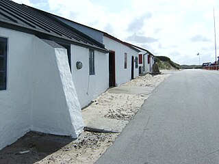
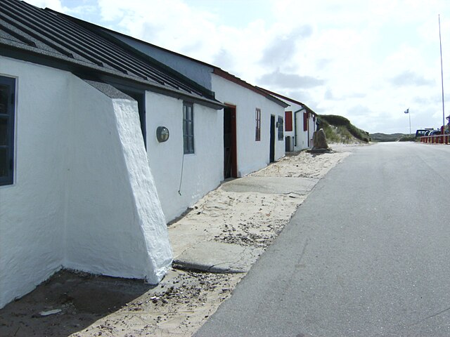
Stenbjerg Landingsplads er en ophalerplads for Veterhavskystfiskeri vest for Thisted Former fishingplace in Jylland, Denmark Vejen mod øst |
| Date | |
| Source | Own work |
| Author | Erik Damskier |
| Permission (Reusing this file) |
Own work, all rights released (Public domain) |
| Camera location | | View this and other nearby images on: OpenStreetMap |
|---|
| I, the copyright holder of this work, release this work into the public domain. This applies worldwide. In some countries this may not be legally possible; if so: I grant anyone the right to use this work for any purpose, without any conditions, unless such conditions are required by law. |
File history
Click on a date/time to view the file as it appeared at that time.
| Date/Time | Thumbnail | Dimensions | User | Comment | |
|---|---|---|---|---|---|
| current | 20:45, 11 August 2009 | | 2,560 × 1,920 (1.22 MB) | Erik Damskier (talk | contribs) | {{Information |Description=Stenbjerg Landingsplads er en ophalerplads for Veterhavskystfiskeri vest for Thisted Former fishingplace in Jylland, Denmark Vejen mod øst |Source=own work |Date=2009 06 19 |Author=Erik Damskier |Permission=Own work, all right |
You cannot overwrite this file.
File usage on Commons
The following page uses this file:
File usage on other wikis
The following other wikis use this file:
- Usage on da.wikipedia.org
- Usage on da.wikibooks.org
- Usage on de.wikipedia.org