File:Stone Fence (30970374061).jpg

Original file (1,269 × 1,040 pixels, file size: 1.45 MB, MIME type: image/jpeg)
Captions
Captions
Summary
[edit].jpg&action=edit§ion=1)
| Description |
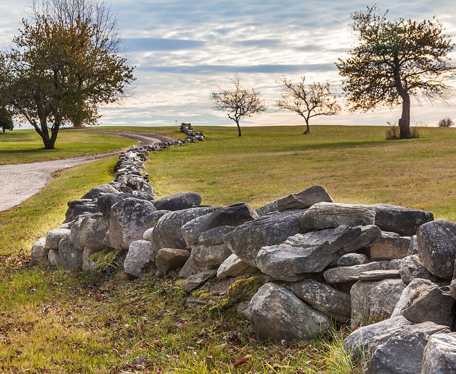
Taken in Harpswell, Maine. HFF In 1871 the U.S. Department of Agriculture published a “Statistics of Fences In the United States.” At that time, it noted that in New England and New York State alone, there were 252,539 miles of stone walls, enough to circle the globe ten times, and to build all the pyramids of Egypt times one hundred. It has been calculated that such an effort would have required an army of 15,000 workers 243 years to accomplish. The “when” and “why” and “how” of that story would challenge far more than a single column of newsprint; but let me give it a try. The first colonial settlers in New England gave little thought to long-term fences, since to begin with, they were “new” to the whole ethic of private land ownership, and generally farmed cleared land “in common” with their neighbors anyway. Early towns were usually about five to six square miles, with a church, trade buildings and residences at or near the center, and farmsteads on the outer fringes. What fencing they did do made use of excavated tree roots and brush from newly-cleared forest growth. What took them by surprise was that as fast as they removed rocks and stones from fields, more kept coming to the surface each time they plowed or cultivated – a consequence of the freeze-thaw cycles of that glacier-formed region which still continues two centuries later. At first, they threw the stones into random piles where they merely accumulated. Of course, some were used in constructing building foundations, chimneys and such. The initial reluctance to lay out “boundaries” and property lines was motivated in part by the need to maintain friendly relations with neighboring, and mostly accommodating Native Americans whose concept in land-sharing was at odds with the European idea of personal ownership. [<a href="http://www.thespectrum.com/story/life/family/2015/04/05/stone-walls-pervasive-northeast/25328109/" rel="nofollow">www.thespectrum.com/story/life/family/2015/04/05/stone-wa...</a>] |
| Date | |
| Source | Stone Fence |
| Author | Paul VanDerWerf from Brunswick, Maine, USA |
| Camera location | | View this and other nearby images on: OpenStreetMap |
|---|
.jpg¶ms=043.794501_N_-069.981601_E_globe:Earth_type:camera_source:Flickr_&language=en)
Licensing
[edit].jpg&action=edit§ion=2)
- You are free:
- to share – to copy, distribute and transmit the work
- to remix – to adapt the work
- Under the following conditions:
- attribution – You must give appropriate credit, provide a link to the license, and indicate if changes were made. You may do so in any reasonable manner, but not in any way that suggests the licensor endorses you or your use.
| This image was originally posted to Flickr by Me in ME at https://flickr.com/photos/12357841@N02/30970374061 (archive). It was reviewed on 12 July 2018 by FlickreviewR 2 and was confirmed to be licensed under the terms of the cc-by-2.0. |
File history
Click on a date/time to view the file as it appeared at that time.
| Date/Time | Thumbnail | Dimensions | User | Comment | |
|---|---|---|---|---|---|
| current | 01:00, 12 July 2018 | | 1,269 × 1,040 (1.45 MB) | Hiàn (alt) (talk | contribs) | Transferred from Flickr via #flickr2commons |
You cannot overwrite this file.
File usage on Commons
There are no pages that use this file.
.jpg&oldid=896190745)