File:Straßburg Belagerung 1.jpg
Jump to navigation
Jump to search
Size of this preview: 800 × 591 pixels. Other resolutions: 320 × 236 pixels | 640 × 473 pixels | 1,024 × 756 pixels | 1,280 × 945 pixels | 2,000 × 1,477 pixels.
Original file (2,000 × 1,477 pixels, file size: 1.2 MB, MIME type: image/jpeg)
Captions
Captions
Add a one-line explanation of what this file represents
Summary
[edit]
| Description |
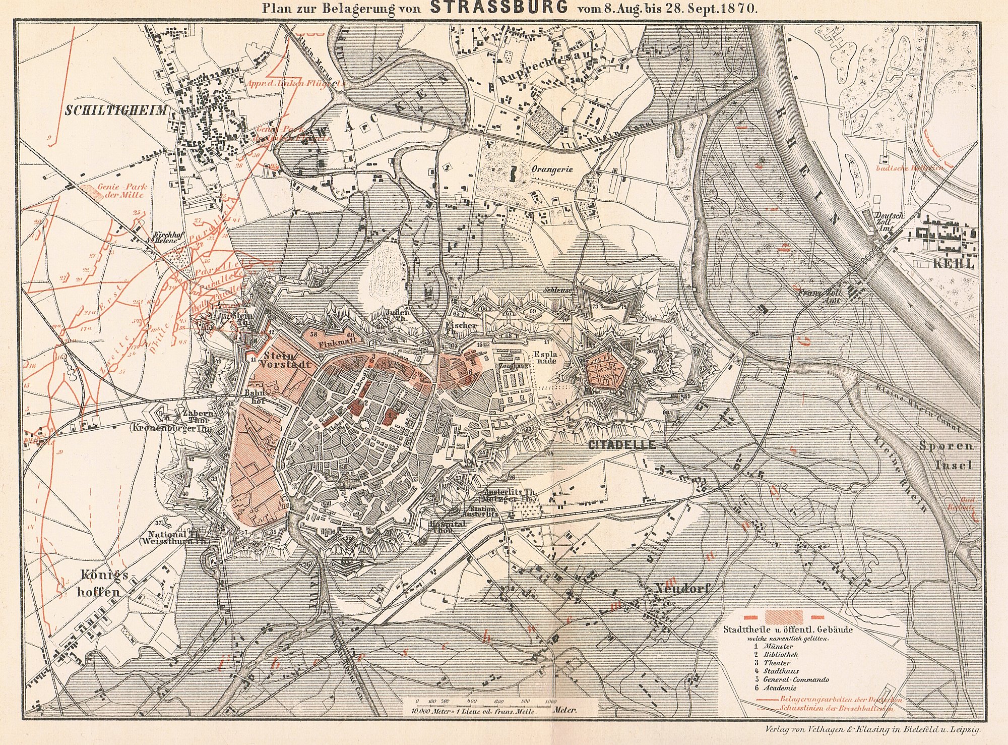
English: Map of the siegeworks around the city of Straßburg from the siege during the Franco-Prussian War of 1870-71.
Deutsch: Karte der Belagerungswerke um die Stadt Straßburg während der Belagerung im Deutsch-Französischen Krieg 1870-71. |
| Date | |
| Source | Der Französische Krieg von 1870 und 1871. |
| Author | Verlag von Velhagen & Klasing |
|longitude=07/44/53/E |latitude=48/35/01/N
Licensing
[edit]
|
This work is in the public domain in its country of origin and other countries and areas where the copyright term is the author's life plus 70 years or fewer. | |
| This file has been identified as being free of known restrictions under copyright law, including all related and neighboring rights. | |
File history
Click on a date/time to view the file as it appeared at that time.
| Date/Time | Thumbnail | Dimensions | User | Comment | |
|---|---|---|---|---|---|
| current | 13:45, 22 July 2013 | | 2,000 × 1,477 (1.2 MB) | Nikephoros (talk | contribs) | {{Information |Description ={{en|1=Map of the siegeworks around the city of Straßburg from the siege during the Franco-Prussian War of 1870-71.}} {{de|1=Karte der Belagerungswerke um die Stadt Straßburg während der Belagerung im Deutsch-Französi... |
You cannot overwrite this file.
File usage on Commons
There are no pages that use this file.
File usage on other wikis
The following other wikis use this file:
- Usage on de.wikipedia.org
- Usage on ru.wikipedia.org
- Usage on www.wikidata.org