File:StraitsSevres.gif
Naviqasiyaya keç
Axtarışa keç

Sınaq göstərişi ölçüsü: 428 × 599 piksel. Digər ölçülər: 171 × 240 piksel | 343 × 480 piksel | 548 × 768 piksel | 731 × 1.024 piksel | 1.477 × 2.068 piksel.
Faylın orijinalı (1.477 × 2.068 piksel, fayl həcmi: 342 KB, MIME növü: image/gif)
Captions
Captions
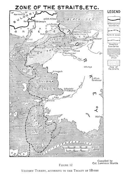
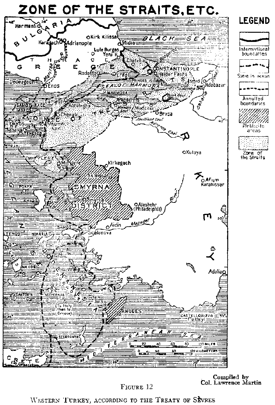
Sevr müqaviləsindəki boğaz bölgəsini göstərən Qərbi Türkiyənin xəritəsi
Xülasə[redaktə]
| İzah |
English: Map of Western Turkey, showing the Zone of the Straits in Treaty of Sèvres. |
| Tarix | |
| Mənbə | http://www.gwpda.org/gifs/straits.gif |
| Müəllif | Lt. Colonel Lawrence Martin ... Geographer of the Institute of Politics at Williamstown, Mass, 1921-27 |
Lisenziya[redaktə]
This media file is in the public domain in the United States. This applies to U.S. works where the copyright has expired, often because its first publication occurred prior to January 1, 1929, and if not then due to lack of notice or renewal. See this page for further explanation.
|
 | |
 |
This image might not be in the public domain outside of the United States; this especially applies in the countries and areas that do not apply the rule of the shorter term for US works, such as Canada, Mainland China (not Hong Kong or Macao), Germany, Mexico, and Switzerland. The creator and year of publication are essential information and must be provided. See Wikipedia:Public domain and Wikipedia:Copyrights for more details.
|
Faylın tarixçəsi
Faylın əvvəlki versiyasını görmək üçün gün/tarix bölməsindəki tarixlərə klikləyin.
| Tarix/Vaxt | Kiçik şəkil | Ölçülər | İstifadəçi | Şərh | |
|---|---|---|---|---|---|
| indiki | 07:08, 30 iyun 2021 | | 1.477 × 2.068 (342 KB) | Zero0000 (müzakirə | töhfələr) | Higher resolution |
| 18:14, 30 iyun 2012 |  | 899 × 1.324 (54 KB) | Infestor (müzakirə | töhfələr) |
Siz bu faylı yenidən yükləyə bilməzsiniz.
Fayl keçidləri
Bu faylı istifadə edən səhifə yoxdur.
Faylın qlobal istifadəsi
Bu fayl aşağıdakı vikilərdə istifadə olunur:
- ar.wikipedia.org layihəsində istifadəsi
- azb.wikipedia.org layihəsində istifadəsi
- az.wikipedia.org layihəsində istifadəsi
- ckb.wikipedia.org layihəsində istifadəsi
- en.wikipedia.org layihəsində istifadəsi
- et.wikipedia.org layihəsində istifadəsi
- sk.wikipedia.org layihəsində istifadəsi
- tr.wikipedia.org layihəsində istifadəsi