File:Sub-prefectures map Côte d'Ivoire.jpg
Jump to navigation
Jump to search

Size of this preview: 580 × 600 pixels. Other resolutions: 232 × 240 pixels | 464 × 480 pixels | 743 × 768 pixels | 990 × 1,024 pixels | 1,981 × 2,048 pixels | 4,110 × 4,250 pixels.
Original file (4,110 × 4,250 pixels, file size: 2.54 MB, MIME type: image/jpeg)
Captions
Captions
Add a one-line explanation of what this file represents
Summary[edit]
| Description |
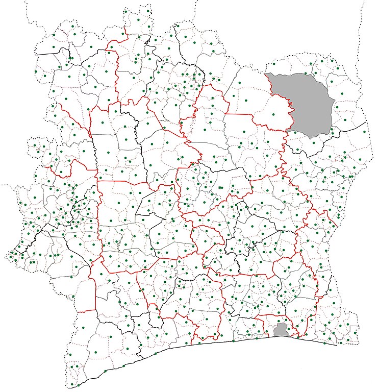
English: Map of the sub-prefectures of Côte d'Ivoire. The dotted lines are the boundaries of the sub-prefectures and the green dot indicates the location of the settlement that is the seat of the sub-prefecture. District borders are in red; region borders are in bolded black; department boundaries are solid lines. Grey zones are areas of the country not governed by sub-prefectures (Abidjan city proper (south) and the portion of Comoé National Park in Zanzan District (north)). |
| Date | |
| Source | Own work |
| Author | Good Olfactory |
Licensing[edit]
I, the copyright holder of this work, hereby publish it under the following license:
This file is licensed under the Creative Commons Attribution-Share Alike 4.0 International license.
- You are free:
- to share – to copy, distribute and transmit the work
- to remix – to adapt the work
- Under the following conditions:
- attribution – You must give appropriate credit, provide a link to the license, and indicate if changes were made. You may do so in any reasonable manner, but not in any way that suggests the licensor endorses you or your use.
- share alike – If you remix, transform, or build upon the material, you must distribute your contributions under the same or compatible license as the original.
File history
Click on a date/time to view the file as it appeared at that time.
| Date/Time | Thumbnail | Dimensions | User | Comment | |
|---|---|---|---|---|---|
| current | 10:12, 6 January 2016 | | 4,110 × 4,250 (2.54 MB) | Good Olfactory (talk | contribs) | User created page with UploadWizard |
You cannot overwrite this file.
File usage on Commons
There are no pages that use this file.
File usage on other wikis
The following other wikis use this file:
- Usage on en.wikipedia.org
- Usage on pl.wikipedia.org
- Usage on sw.wikipedia.org