File:Sumatra 2007 earthquakes map.gif
跳至導覽
跳至搜尋
無更高解析度可提供。
Sumatra_2007_earthquakes_map.gif (505 × 496 像素,檔案大小:30 KB,MIME 類型:image/gif)
說明
說明
添加單行說明來描述出檔案所代表的內容
摘要[編輯]
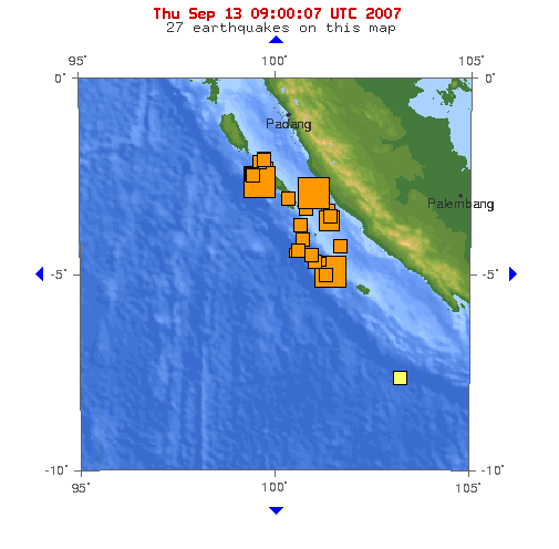
Image: This map shows the location of the 3 major earthquakes and it's many aftershocks off the coast of Sumatra on September 12 and September 13, 2007. It shows a total of 27 earthquakes, 25 of them in the last 24 hours.
Source: https://earthquake.usgs.gov/eqcenter/recenteqsww/Maps/10/100_-5.php (dynamic)
授權條款[編輯]
|
|
檔案歷史
點選日期/時間以檢視該時間的檔案版本。
| 日期/時間 | 縮圖 | 尺寸 | 使用者 | 備註 | |
|---|---|---|---|---|---|
| 目前 | 2007年9月13日 (四) 09:53 | | 505 × 496(30 KB) | TheDJ(留言 | 貢獻) | == Summary == '''Image:''' This map shows the location of the 3 major earthquakes and it's many aftershocks off the coast of Sumatra on September 12 and September 13, 2007. It shows a total of 27 earthquakes, 25 of them in the last 24 hours. |
無法覆蓋此檔案。
檔案用途
沒有使用此檔案的頁面。
全域檔案使用狀況
以下其他 wiki 使用了這個檔案:
- de.wikipedia.org 的使用狀況
- en.wikipedia.org 的使用狀況
- id.wikipedia.org 的使用狀況
- ja.wikipedia.org 的使用狀況
- wuu.wikipedia.org 的使用狀況
- zh.wikipedia.org 的使用狀況