File:Sumba and Beinisvord in Suduroy, Faroe Islands.JPG
跳至導覽
跳至搜尋

預覽大小:800 × 600 像素。 其他解析度:320 × 240 像素 | 640 × 480 像素 | 1,024 × 768 像素 | 1,280 × 960 像素 | 2,560 × 1,920 像素 | 3,648 × 2,736 像素。
原始檔案 (3,648 × 2,736 像素,檔案大小:2.06 MB,MIME 類型:image/jpeg)
說明
說明
添加單行說明來描述出檔案所代表的內容
摘要
[編輯]
| 描述 |
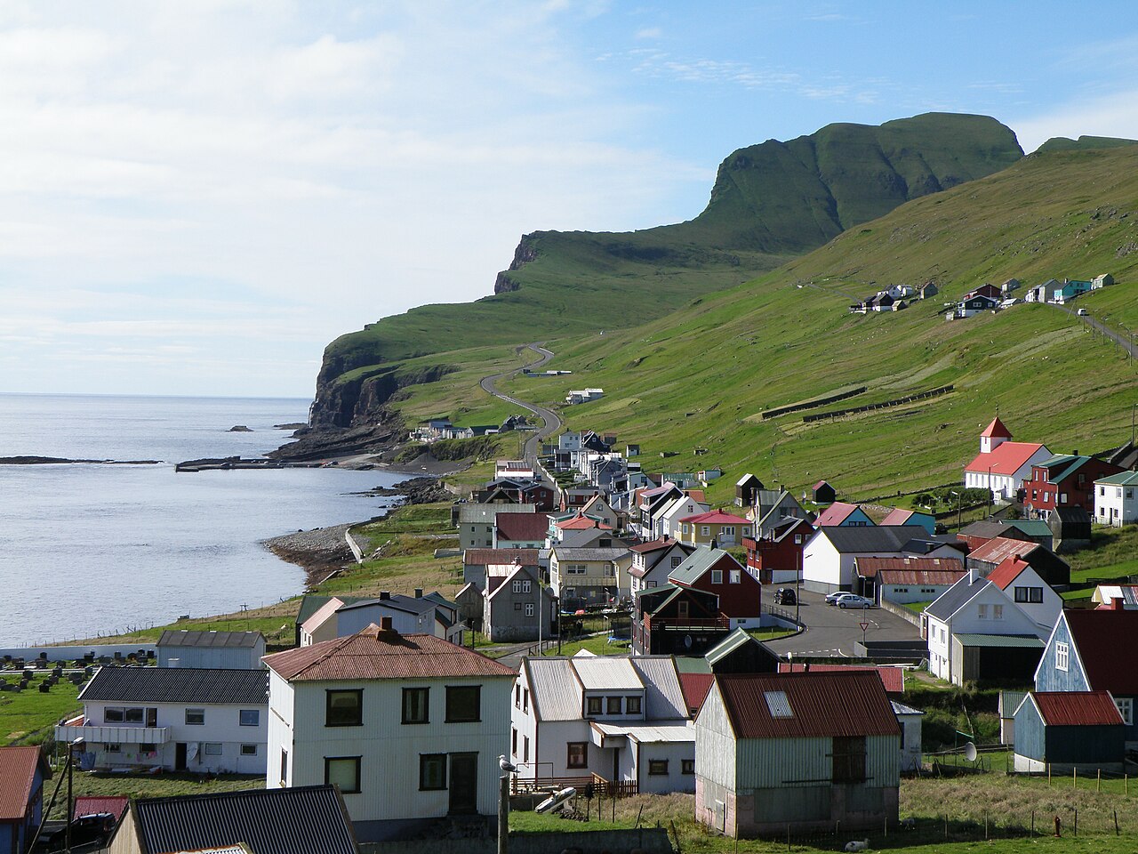
English: Sumba is the southernmost village in the Faroe Islands, located on the south-western coast of the island Suðuroy. Beinisvørð is a 470 meter high sea cliff. It goes vertically down to the North Atlantic Ocean on the western side and on its eastern side it has a green slope, as one can see on this photo. The population of Sumba is around 250. The population of the island Suðuroy is ca. 4900.
Dansk: Sumba er den sydligste bygd på Færøerne. Sumba vender mod sydvest og er karakteriseret af den 470 meter høje klint Beinisvørð, som beskytter bygden mod nordvest. Sumba ligger dog mod åbent hav mod sydvest, kun delvis beskyttet af Sumbiarhólmur. Der bor ca. 250 mennesker i Sumba. Bygden er forbundet med Lopra via en tunnel og med en vej som går over bjergene, forbi Beinisvørð.
Føroyskt: Sumba er bygd í Føroyum. Sumba er syðsta bygd í Suðuroynni. |
| 日期 | |
| 來源 | 自己的作品 |
| 作者 | Eileen Sandá |
授權條款
[編輯]
我,本作品的著作權持有者,決定用以下授權條款發佈本作品:
此檔案採用創用CC 姓名標示-相同方式分享 3.0 未在地化版本授權條款。
- 您可以自由:
- 分享 – 複製、發佈和傳播本作品
- 重新修改 – 創作演繹作品
- 惟需遵照下列條件:
- 姓名標示 – 您必須指名出正確的製作者,和提供授權條款的連結,以及表示是否有對內容上做出變更。您可以用任何合理的方式來行動,但不得以任何方式表明授權條款是對您許可或是由您所使用。
- 相同方式分享 – 如果您利用本素材進行再混合、轉換或創作,您必須基於如同原先的相同或兼容的條款,來分布您的貢獻成品。

|
已授權您依據自由軟體基金會發行的無固定段落、封面文字和封底文字GNU自由文件授權條款1.2版或任意後續版本,對本檔進行複製、傳播和/或修改。該協議的副本列在GNU自由文件授權條款中。 |
您可以選擇您需要的授權條款。
檔案歷史
點選日期/時間以檢視該時間的檔案版本。
| 日期/時間 | 縮圖 | 尺寸 | 使用者 | 備註 | |
|---|---|---|---|---|---|
| 目前 | 2011年4月18日 (一) 17:23 | | 3,648 × 2,736(2.06 MB) | EileenSanda(留言 | 貢獻) | {{Information |Description ={{en|1=Sumba is the southernmost village in the Faroe Islands, located on the south-western coast of the island Suðuroy. Beinisvørð is a 470 meter high sea cliff. It goes vertically down to the North Atlantic Ocean on the |
無法覆蓋此檔案。
檔案用途
下列3個頁面有用到此檔案:
全域檔案使用狀況
以下其他 wiki 使用了這個檔案:
- ca.wikipedia.org 的使用狀況
- da.wikipedia.org 的使用狀況
- el.wikipedia.org 的使用狀況
- en.wikipedia.org 的使用狀況
- es.wikipedia.org 的使用狀況
- eu.wikipedia.org 的使用狀況
- fo.wikipedia.org 的使用狀況
- is.wikipedia.org 的使用狀況
- it.wikipedia.org 的使用狀況
- lt.wikipedia.org 的使用狀況
- nl.wikipedia.org 的使用狀況
- no.wikipedia.org 的使用狀況
- pl.wikipedia.org 的使用狀況
- zh.wikipedia.org 的使用狀況