File:Sunagawabori River Tamon'in-dori Ave.jpg
Jump to navigation
Jump to search
Size of this preview: 800 × 600 pixels. Other resolutions: 320 × 240 pixels | 640 × 480 pixels | 1,024 × 768 pixels | 1,280 × 960 pixels | 1,600 × 1,200 pixels.
Original file (1,600 × 1,200 pixels, file size: 544 KB, MIME type: image/jpeg)
Captions
Captions
Add a one-line explanation of what this file represents
Summary
[edit]
| Description |
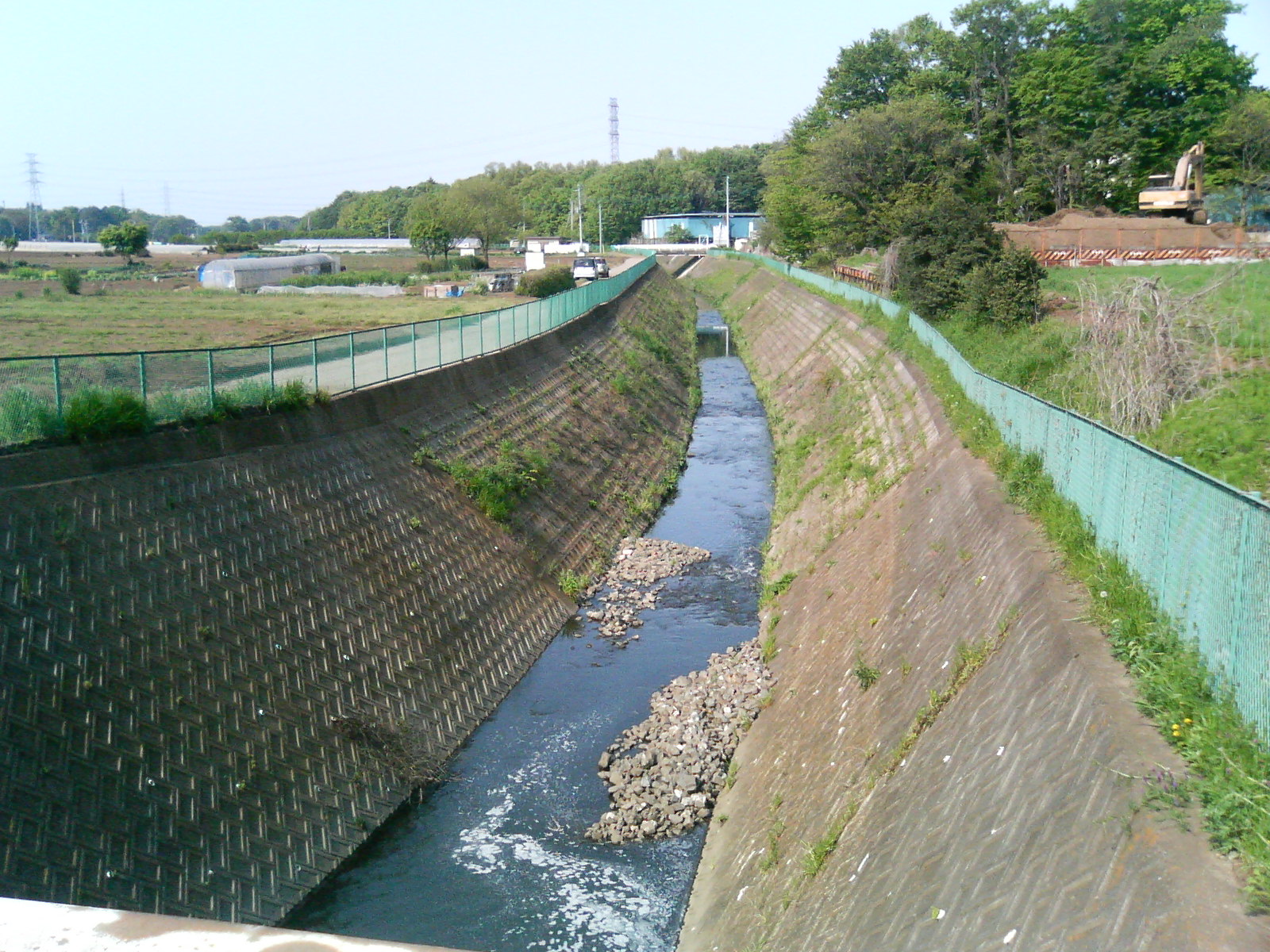
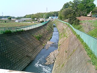
English: Suna-gawa-bori river - seeing lower reaches, from Tamon'in dōri Ave. , in Tokorozawa, Saitama, Japan. |
| Date | |
| Source | Own work |
| Author | tokoro koko |
| Camera location | | View this and other nearby images on: OpenStreetMap |
|---|
Licensing
[edit]
| I, the copyright holder of this work, release this work into the public domain. This applies worldwide. In some countries this may not be legally possible; if so: I grant anyone the right to use this work for any purpose, without any conditions, unless such conditions are required by law. |
File history
Click on a date/time to view the file as it appeared at that time.
| Date/Time | Thumbnail | Dimensions | User | Comment | |
|---|---|---|---|---|---|
| current | 18:07, 20 May 2010 | | 1,600 × 1,200 (544 KB) | Tokorokoko (talk | contribs) | {{Information |Description={{ja|砂川堀(すながわぼり) — 所沢市道「多聞院通り」沿いより下流(東)側を撮影。}} {{en|1=''Suna-gawa-bori'' river - seeing lower re |
You cannot overwrite this file.
File usage on Commons
There are no pages that use this file.
File usage on other wikis
The following other wikis use this file: