File:Surveillance cameras mapped.png
Jump to navigation
Jump to search
Size of this preview: 800 × 396 pixels. Other resolutions: 320 × 158 pixels | 640 × 317 pixels | 1,024 × 507 pixels | 1,690 × 837 pixels.
Original file (1,690 × 837 pixels, file size: 1.11 MB, MIME type: image/png)
Captions
Captions
Add a one-line explanation of what this file represents
Summary
[edit]
| Description |
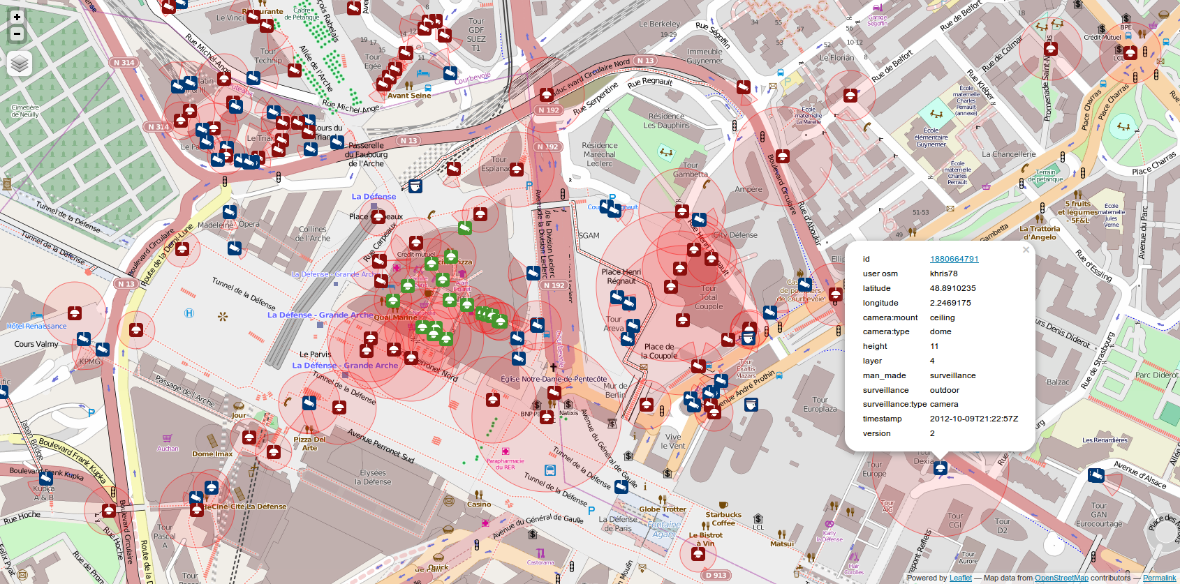
English: A crowdsourced map of surveillance cameras near La Grande Arche de la Défense in France. Map data OpenStreetMap. osmcamera.tk. |
|||
| Date | ||||
| Source | Own work | |||
| Author | Windsock92 | |||
| Permission (Reusing this file) |
|
| Camera location | | View this and other nearby images on: OpenStreetMap |
|---|
Licensing
[edit]
I, the copyright holder of this work, hereby publish it under the following license:
| This file is made available under the Creative Commons CC0 1.0 Universal Public Domain Dedication. | |
| The person who associated a work with this deed has dedicated the work to the public domain by waiving all of their rights to the work worldwide under copyright law, including all related and neighboring rights, to the extent allowed by law. You can copy, modify, distribute and perform the work, even for commercial purposes, all without asking permission.
|
File history
Click on a date/time to view the file as it appeared at that time.
| Date/Time | Thumbnail | Dimensions | User | Comment | |
|---|---|---|---|---|---|
| current | 23:01, 21 July 2014 | | 1,690 × 837 (1.11 MB) | Windsock92 (talk | contribs) | User created page with UploadWizard |
You cannot overwrite this file.
File usage on Commons
There are no pages that use this file.
File usage on other wikis
The following other wikis use this file:
- Usage on de.wikipedia.org
- Usage on en.wikipedia.org