File:Svea kanal 1600-tal.JPG
Jump to navigation
Jump to search

Size of this preview: 768 × 600 pixels. Other resolutions: 308 × 240 pixels | 615 × 480 pixels | 984 × 768 pixels | 1,280 × 999 pixels | 2,560 × 1,999 pixels | 3,096 × 2,417 pixels.
Original file (3,096 × 2,417 pixels, file size: 2.2 MB, MIME type: image/jpeg)
Captions
Captions
Add a one-line explanation of what this file represents
Summary
[edit]
| Description |
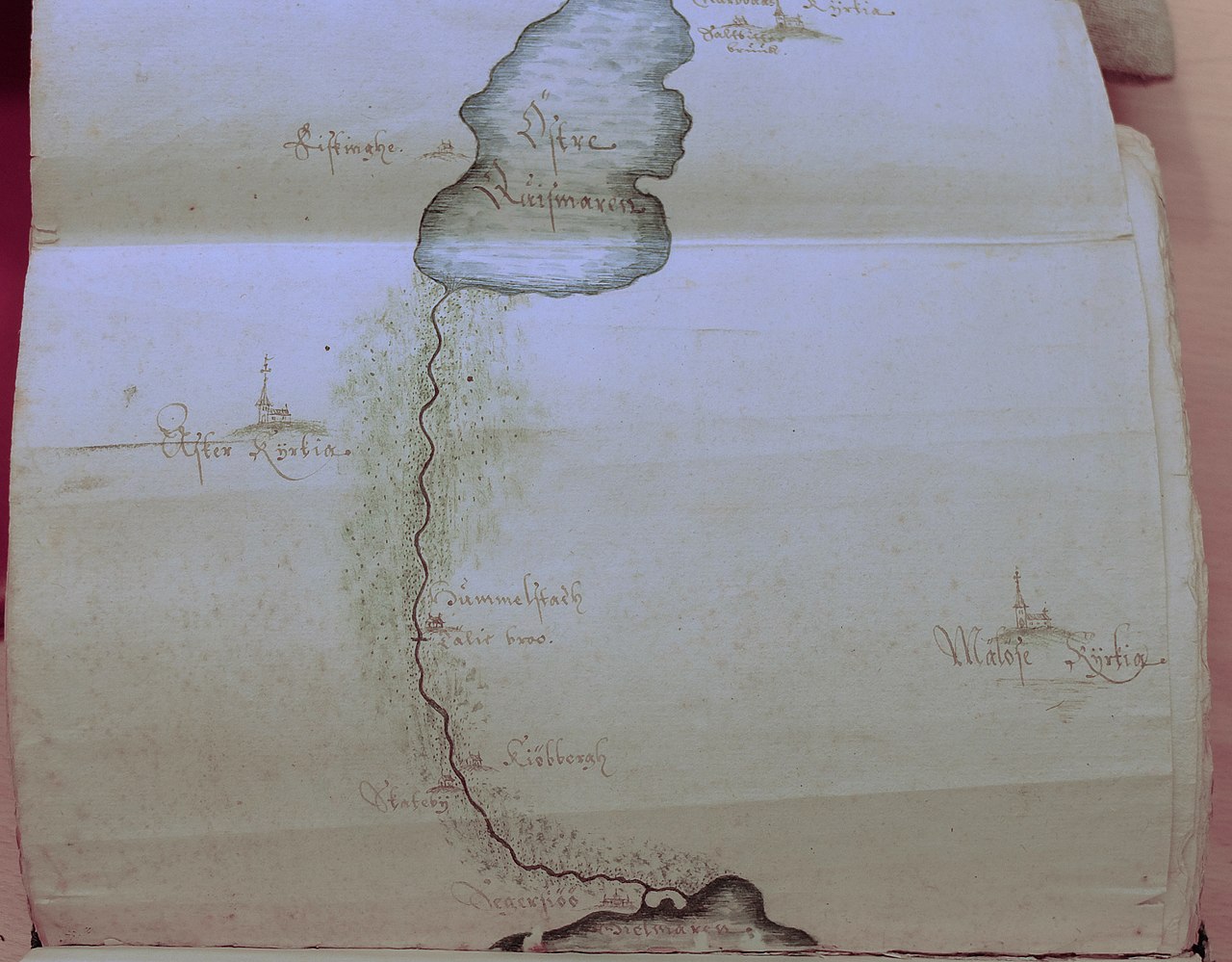
English: Part of a 1700th century map showing the planned Svea canal, which newver was built.
Svenska: Del av en 1600-tals karta som visar den av Gustav II Adolf planerade Svea kanal. |
| Source | Own work |
| Author | Peterappelros |
Licensing
[edit]
I, the copyright holder of this work, hereby publish it under the following license:
This file is licensed under the Creative Commons Attribution 3.0 Unported license.
- You are free:
- to share – to copy, distribute and transmit the work
- to remix – to adapt the work
- Under the following conditions:
- attribution – You must give appropriate credit, provide a link to the license, and indicate if changes were made. You may do so in any reasonable manner, but not in any way that suggests the licensor endorses you or your use.
File history
Click on a date/time to view the file as it appeared at that time.
| Date/Time | Thumbnail | Dimensions | User | Comment | |
|---|---|---|---|---|---|
| current | 13:15, 24 August 2019 | | 3,096 × 2,417 (2.2 MB) | Peterappelros (talk | contribs) | {{Information |description ={{en|1=Part of a 1700th century map showing the planned Svea canal, which newver was built.}} {{sv|1=Del av en 1600-tals karta som visar den av Gustav II Adolf planerade Svea kanal.}} |date = |source ={{own}} |author =User:Peterappelros }} |
You cannot overwrite this file.
File usage on Commons
There are no pages that use this file.
File usage on other wikis
The following other wikis use this file:
- Usage on sv.wikipedia.org