File:Sverdlovskaya-Artinsky-pozkarta.png
Jump to navigation
Jump to search
Size of this preview: 514 × 599 pixels. Other resolutions: 206 × 240 pixels | 412 × 480 pixels | 659 × 768 pixels | 878 × 1,024 pixels | 2,237 × 2,608 pixels.
Original file (2,237 × 2,608 pixels, file size: 118 KB, MIME type: image/png)
Captions
Captions
Add a one-line explanation of what this file represents
| Description |
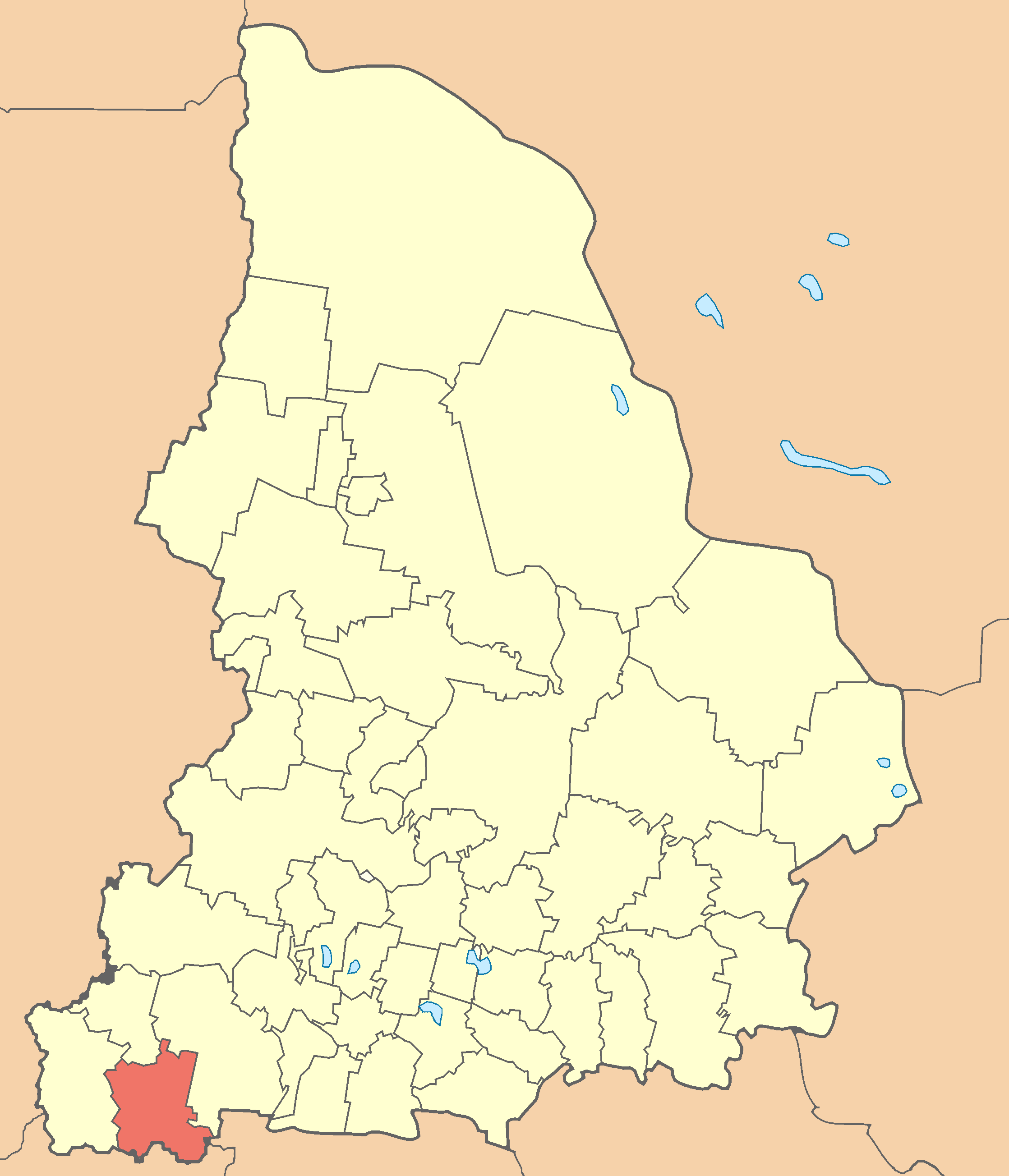
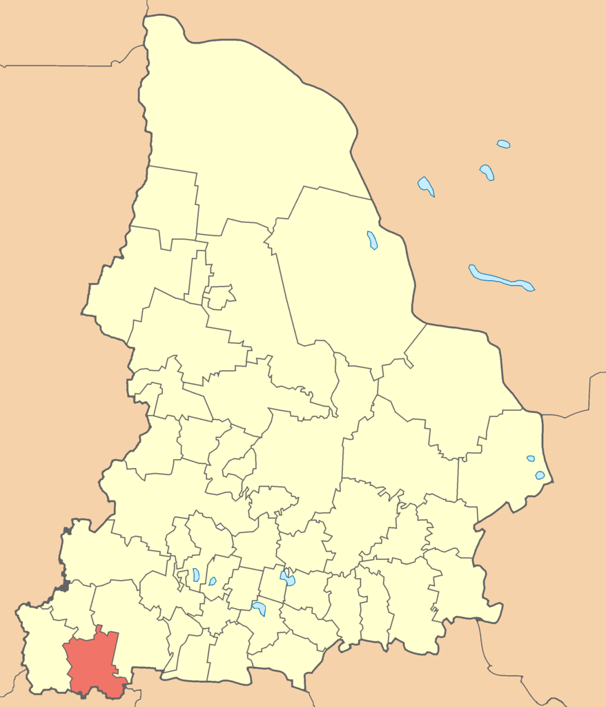
Map of Sverdlovskaya oblast (Russia), in the Mercator projection. Артинский городской округ на карте Свердловской области. |
| Date | (UTC) |
| Source | |
| Author |
|
| This is a retouched picture, which means that it has been digitally altered from its original version. Modifications: Выделение Артинского городского района. The original can be viewed here: Sverdlovskaya-pozkarta.png:
|
I, the copyright holder of this work, hereby publish it under the following license:
| I, the copyright holder of this work, release this work into the public domain. This applies worldwide. In some countries this may not be legally possible; if so: I grant anyone the right to use this work for any purpose, without any conditions, unless such conditions are required by law. |
Original upload log
[edit]
This image is a derivative work of the following images:
- File:Sverdlovskaya-pozkarta.png licensed with PD-self
- 2010-03-22T16:26:05Z Const st 2237x2608 (72635 Bytes) убрал рамку
- 2010-03-22T16:15:20Z Const st 2237x2608 (57489 Bytes) цвета и линии привёл в соответствие с принятыми [[:w:ru:Шаблон:ПозКарта/doc#Изображение|нормами]]
- 2007-05-25T08:27:29Z Koryakov Yuri 2237x2608 (76091 Bytes) {{Information |Description= |Source=self-made |Date=May 2007 |Author=[[:ru:Участник:Koryakov Yuri| Koryakov Yuri]] |other_versions= }}
Uploaded with derivativeFX
File history
Click on a date/time to view the file as it appeared at that time.
| Date/Time | Thumbnail | Dimensions | User | Comment | |
|---|---|---|---|---|---|
| current | 11:05, 3 June 2011 | | 2,237 × 2,608 (118 KB) | SysMusDes (talk | contribs) | {{Information |Description=Map of Sverdlovskaya oblast (Russia), in the Mercator projection. Артинский городской округ на карте Свердловской области. |Source=*File:Sverdlovskaya-pozkarta.png |Date=20 |
You cannot overwrite this file.
File usage on Commons
The following page uses this file:
File usage on other wikis
The following other wikis use this file:
- Usage on ba.wikipedia.org
- Usage on ce.wikipedia.org
- Usage on www.wikidata.org
- Usage on zh-min-nan.wikipedia.org