File:Svobodné Hamry, CZ171201-164.jpg
Jump to navigation
Jump to search

Size of this preview: 800 × 512 pixels. Other resolutions: 320 × 205 pixels | 640 × 410 pixels | 1,024 × 656 pixels | 1,280 × 820 pixels | 2,560 × 1,640 pixels | 4,303 × 2,756 pixels.
Original file (4,303 × 2,756 pixels, file size: 2.77 MB, MIME type: image/jpeg)
Captions
Captions
Protected cultural monuments of buildings in the Czech Republic
Summary
[edit]
| Description |
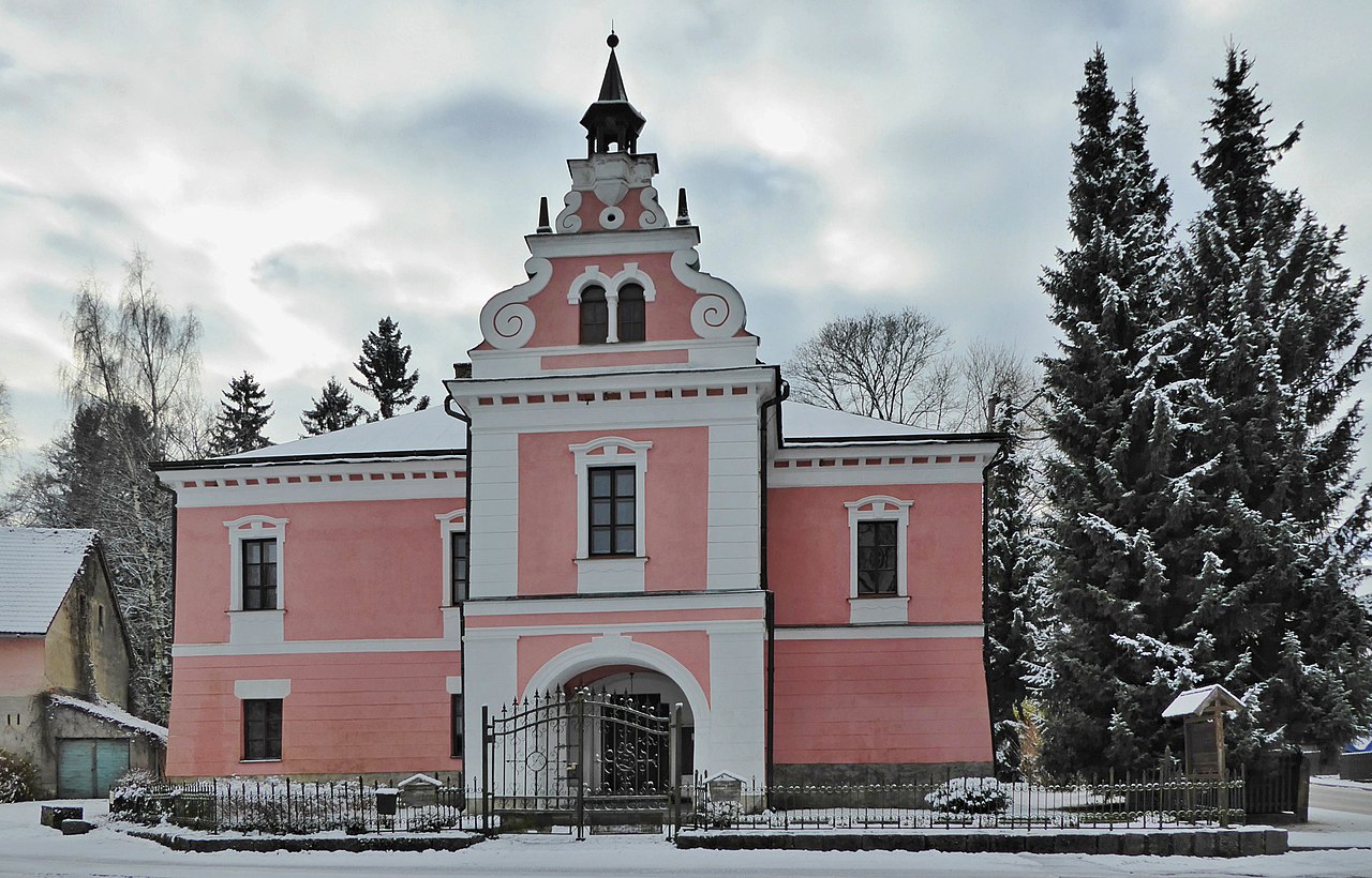
English: Rural chateau with renaissance layout from the 16th century, after a fire in 1896 rebuilt in pseudo-baroque style. On the place of the chateau originally a fortress from the 15th century named "Odranec", later hamlet with name Hamr nad Kamenicí, since 1769 called Svobodné Hamry. Since 1862 the owner was the czech architect Jan Nevole (1812–1903), he lived in the chateau from 1863 until his death. During life of Jan Nevole, the chateau became also a cultural center with a patriotic element. Monument protected building from May 3, 1958. In the years 1982–1996 he was the seat of the museum of folk architecture titled the Set of Folk Buildings Vysočina (now: Open-air Museum Vysočina), rural chateau since 1997 private object. Photo location: Czechia, Pardubice Region, municipality Vysočina, hamlet of Svobodné Hamry, Rural Chateau No. 1, Stružinecká knoll land (azimuth 198°).
Čeština: Venkovský zámek s renesanční dispozicí ze 16. století, po požáru v roce 1896 přestavěn v pseudobarokním stylu. Na místě zámku původně tvrz z 15. století s názvem Odranec, později osada Hamr nad Kamenicí, od roku 1769 s názvem Svobodné Hamry. Od roku 1862 majitelem český architekt a stavitel Jan Nevole (1812-1903), žil na zámku od roku 1863 do své smrti. Během jeho života se zámek stal kulturním centrem s vlasteneckým prvkem. Kulturní památka od 3. května 1958. V letech 1982–1996 sídlo správy muzea lidové architektury a technického stavutelství s názvem Soubor lidových staveb Vysočina (nyní: Muzeum v přírodě Vysočina), zámek od roku 1997 soukromý objekt. Foto lokace: Česko, Pardubický kraj, obec Vysočina, vesnice Svobodné Hamry, venkovský zámek čp. 1, Stružinecká pahorkatina (azimut 198°). |
| Date | |
| Source | Own work |
| Author | Josef Kreuz (PEPan) |
| Camera location | | View this and other nearby images on: OpenStreetMap |
|---|
Zdroje informací:
[edit]
- Národní památkový ústav, památkový katalog – zámek a socha sv. Jana Nepomuckého viz
- Mapy.cz, turistická mapa (letecký pohled) – kompozice Svobodné Hamry, viz
- Obec Vysočina, historie – webové stránky viz
- Veselý Kopec, oficiální webová prezentace Muzea v přírodě Vysočina (dříve Soubor lidových staveb Vysočina) viz
- VOJANCOVÁ, Ilona; KŘIVANOVÁ, Magda, a kolektiv. Soubor lidových staveb Vysočina. 1. vyd. Chrudim: Národní památkový ústav, územní památková správa na Sychrově, 2016. 120 s. ISBN 978-80-905871-8-2
Licensing
[edit]
I, the copyright holder of this work, hereby publish it under the following license:
This file is licensed under the Creative Commons Attribution-Share Alike 4.0 International license.
- You are free:
- to share – to copy, distribute and transmit the work
- to remix – to adapt the work
- Under the following conditions:
- attribution – You must give appropriate credit, provide a link to the license, and indicate if changes were made. You may do so in any reasonable manner, but not in any way that suggests the licensor endorses you or your use.
- share alike – If you remix, transform, or build upon the material, you must distribute your contributions under the same or compatible license as the original.
File history
Click on a date/time to view the file as it appeared at that time.
| Date/Time | Thumbnail | Dimensions | User | Comment | |
|---|---|---|---|---|---|
| current | 14:33, 22 February 2019 | | 4,303 × 2,756 (2.77 MB) | PEPan (talk | contribs) | User created page with UploadWizard |
You cannot overwrite this file.
File usage on Commons
There are no pages that use this file.
File usage on other wikis
The following other wikis use this file:
- Usage on cs.wikipedia.org