File:Swan River.jpg
Jump to navigation
Jump to search

Size of this preview: 563 × 599 pixels. Other resolutions: 225 × 240 pixels | 451 × 480 pixels | 857 × 912 pixels.
Original file (857 × 912 pixels, file size: 177 KB, MIME type: image/jpeg)
Captions
Captions
Add a one-line explanation of what this file represents
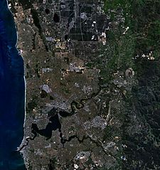
| Description | This is a map of the Swan River, Western Australia, made with World Wind using Landsat 7 data. | |||
| Source | NASA | |||
| Author | Created by the uploader. Any IP involved in the creation of this image is released into the public domain. | |||
| Permission (Reusing this file) |
|

File history
Click on a date/time to view the file as it appeared at that time.
| Date/Time | Thumbnail | Dimensions | User | Comment | |
|---|---|---|---|---|---|
| current | 02:56, 16 November 2006 | | 857 × 912 (177 KB) | Hesperian (talk | contribs) | {{Information |Description=This is a map of the Swan River, Western Australia, made with World Wind using Landsat 7 data. |Source= |Date= |Author=Created by the uploader. Any IP involved in the creation of this image is released into the public domain. |P |
You cannot overwrite this file.
File usage on Commons
There are no pages that use this file.
File usage on other wikis
The following other wikis use this file:
- Usage on af.wikipedia.org
- Usage on ar.wikipedia.org
- Usage on no.wikipedia.org
- Usage on pl.wikipedia.org
- Usage on ta.wikipedia.org