File:Sweden Blekinge location map.svg
Jump to navigation
Jump to search

Size of this PNG preview of this SVG file: 800 × 398 pixels. Other resolutions: 320 × 159 pixels | 640 × 319 pixels | 1,024 × 510 pixels | 1,280 × 637 pixels | 2,560 × 1,275 pixels | 1,000 × 498 pixels.
Original file (SVG file, nominally 1,000 × 498 pixels, file size: 166 KB)
Captions
Captions
Add a one-line explanation of what this file represents
Summary
[edit]
| Description |
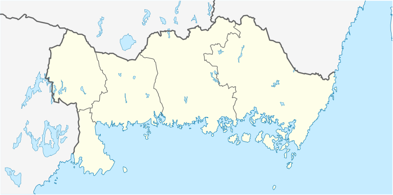
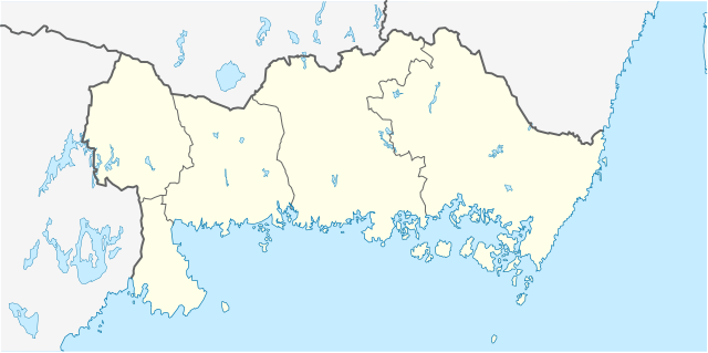
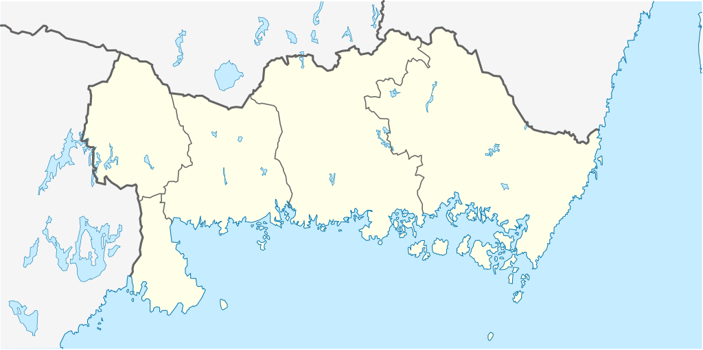
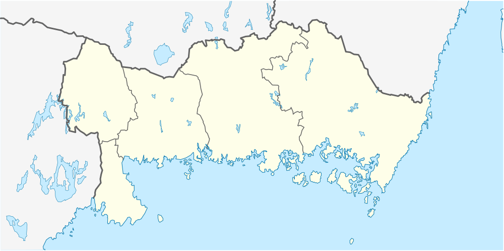
English: Location map of Blekinge County in Sweden
Equirectangular projection, N/S stretching 182 %. Geographic limits of the map:
Deutsch: Positionskarte von Blekinge län in Schweden
Quadratische Plattkarte, N-S-Streckung 182 %. Geographische Begrenzung der Karte:
|
| Date | |
| Source | Own work |
| Author | Erik Frohne |
Licensing
[edit]
I, the copyright holder of this work, hereby publish it under the following licenses:

|
Permission is granted to copy, distribute and/or modify this document under the terms of the GNU Free Documentation License, Version 1.2 or any later version published by the Free Software Foundation; with no Invariant Sections, no Front-Cover Texts, and no Back-Cover Texts. A copy of the license is included in the section entitled GNU Free Documentation License. |
This file is licensed under the Creative Commons Attribution 3.0 Unported license.
- You are free:
- to share – to copy, distribute and transmit the work
- to remix – to adapt the work
- Under the following conditions:
- attribution – You must give appropriate credit, provide a link to the license, and indicate if changes were made. You may do so in any reasonable manner, but not in any way that suggests the licensor endorses you or your use.
You may select the license of your choice.
File history
Click on a date/time to view the file as it appeared at that time.
| Date/Time | Thumbnail | Dimensions | User | Comment | |
|---|---|---|---|---|---|
| current | 17:42, 26 January 2009 | | 1,000 × 498 (166 KB) | Erik Frohne (talk | contribs) | Smaller waterborder |
| 23:07, 17 January 2009 |  | 1,000 × 498 (150 KB) | Erik Frohne (talk | contribs) | {{Information |Description= |Source= |Date= |Author= |Permission= |other_versions= }} Category:Location maps of Sweden | |
| 08:49, 2 January 2009 |  | 153 × 80 (67 KB) | Erik Frohne (talk | contribs) | {{Information |Description=Update (gray out other län) |Source=Own work |Date=02-Jan-2009 |Author=Erik Frohne |Permission=see below |other_versions= }} | |
| 20:08, 1 January 2009 |  | 153 × 80 (29 KB) | Erik Frohne (talk | contribs) | {{Information |Description=Addition of municipiality |Source=Own work |Date=01-01-2009 |Author=Erik Frohne |Permission= |other_versions= }} Category:Location maps of Europe | |
| 17:14, 1 January 2009 |  | 153 × 80 (23 KB) | Erik Frohne (talk | contribs) | {{Information |Description={{en|1=Location map of Blekinge in Sweden Equirectangular projection, N/S stretching 190 %. Geographic limits of the map: * N: 56° 33' N * S: 55° 56' N * W: 14° 08' E * E: 16° 23' E }} {{de|1=Positionskarte von Schonen |
You cannot overwrite this file.
File usage on Commons
There are no pages that use this file.
File usage on other wikis
The following other wikis use this file:
- Usage on ar.wikipedia.org
- Usage on bg.wikipedia.org
- Usage on ceb.wikipedia.org
- Usage on cs.wikipedia.org
- Usage on da.wikipedia.org
- Karlskrona
- Ronneby
- Karlshamn
- Olofström
- Sölvesborg
- Kristianopel
- Elleholm
- Sølvesborg Slotsruin
- Lyckeby
- Nättraby
- Brömsebro
- Skabelon:Kortpositioner Sverige Blekinge
- Bräkne-Hoby
- Järnavik
- Rödeby
- Drottningskär
- Fridlevstad
- Fågelmara
- Hasslö
- Holmsjö
- Jämjö
- Kättilsmåla
- Torhamn
- Mörrum
- Hällaryd
- Mjällby
- Svängsta
- Trolleboda (Ronneby kommun)
- Backaryd
- Åryd (Blekinge)
- Bruger:DykplatserISverige/Vragkirkegården ved Ekenabben
- Usage on de.wikipedia.org
View more global usage of this file.