File:TC Dina 23 jan 2002 0640Z.jpg
跳转到导航
跳转到搜索

本预览的尺寸:452 × 600像素。 其他分辨率:181 × 240像素 | 362 × 480像素 | 579 × 768像素 | 772 × 1,024像素 | 1,544 × 2,048像素 | 6,000 × 7,960像素。
原始文件 (6,000 × 7,960像素,文件大小:7.01 MB,MIME类型:image/jpeg)
说明
说明
添加一行文字以描述该文件所表现的内容
摘要
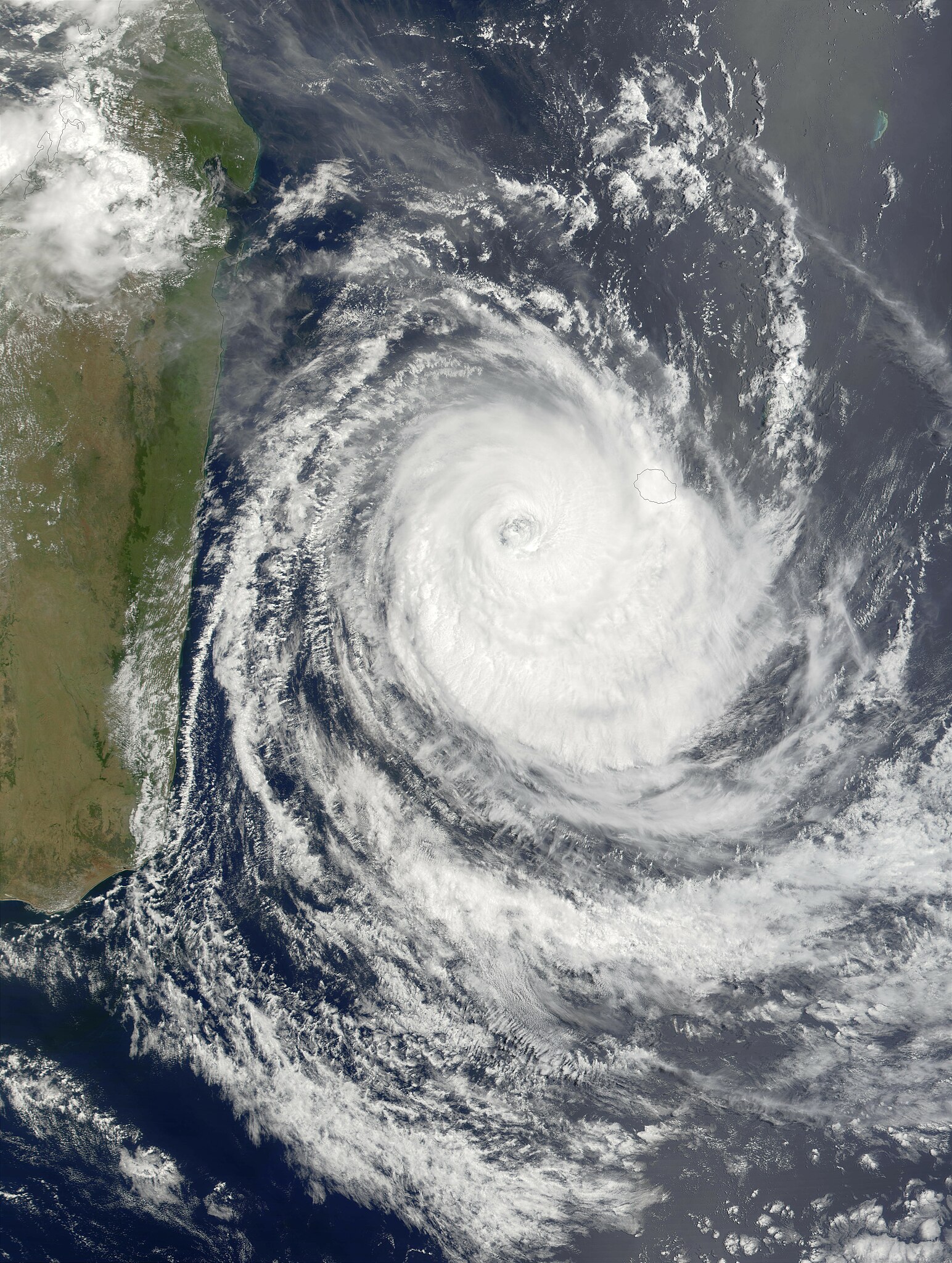
[编辑]| 描述 | Maximum sustained winds in Cyclone Dina had dropped to about 130 miles per hour as of Wednesday morning, January 23, 2002, and were predicted to continue dropping as the storm pursued a west-southwestward track that will likely shift more toward the south, keeping the center of the storm away from the island of Madagascar. In this true-color MODIS image made from data acquired on the morning of January 23, the storm had cleared Mauritius (eastern-most island) but was still covering Riunion. The outer bands of clouds were skirting the southeast coast of Madagascar. | |||||
| 日期 | ||||||
| 来源 | http://visibleearth.nasa.gov/view_rec.php?id=2402 | |||||
| 作者 | Jacques Descloitres, MODIS Land Rapid Response Team, NASA/GSFC | |||||
| 授权 (二次使用本文件) |
|

文件历史
点击某个日期/时间查看对应时刻的文件。
| 日期/时间 | 缩略图 | 大小 | 用户 | 备注 | |
|---|---|---|---|---|---|
| 当前 | 2006年12月3日 (日) 20:18 | | 6,000 × 7,960(7.01 MB) | Good kitty(留言 | 贡献) | == Summary == {{Information |Description=Maximum sustained winds in Cyclone Dina had dropped to about 130 miles per hour as of Wednesday morning, January 23, 2002, and were predicted to continue dropping as the storm pursued a west-southwestward track tha |
您不可以覆盖此文件。
文件用途
没有页面使用本文件。
全域文件用途
以下其他wiki使用此文件:
- en.wikipedia.org上的用途
- zh.wikipedia.org上的用途