File:THW-Landesverbaende.svg
Jump to navigation
Jump to search

Size of this PNG preview of this SVG file: 443 × 599 pixels. Other resolutions: 177 × 240 pixels | 355 × 480 pixels | 567 × 768 pixels | 757 × 1,024 pixels | 1,513 × 2,048 pixels | 592 × 801 pixels.
Original file (SVG file, nominally 592 × 801 pixels, file size: 208 KB)
Captions
Captions
Add a one-line explanation of what this file represents
| Description |
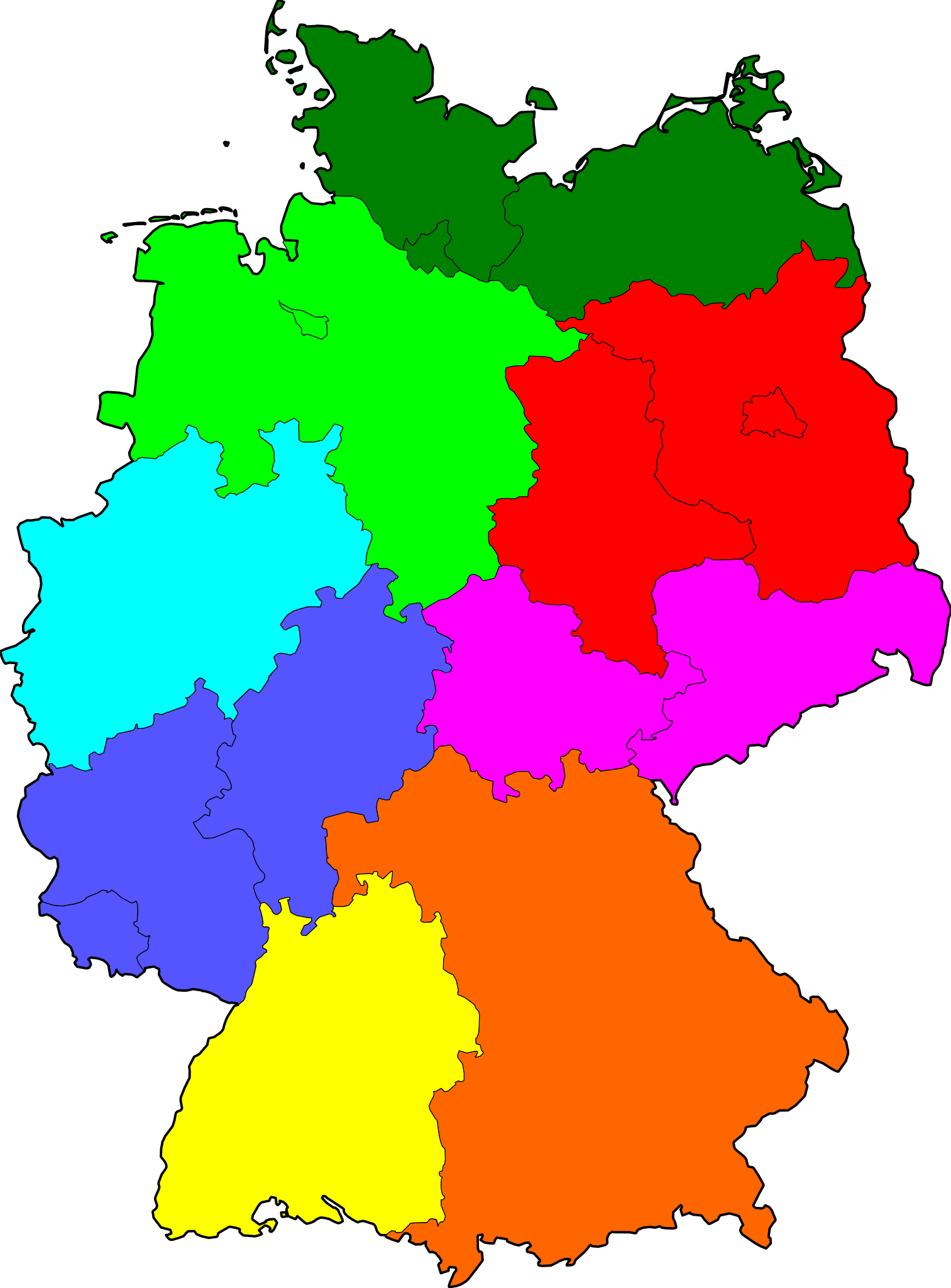
Deutsch: Karte der Bundesrepublik Deutschland mit den Regionen der acht Landesverbände der Bundesanstalt technisches Hilfswerk. English: Map of Germany with the eight regions of the Landesverbände of Bundesanstant THW |
| Date | (UTC) |
| Source | |
| Author |
|
| This is a retouched picture, which means that it has been digitally altered from its original version. Modifications: Die 8 Landesverbände der Bundesanstalt Technisches Hilfswerk. The original can be viewed here: Karte Deutschland.svg:
|
This file is licensed under the Creative Commons Attribution-Share Alike 3.0 Unported license.
- You are free:
- to share – to copy, distribute and transmit the work
- to remix – to adapt the work
- Under the following conditions:
- attribution – You must give appropriate credit, provide a link to the license, and indicate if changes were made. You may do so in any reasonable manner, but not in any way that suggests the licensor endorses you or your use.
- share alike – If you remix, transform, or build upon the material, you must distribute your contributions under the same or compatible license as the original.
Original upload log
[edit]
This image is a derivative work of the following images:
- File:Karte_Deutschland.svg licensed with Cc-by-sa-2.0-de
- 2008-03-18T08:51:34Z TMg 592x801 (212856 Bytes) Border lines a little bit darker so they are equal when viewing both images in the same size, e.g. 140px.
- 2007-08-20T20:34:37Z Kjunix 592x801 (213910 Bytes) {{Information| |Description= {{de|Karte der [[Bundesrepublik Deutschland]] mit eingezeichneten Grenzen der Bundesländer.}} |Source=based on [[Image:Karte Deutsche Bundesländer (nummeriert).svg|Karte Deutsche Bundesländer (
Uploaded with derivativeFX
File history
Click on a date/time to view the file as it appeared at that time.
| Date/Time | Thumbnail | Dimensions | User | Comment | |
|---|---|---|---|---|---|
| current | 15:36, 28 June 2010 | | 592 × 801 (208 KB) | Starwhooper (talk | contribs) | {{Information |Description={{de|Karte der Bundesrepublik Deutschland mit den Regionen der acht Landesverbände der Bundesanstalt technisches Hilfswerk.}} {{en|Map of Germany with the eight regions of the Landesverbände of Bundesanstant THW}} |Source |
You cannot overwrite this file.
File usage on Commons
The following page uses this file:
File usage on other wikis
The following other wikis use this file:
- Usage on de.wikipedia.org
- Usage on nl.wikipedia.org
- Usage on pl.wikipedia.org