File:TJØNNEBERGET Hvasser Oslofjorden Norway. Kystradarstasjon DNT Kystled View Utsikt Sør Store Færder fyr Kløvningen Uleholmen Radar Røssesund Verdens Ende Tjøme WW2 ruins Svaberg rocks Sunset solnedgang 2021-04-10 Distorted panoram.jpg
Jump to navigation
Jump to search

Size of this preview: 800 × 208 pixels. Other resolutions: 320 × 83 pixels | 640 × 166 pixels | 1,024 × 266 pixels | 1,280 × 333 pixels | 2,560 × 665 pixels | 14,324 × 3,723 pixels.
Original file (14,324 × 3,723 pixels, file size: 9.98 MB, MIME type: image/jpeg)
Captions
Captions
Add a one-line explanation of what this file represents
Summary[edit]
| Description |
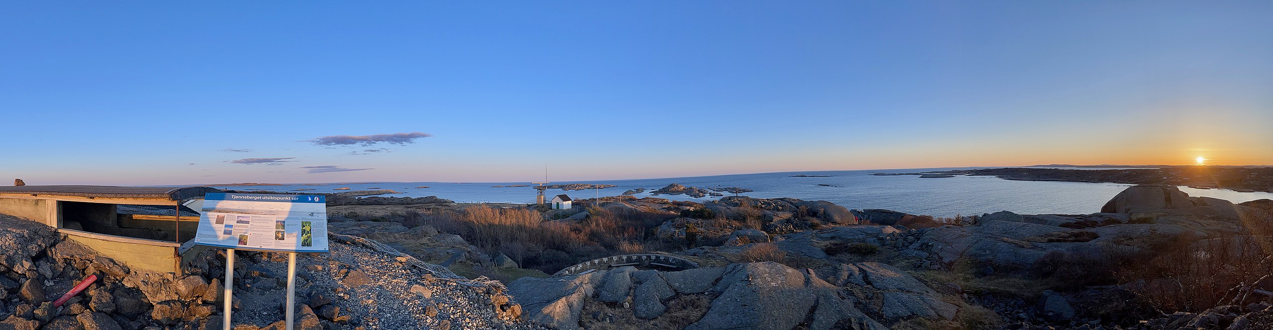
English: Distorted panorama photo taken at sunset in early April 2021, showing the view from Tjønneberget, a hill on the island of Hvasser on the west side of the Oslo Fjord, Norway.
From the top at 42 meters there is a great view in all directions: southeast towards Færder lighthouse and Skagerak, west towards the neighboring island of Tjøme, and north and east towards the rest of the Hvasser island. The ridge is hilly with smooth slopes of bare rock with boulders and scattered vegetation. Norsk bokmål: Delvis forvrengt panoramafoto tatt ved solnedgang en kveld i april 2021 fra Tjønneberget på Hvasser.
|
| Date | |
| Source | Own work |
| Author | Wolfmann |
Licensing[edit]
I, the copyright holder of this work, hereby publish it under the following license:
This file is licensed under the Creative Commons Attribution-Share Alike 4.0 International license.
- You are free:
- to share – to copy, distribute and transmit the work
- to remix – to adapt the work
- Under the following conditions:
- attribution – You must give appropriate credit, provide a link to the license, and indicate if changes were made. You may do so in any reasonable manner, but not in any way that suggests the licensor endorses you or your use.
- share alike – If you remix, transform, or build upon the material, you must distribute your contributions under the same or compatible license as the original.
File history
Click on a date/time to view the file as it appeared at that time.
| Date/Time | Thumbnail | Dimensions | User | Comment | |
|---|---|---|---|---|---|
| current | 16:54, 13 April 2021 | 14,324 × 3,723 (9.98 MB) | Wolfmann (talk | contribs) | Uploaded own work with UploadWizard |
You cannot overwrite this file.
File usage on Commons
There are no pages that use this file.