File:Tabula Tertia Asiae.jpg
Jump to navigation
Jump to search

Size of this preview: 800 × 585 pixels. Other resolutions: 320 × 234 pixels | 640 × 468 pixels | 806 × 589 pixels.
Original file (806 × 589 pixels, file size: 212 KB, MIME type: image/jpeg)
Captions
Captions
Add a one-line explanation of what this file represents
Summary
[edit]
| Description |
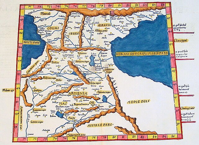
English: Ptolemy's Third Map of Asia, containing Greater Armenia (Armenia Maior) and the Roman-era Caucasus (Colhi, Iberia, Albania), from the Vienna edition of the Geography produced by Laurent Fries |
| Date | |
| Source | Classical Images |
| Author | Ptolemy |
Licensing
[edit]
|
This work is in the public domain in its country of origin and other countries and areas where the copyright term is the author's life plus 70 years or fewer. This work is in the public domain in the United States because it was published (or registered with the U.S. Copyright Office) before January 1, 1929. | |
| This file has been identified as being free of known restrictions under copyright law, including all related and neighboring rights. | |
File history
Click on a date/time to view the file as it appeared at that time.
| Date/Time | Thumbnail | Dimensions | User | Comment | |
|---|---|---|---|---|---|
| current | 21:05, 25 February 2024 | | 806 × 589 (212 KB) | Enyavar (talk | contribs) | Cropped 19 % horizontally, 21 % vertically using CropTool with precise mode. |
| 23:03, 12 September 2016 |  | 1,000 × 748 (232 KB) | LlywelynII (talk | contribs) | User created page with UploadWizard |
You cannot overwrite this file.
File usage on Commons
The following page uses this file:
File usage on other wikis
The following other wikis use this file:
- Usage on en.wikipedia.org
- Usage on it.wikipedia.org