File:Tabula hungariae tájolás.jpg
Jump to navigation
Jump to search

Size of this preview: 599 × 599 pixels. Other resolutions: 240 × 240 pixels | 480 × 480 pixels | 768 × 768 pixels | 1,024 × 1,024 pixels | 2,048 × 2,048 pixels | 5,548 × 5,549 pixels.
Original file (5,548 × 5,549 pixels, file size: 17.26 MB, MIME type: image/jpeg)
Captions
Captions
Add a one-line explanation of what this file represents
Summary
[edit]| Description |
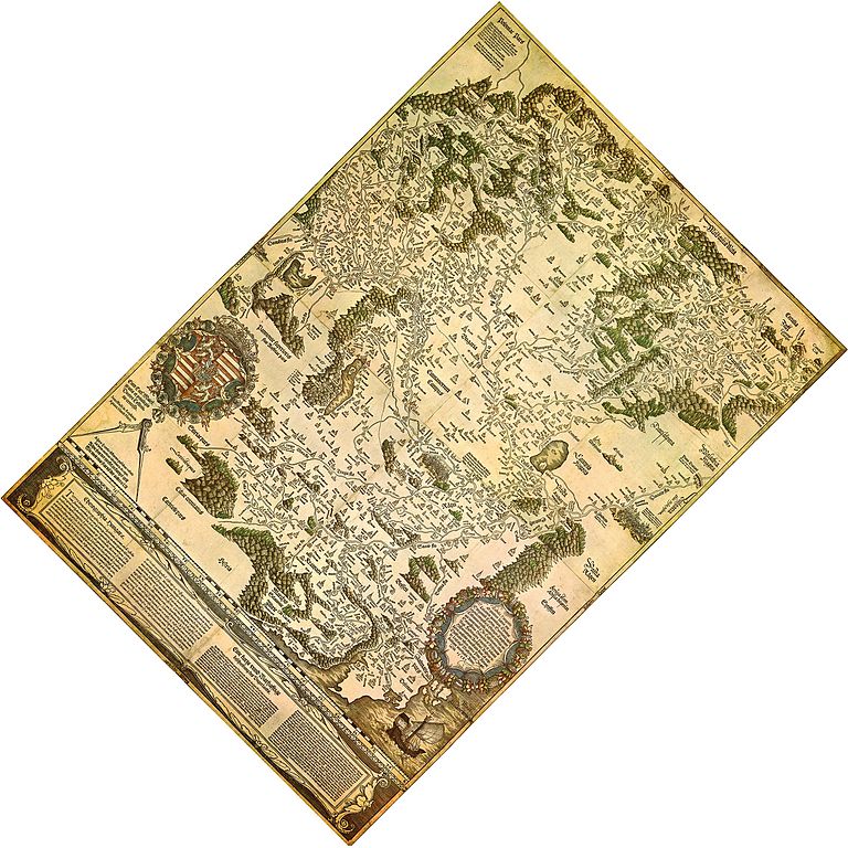
Magyar: A Tabula Hungariae délnyugat-északkeleti tájolása "Ha pedig ezt a térképet helyesen fekteted a négy égtáj felé, látni fogod, melyik város fekszik a másikhoz képest inkább napkeletre vagy napnyugatra, hasonlóképpen délre vagy északra." |
| Date | somewhere between 1526-1528 |
| Source | File:Tabula_hungariae.jpg |
| Author | Lázár Deák (Lazarus Secretarius) |
| Other versions |
|


Licensing
[edit]
|
This work is in the public domain in its country of origin and other countries and areas where the copyright term is the author's life plus 70 years or fewer. | |
| This file has been identified as being free of known restrictions under copyright law, including all related and neighboring rights. | |
File history
Click on a date/time to view the file as it appeared at that time.
| Date/Time | Thumbnail | Dimensions | User | Comment | |
|---|---|---|---|---|---|
| current | 05:08, 22 May 2016 | | 5,548 × 5,549 (17.26 MB) | Dencey (talk | contribs) | User created page with UploadWizard |
You cannot overwrite this file.
File usage on Commons
The following 2 pages use this file:
File usage on other wikis
The following other wikis use this file:
- Usage on hu.wikipedia.org