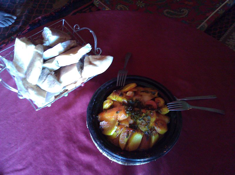
File:Tagine for lunch in Zagora, Morocco (5422895511) (6).jpg

Original file (2,592 × 1,936 pixels, file size: 839 KB, MIME type: image/jpeg)
Captions
Captions
Summary[edit]
| DescriptionTagine for lunch in Zagora, Morocco (5422895511) (6).jpg |
A tajine or tagine (Berber: tajin) is a Moroccan dish, which is named after the special pot in which it is cooked. A similar dish, known as Tavvas, is found in the cuisine of Cyprus. The traditional tajine pot is formed entirely of a heavy clay, which is sometimes painted or glazed. It consists of two parts: a base unit that is flat and circular with low sides, and a large cone or dome-shaped cover that rests inside the base during cooking. The cover is so designed to promote the return of all condensation to the bottom. With the cover removed, the base can be taken to the table for serving. Recently, European manufacturers have created tajines with heavy cast-iron bottoms that can be heated on a cooking stove to a high temperature. This permits the browning of meat and vegetables before cooking. Zagora (Arabic: زكورة) is a town in the valley of the Draa River in Souss-Massa-Draâ, southeastern Morocco. It is located at around 30°19′50″N 5°50′17″W / 30.33056°N 5.83806°W / 30.33056; -5.83806Coordinates: 30°19′50″N 5°50′17″W / 30.33056°N 5.83806°W / 30.33056; -5.83806. It is flanked by the mountain Zagora from which the town got its name. Originally it was called 'Tazagourt' (ⵜⴰⵣⴰⴳⵓⵔⵜ) the singular of plural 'Tizigirt' (ⵜⵉⵣⵉⴳⵉⵔⵜ), Berber for 'twinpeaks', referring to the form of the mountain. In old European maps the mountain Zagora is already indicated but the town itself was only built in the 20th century. On the top of the Zagora mountain the remains of an Almoravid fortress can still be seen. [1] The exact location of the former Almoravid mosque is still a matter of dispute. Each year the moussem (festival) of the Sufi saint moulay Abdelkader Jilali is celebrated at Zagora. A well known sign at the town border states "Tombouctou 52 jours", the supposed time it takes to get to Timbuktu, Mali on foot or camel. |
| Date | |
| Source | Tagine for lunch in Zagora, Morocco |
| Author | YoTuT from United States |
| Camera location | 30° 22′ 08.87″ N, 5° 46′ 33.5″ W | View this and other nearby images on: OpenStreetMap |
|---|
Licensing[edit]
- You are free:
- to share – to copy, distribute and transmit the work
- to remix – to adapt the work
- Under the following conditions:
- attribution – You must give appropriate credit, provide a link to the license, and indicate if changes were made. You may do so in any reasonable manner, but not in any way that suggests the licensor endorses you or your use.
| This image, originally posted to Flickr, was reviewed on 21 September 2013 by the administrator or reviewer File Upload Bot (Magnus Manske), who confirmed that it was available on Flickr under the stated license on that date. |
File history
Click on a date/time to view the file as it appeared at that time.
| Date/Time | Thumbnail | Dimensions | User | Comment | |
|---|---|---|---|---|---|
| current | 15:29, 21 September 2013 |  | 2,592 × 1,936 (839 KB) | File Upload Bot (Magnus Manske) (talk | contribs) | Transferred from Flickr by User:russavia |
You cannot overwrite this file.
File usage on Commons
There are no pages that use this file.
Metadata
This file contains additional information such as Exif metadata which may have been added by the digital camera, scanner, or software program used to create or digitize it. If the file has been modified from its original state, some details such as the timestamp may not fully reflect those of the original file. The timestamp is only as accurate as the clock in the camera, and it may be completely wrong.
| Camera manufacturer | HTC |
|---|---|
| Camera model | T-Mobile G2 |
| ISO speed rating | 533 |
| Date and time of data generation | 14:20, 5 February 2011 |
| Lens focal length | 3.53 mm |
| Latitude | 30° 22′ 8.87″ N |
| Longitude | 5° 46′ 33.5″ W |
| Altitude | 782 meters above sea level |
| Horizontal resolution | 72 dpi |
| Vertical resolution | 72 dpi |
| Y and C positioning | Centered |
| Exif version | 2.2 |
| Date and time of digitizing | 14:20, 5 February 2011 |
| Meaning of each component |
|
| Supported Flashpix version | 1 |
| Color space | sRGB |
| GPS time (atomic clock) | 14:20 |
| Geodetic survey data used | WGS-84 |
| GPS date | 5 February 2011 |
| GPS tag version | 2.2.0 |