File:Tammy 2023-10-24 1245Z IR.png
Jump to navigation
Jump to search

Size of this preview: 800 × 600 pixels. Other resolutions: 320 × 240 pixels | 640 × 480 pixels | 1,024 × 768 pixels | 1,280 × 960 pixels | 2,160 × 1,620 pixels.
Original file (2,160 × 1,620 pixels, file size: 6.18 MB, MIME type: image/png)
Captions
Captions
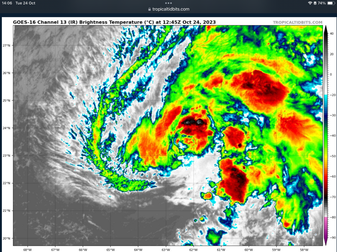
Satellite imagery of Hurricane Tammy. Taken by GOES-East at 1245Z.
Summary[edit]
| Description |
English: The GOES-16 Band-13 infrared satellite image of Hurricane Tammy. This image was taken at 12:45Z on Oct 24, 2023. |
| Date | |
| Source | https://www.tropicaltidbits.com/sat/satlooper.php?region=20L&product=ir |
| Author | NOAA.gov’s GOES-16 satellite |
Licensing[edit]
This image is in the public domain because it contains materials that originally came from the U.S. National Oceanic and Atmospheric Administration, taken or made as part of an employee's official duties.
|
File history
Click on a date/time to view the file as it appeared at that time.
| Date/Time | Thumbnail | Dimensions | User | Comment | |
|---|---|---|---|---|---|
| current | 13:23, 24 October 2023 | | 2,160 × 1,620 (6.18 MB) | Edit of edit (talk | contribs) | Uploaded a work by NOAA.gov’s GOES-16 satellite from https://www.tropicaltidbits.com/sat/satlooper.php?region=20L&product=ir with UploadWizard |
You cannot overwrite this file.
File usage on Commons
The following page uses this file:
- File:Tammy IR 2023-10-24 1245Z.png (file redirect)