File:Tangkak IC.svg
跳转到导航
跳转到搜索

此SVG文件的PNG预览的大小:800 × 524像素。 其他分辨率:320 × 209像素 | 640 × 419像素 | 1,024 × 670像素 | 1,280 × 838像素 | 2,560 × 1,676像素 | 3,029 × 1,983像素。
原始文件 (SVG文件,尺寸为3,029 × 1,983像素,文件大小:2.42 MB)
说明
说明
添加一行文字以描述该文件所表现的内容
摘要
[编辑]
| 描述 |
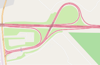
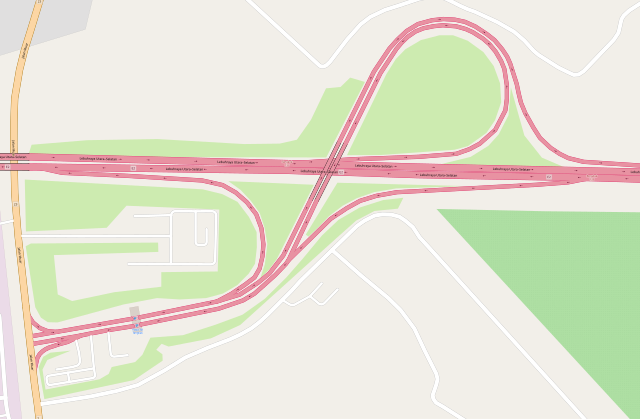
English: Map of Tangkak I/C, provided by openstreetmap.org. |
| 日期 | |
| 来源 | OpenStreetMap |
| 作者 | © OpenStreetMap contributors |
| 描写 |
本地圖以OpenStreetMap計畫資料建立,由社群收集。 此地圖可能不完整,也可能包含錯誤。別只用它當導航。 |
|||
| 日期 | (參見檔案歷史) | |||
| 来源 | openstreetmap.org | |||
| 创作作者 |
OpenStreetMap 貢獻者 |
|||
| 授权 (二次使用本文件) |
OpenStreetMap的資料依據開放資料庫授權條款(細節)提供。標準樣式的圖磚按照ODbL生產的作品授權。
|
|||
| 地理参考 | 如果不适当,请设置 warp_status = skip 为隐藏。 |
许可协议
[编辑]
| This work is licensed under the Open Database License (summary). |
文件历史
点击某个日期/时间查看对应时刻的文件。
| 日期/时间 | 缩略图 | 大小 | 用户 | 备注 | |
|---|---|---|---|---|---|
| 当前 | 2020年10月30日 (五) 07:25 | | 3,029 × 1,983(2.42 MB) | *angys*(留言 | 贡献) | 2020 update |
| 2018年11月23日 (五) 05:15 |  | 3,259 × 1,785(2.29 MB) | *angys*(留言 | 贡献) | User created page with UploadWizard |
您不可以覆盖此文件。
文件用途
没有页面使用本文件。
全域文件用途
以下其他wiki使用此文件:
- zh.wikipedia.org上的用途