File:Tassili n'Ajjer Landsat.jpg
Jump to navigation
Jump to search

Size of this preview: 750 × 600 pixels. Other resolutions: 300 × 240 pixels | 600 × 480 pixels | 960 × 768 pixels | 1,280 × 1,024 pixels.
Original file (1,280 × 1,024 pixels, file size: 1.2 MB, MIME type: image/jpeg)
Captions
Captions
Add a one-line explanation of what this file represents
| Description |
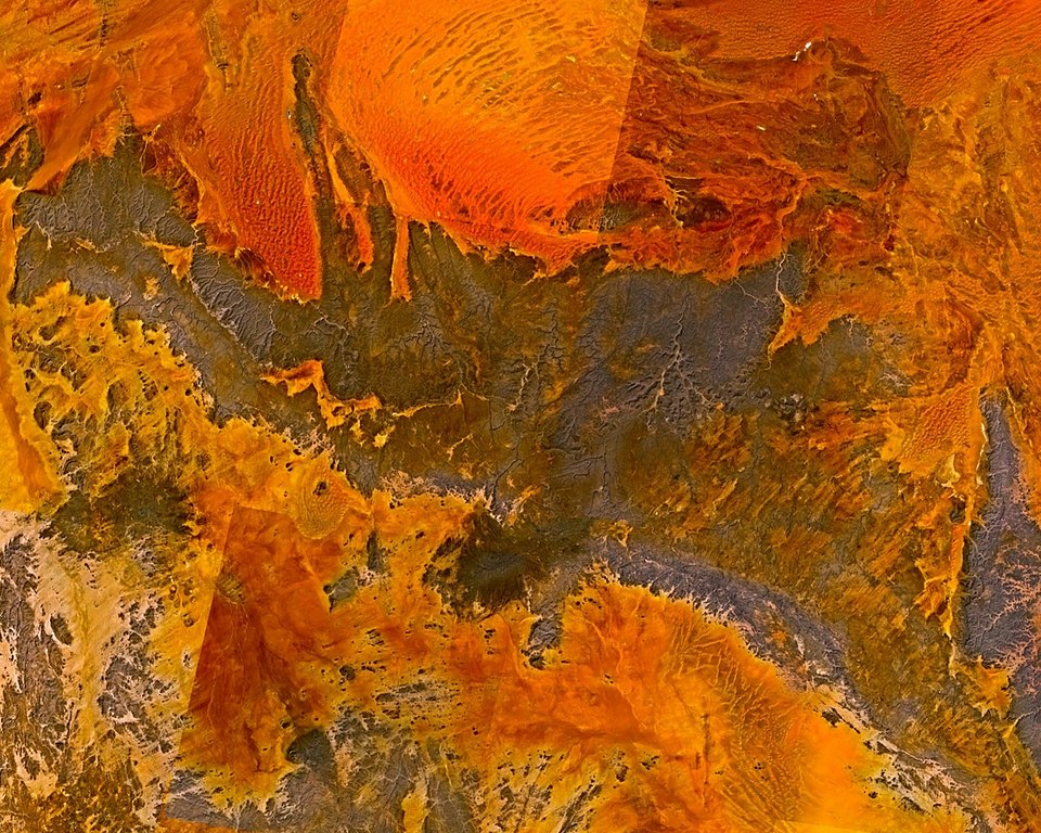
English: Tassili n'Ajjer massif in the Sahara, Algeria. |
| Date | |
| Source |
Made with The GIMP! from a NASA World Wind screenshot.
|
| Author | Júlio Reis (User:Tintazul) |
| Permission (Reusing this file) |
I, the author release this image into Public Domain. |
| This image is in the public domain because it is a screenshot from NASA’s globe software World Wind using a public domain layer, such as Blue Marble, MODIS, Landsat, SRTM, USGS or GLOBE.
|
 |
File history
Click on a date/time to view the file as it appeared at that time.
| Date/Time | Thumbnail | Dimensions | User | Comment | |
|---|---|---|---|---|---|
| current | 16:48, 3 November 2005 | | 1,280 × 1,024 (1.2 MB) | Tintazul (talk | contribs) | {{Information| |Description=Tassili n'Ajjer massif in the Sahara, Algeria. |Source=Made with [http://www.gimp.org/ The GIMP!] from a [http://worldwind.arc.nasa.gov/ NASA World Wind] screenshot |Date=03 November 2005 |Author=Júlio Reis (User:Tintazul) |
You cannot overwrite this file.
File usage
The following page uses this file:
Global file usage
The following other wikis use this file:
- Usage on ast.wikipedia.org
- Usage on be.wikipedia.org
- Usage on bg.wikipedia.org
- Usage on ca.wikipedia.org
- Usage on cs.wikipedia.org
- Usage on de.wikipedia.org
- Usage on eo.wikipedia.org
- Usage on es.wikipedia.org
- Usage on he.wikipedia.org
- Usage on hr.wikipedia.org
- Usage on hy.wikipedia.org
- Usage on ja.wikipedia.org
- Usage on ka.wikipedia.org
- Usage on kk.wikipedia.org
- Usage on nl.wikipedia.org
- Usage on nn.wikipedia.org
- Usage on no.wikipedia.org
- Usage on pt.wikipedia.org
- Usage on ru.wikipedia.org
- Usage on sh.wikipedia.org
- Usage on sv.wikipedia.org
- Usage on xmf.wikipedia.org