File:Tepanecapan.png
Jump to navigation
Jump to search
Size of this preview: 492 × 599 pixels. Other resolutions: 197 × 240 pixels | 394 × 480 pixels | 631 × 768 pixels | 1,116 × 1,359 pixels.
Original file (1,116 × 1,359 pixels, file size: 831 KB, MIME type: image/png)
Captions
Captions
Add a one-line explanation of what this file represents
| Description |
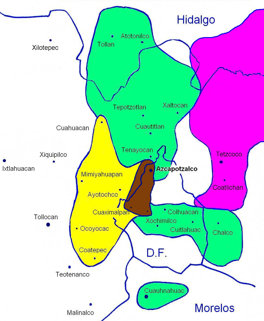
Español: Evolución de la extensión del territorio tepaneca.
|
| Date | (UTC) |
| Source | |
| Author |
|
| This is a retouched picture, which means that it has been digitally altered from its original version. Modifications: Mix of 2 maps without caption. The original can be viewed here: Tepanecapan I.JPG:
|
This file is licensed under the Creative Commons Attribution-Share Alike 3.0 Unported license.
- You are free:
- to share – to copy, distribute and transmit the work
- to remix – to adapt the work
- Under the following conditions:
- attribution – You must give appropriate credit, provide a link to the license, and indicate if changes were made. You may do so in any reasonable manner, but not in any way that suggests the licensor endorses you or your use.
- share alike – If you remix, transform, or build upon the material, you must distribute your contributions under the same or compatible license as the original.
Original upload log[edit]
This image is a derivative work of the following images:
- File:Tepanecapan_II.JPG licensed with Cc-by-3.0, GFDL
- 2008-04-17T22:15:06Z Akapochtli 1248x1454 (189549 Bytes) {{Information |Description= Extensión del señorio Tepaneca de 1222 a 1431. |Source=self-made Investigación realizada por Francisco Jesús Hernández Maciel durante 2004, en base a las fuentes coloniales. |Date=17-abril-200
- File:Tepanecapan_I.JPG licensed with Cc-by-3.0, GFDL
- 2008-04-25T22:07:13Z Akapochtli 1080x1553 (183109 Bytes) {{Information |Description=Mapa del territorio que se cree originalmente ocupó la etnia Tepaneca, de filiación otopame. Que se desarrollo del 600 a 1222 d.n.E., y su posterior extensión hasta la muerte de Tezcapoctzin en 1
Uploaded with derivativeFX

File history
Click on a date/time to view the file as it appeared at that time.
| Date/Time | Thumbnail | Dimensions | User | Comment | |
|---|---|---|---|---|---|
| current | 16:34, 10 December 2010 | | 1,116 × 1,359 (831 KB) | El Comandante (talk | contribs) | {{Information |Description={{es|Evolución de la extensión del territorio tepaneca. * '''En marrón :''' territorio que se cree originalmente ocupó la etnia tepaneca. * '''En amarillo :''' primera fase de extensión, '''entre 1222 y 1283''' (territorio |
You cannot overwrite this file.
File usage on Commons
There are no pages that use this file.
File usage on other wikis
The following other wikis use this file:
- Usage on fr.wikipedia.org