File:LIDAR image of the City of Durham, 1m resolution.tiff
(Redirected from File:Terrain map of the City of Durham, 1m resolution.tif)

Size of this JPG preview of this TIF file: 800 × 533 pixels. Other resolutions: 320 × 213 pixels | 640 × 427 pixels | 1,024 × 683 pixels | 1,280 × 853 pixels | 3,000 × 2,000 pixels.
Original file (3,000 × 2,000 pixels, file size: 5.73 MB, MIME type: image/tiff)
Captions
Captions
Add a one-line explanation of what this file represents
Summary
[edit]| Description |
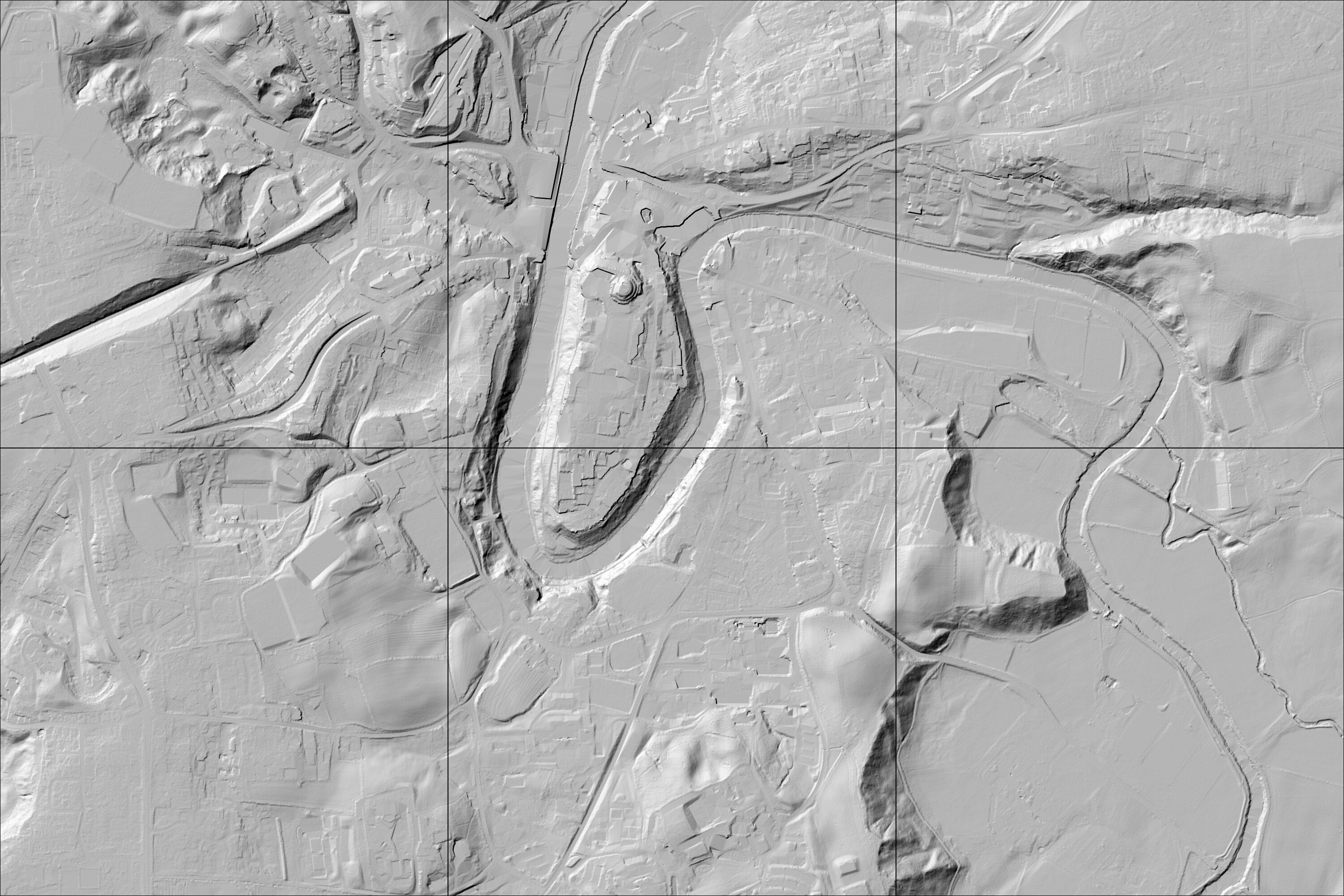
English: Terrain map of the area around the centre of the City of Durham at 1m resolution. Generated using Environment Agency LIDAR data |
| Date | |
| Source | Environment Agency LIDAR terrain data |
| Author | UK Government |
| Other versions | Version with buildings |
| Camera location | | View this and other nearby images on: OpenStreetMap |
|---|
Licensing
[edit]_(St_Edwards_Crown).svg)
|
This file is licensed under the Open Government Licence version 1.0 (OGL v1.0).
|
|---|---|
|
You are free to:
See the Open Government Licence page on Meta-Wiki for more information.
|
File history
Click on a date/time to view the file as it appeared at that time.
| Date/Time | Thumbnail | Dimensions | User | Comment | |
|---|---|---|---|---|---|
| current | 18:51, 2 October 2015 |  | 3,000 × 2,000 (5.73 MB) | Andrew Gray (talk | contribs) | User created page with UploadWizard |
You cannot overwrite this file.
File usage on Commons
The following page uses this file:
- File:Terrain map of the City of Durham, 1m resolution.tif (file redirect)