File:Teysinga - Essen.jpg
Jump to navigation
Jump to search
Size of this preview: 426 × 599 pixels. Other resolutions: 170 × 240 pixels | 341 × 480 pixels | 546 × 768 pixels | 728 × 1,024 pixels | 1,417 × 1,993 pixels.
Original file (1,417 × 1,993 pixels, file size: 942 KB, MIME type: image/jpeg)
Captions
Captions
Add a one-line explanation of what this file represents
Summary
[edit]
| Description |
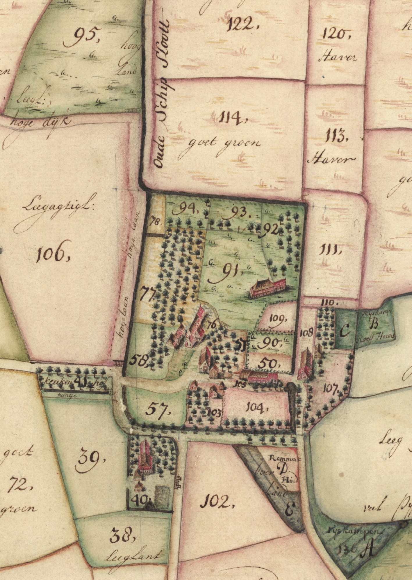
Nederlands: Plattegrond van Essen in 1732 met duidelijk zichtbaar de contour van het voormalige klooster, die ook tegenwoordig nog terug te zien is. Het noorden is links. Uitsnede van de Kaart van een groot aantal Provincie- en enige particuliere landen onder Essen en Haren [...] van Henricus Teijsinga. |
| Date | 4-12-1732 |
| Source | Beeldbank Groningen, verkleind tot Essen. |
| Author | Henricus Teijsinga |
Licensing
[edit]
|
This work is in the public domain in its country of origin and other countries and areas where the copyright term is the author's life plus 70 years or fewer. | |
| This file has been identified as being free of known restrictions under copyright law, including all related and neighboring rights. | |
File history
Click on a date/time to view the file as it appeared at that time.
| Date/Time | Thumbnail | Dimensions | User | Comment | |
|---|---|---|---|---|---|
| current | 20:26, 18 February 2024 | | 1,417 × 1,993 (942 KB) | Hardscarf (talk | contribs) | Uploaded a work by Henricus Teijsinga from [https://hdl.handle.net/21.12105/793eb5d4-53c4-baf5-2da9-4d3ee0342279 Beeldbank Groningen], verkleind tot Essen. with UploadWizard |
You cannot overwrite this file.
File usage on Commons
There are no pages that use this file.
File usage on other wikis
The following other wikis use this file:
- Usage on nl.wikipedia.org