File:Théviec - début du dégagement MHNT PHa 613 02 66 .jpg
Jump to navigation
Jump to search

Size of this preview: 700 × 600 pixels. Other resolutions: 280 × 240 pixels | 560 × 480 pixels | 896 × 768 pixels | 1,195 × 1,024 pixels | 2,389 × 2,048 pixels | 2,765 × 2,370 pixels.
Original file (2,765 × 2,370 pixels, file size: 5.56 MB, MIME type: image/jpeg)
Captions
Captions
Add a one-line explanation of what this file represents
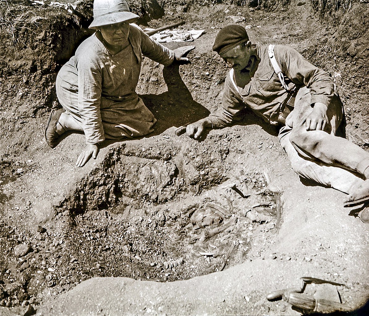
Marthe and Saint-Just Péquart Beginning of the release in 1928 of the tomb of Téviec.
Summary[edit]
| Description |
English: Marthe and Saint-Just Péquart - Beginning of the release in 1928 of the tomb of Téviec.
Français : Marthe et Saint-Just Péquart – Début en 1928 du dégagement de la tombe de Téviec.
|
|||||||||||||||||||||||
| Date |
(photograph) |
|||||||||||||||||||||||
| Source |
|
|||||||||||||||||||||||
| Author |
Saint-Just Péquart (photographer) |
|||||||||||||||||||||||
| Permission (Reusing this file) |
I, the copyright holder of this work, hereby publish it under the following license: This file is licensed under the Creative Commons Attribution-Share Alike 4.0 International license.
|
|||||||||||||||||||||||

| Camera location | | View this and other nearby images on: OpenStreetMap |
|---|

|
This document was made as part of the Projet Phoebus.
|
File history
Click on a date/time to view the file as it appeared at that time.
| Date/Time | Thumbnail | Dimensions | User | Comment | |
|---|---|---|---|---|---|
| current | 15:49, 19 January 2016 | | 2,765 × 2,370 (5.56 MB) | Archaeodontosaurus (talk | contribs) | {{Information |Description ={{en|1=c}} |Source ={{own}} |Author =Archaeodontosaurus |Date = |Permission = |other_versions = }} |
You cannot overwrite this file.
File usage on Commons
The following 2 pages use this file:
File usage on other wikis
The following other wikis use this file:
- Usage on de.wikipedia.org
- Usage on fr.wikipedia.org
- Usage on www.wikidata.org