File:Thailand-map-CIA-thai.png
Jump to navigation
Jump to search

Size of this preview: 409 × 600 pixels. Other resolutions: 164 × 240 pixels | 327 × 480 pixels | 974 × 1,428 pixels.
Original file (974 × 1,428 pixels, file size: 127 KB, MIME type: image/png)
Captions
Captions
Add a one-line explanation of what this file represents
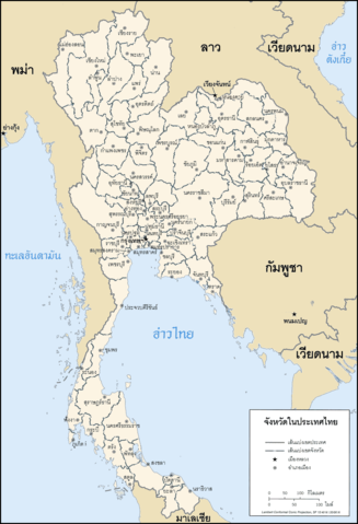
แผนที่แสดงจังหวัดในประเทศไทย Map of Thailand in Thai
This image is in the public domain because it contains materials that originally came from the United States Central Intelligence Agency's World Factbook.
|
 |
File history
Click on a date/time to view the file as it appeared at that time.
| Date/Time | Thumbnail | Dimensions | User | Comment | |
|---|---|---|---|---|---|
| current | 20:37, 20 September 2006 | | 974 × 1,428 (127 KB) | Electionworld (talk | contribs) | แผนที่แสดงจังหวัดในประเทศไทย Map of Thailand in Thai {{PD-USGov-CIA-WF}} Category:Maps of Thailand |
You cannot overwrite this file.
File usage on Commons
The following page uses this file:
File usage on other wikis
The following other wikis use this file:
- Usage on en.wikipedia.org
- Usage on pl.wikipedia.org
- Usage on th.wikipedia.org
- ผู้ใช้:ZenithZealotry
- ผู้ใช้:Poompong1986
- ผู้ใช้:ZenithZealotry/templates/Thailand
- ผู้ใช้:Toeyez
- ผู้ใช้:Jimmy Classic
- ผู้ใช้:Mahatee
- ผู้ใช้:Luckpong
- ผู้ใช้:Mahatee/กล่องผู้ใช้
- ผู้ใช้:Mr.nana
- ผู้ใช้:Sazaja
- ผู้ใช้:Mr.nana/สมุดจด
- ผู้ใช้:RodKren
- ผู้ใช้:Lephill
- ผู้ใช้:Shoshui
- ผู้ใช้:Ns11721
- ผู้ใช้:บุญพฤทธิ์ ทวนทัย
- ผู้ใช้:พุทธามาตย์
- ผู้ใช้:Armkungup
- ผู้ใช้:Oatkridsana/แนะนำตัวและประวัติส่วนตัว
- ผู้ใช้:Noobythailand
- ผู้ใช้:Levi Kambai
- ผู้ใช้:Levi Kambai/แนะนำตัวและประวัติส่วนตัว
- ผู้ใช้:JordanGlass37 - Alyssa May