File:Thailand location map Topographic.png
Pāriet uz navigāciju
Pāriet uz meklēšanu

Šī priekšskata izmērs: 341 × 600 pikseļi. Citi izmēri: 136 × 240 pikseļi | 273 × 480 pikseļi | 437 × 768 pikseļi | 582 × 1 024 pikseļi | 2 000 × 3 517 pikseļi.
Sākotnējais fails (2 000 × 3 517 pikseļi, faila izmērs: 10,24 MB, MIME tips: image/png)
Captions
Captions
Pievieno vienas rindiņas aprakstu, ko šis fails attēlo
Kopsavilkums
[labot šo sadaļu]
| Apraksts |
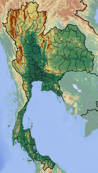
Deutsch: Positionskarte von Thailand
Quadratische Plattkarte, N-S-Streckung 103 %. Geographische Begrenzung der Karte:
English: Location map of Thailand
Equirectangular projection, N/S stretching 103 %. Geographic limits of the map:
|
| Datums | |
| Avots | Paša darbs (backgroung : http://www.maps-for-free.com) |
| Autors | Dr Brains |
Licence
[labot šo sadaļu]
Es, šī darba autortiesību īpašnieks, publicēju to saskaņā ar šīm licencēm:

|
Permission is granted to copy, distribute and/or modify this document under the terms of the GNU Free Documentation License, Version 1.2 only as published by the Free Software Foundation; with no Invariant Sections, no Front-Cover Texts, and no Back-Cover Texts. A copy of the license is included in the section entitled GNU Free Documentation License. | 1.2 only |
|
|
Permission is granted to copy, distribute and/or modify this document under the terms of the GNU Free Documentation License, Version 1.3 or any later version published by the Free Software Foundation; with no Invariant Sections, no Front-Cover Texts, and no Back-Cover Texts. A copy of the license is included in the section entitled GNU Free Documentation License.
|
If this file is eligible for relicensing, it may also be used under the Creative Commons Attribution-ShareAlike 3.0 license. The relicensing status of this image needs to be manually reviewed by an experienced user. You can help.
|
Jūs varat izvēlēties licenci pēc jūsu vēlmes.
Faila hronoloģija
Uzklikšķini uz datums/laiks kolonnā esošās saites, lai apskatītos, kā šis fails izskatījās tad.
| Datums/Laiks | Attēls | Izmēri | Dalībnieks | Komentārs | |
|---|---|---|---|---|---|
| tagadējais | 2012. gada 12. jūnijs, plkst. 16.55 | | 2 000 × 3 517 (10,24 MB) | Dr Brains (diskusija | devums) |
Šo failu nevar pārrakstīt.
Faila lietojums
Šo failu izmanto šajās 2 lapās:
Globālais faila lietojums
Šīs Vikipēdijas izmanto šo failu:
- Izmantojums af.wikipedia.org
- Izmantojums als.wikipedia.org
- Izmantojums ar.wikipedia.org
- Izmantojums ast.wikipedia.org
- Izmantojums ban.wikipedia.org
- Taman Nasional Mu Ko Ang Thong
- Taman Nasional Laem Son
- Taman Nasional Kaeng Krachan
- Taman Nasional Khao Lak–Lam Ru
- Taman Nasional Kui Buri
- Taman Nasional Sai Thong
- Taman Nasional Si Phang Nga
- Kompléks Wana Dong Phayayen–Khao Yai
- Taman Nasional Thale Ban
- Taman Nasional Thong Pha Phum
- Taman Nasional Chaloem Phrakiat Thai Prachan
- Taman Nasional Chaloem Rattanakosin
- Taman Nasional Hat Khanom–Mu Ko Thale Tai
- Taman Nasional Kaeng Krung
- Taman Nasional Khao Laem
- Taman Nasional Khao Lampi–Hat Thai Mueang
- Taman Nasional Khao Phanom Bencha
- Taman Nasional Khlong Phanom
- Taman Nasional Khuean Srinagarindra
- Taman Nasional Lam Nam Nan
- Taman Nasional Mae Wa
- Taman Nasional Namtok Chet Sao Noi
- Taman Nasional Nam Phong
- Ban Chiang
- Taman Lelintihan Ayutthaya
- Kota Malelintihan Sukhothai miwah Kota Malelintihan Kakait
- Izmantojums ba.wikipedia.org
- Izmantojums bh.wikipedia.org
- Izmantojums bn.wikipedia.org
- Izmantojums bs.wikipedia.org
- Izmantojums ca.wikipedia.org
- Izmantojums ceb.wikipedia.org
- Izmantojums ce.wikipedia.org
- Izmantojums cs.wikipedia.org
Skatīt šī faila pilno globālo izmantojumu.