File:The Battle Unfolds (5994783011).jpg
Original file (1,902 × 2,207 pixels, file size: 583 KB, MIME type: image/jpeg)
Captions
Captions
Summary
[edit].jpg&action=edit§ion=1)
| Description |
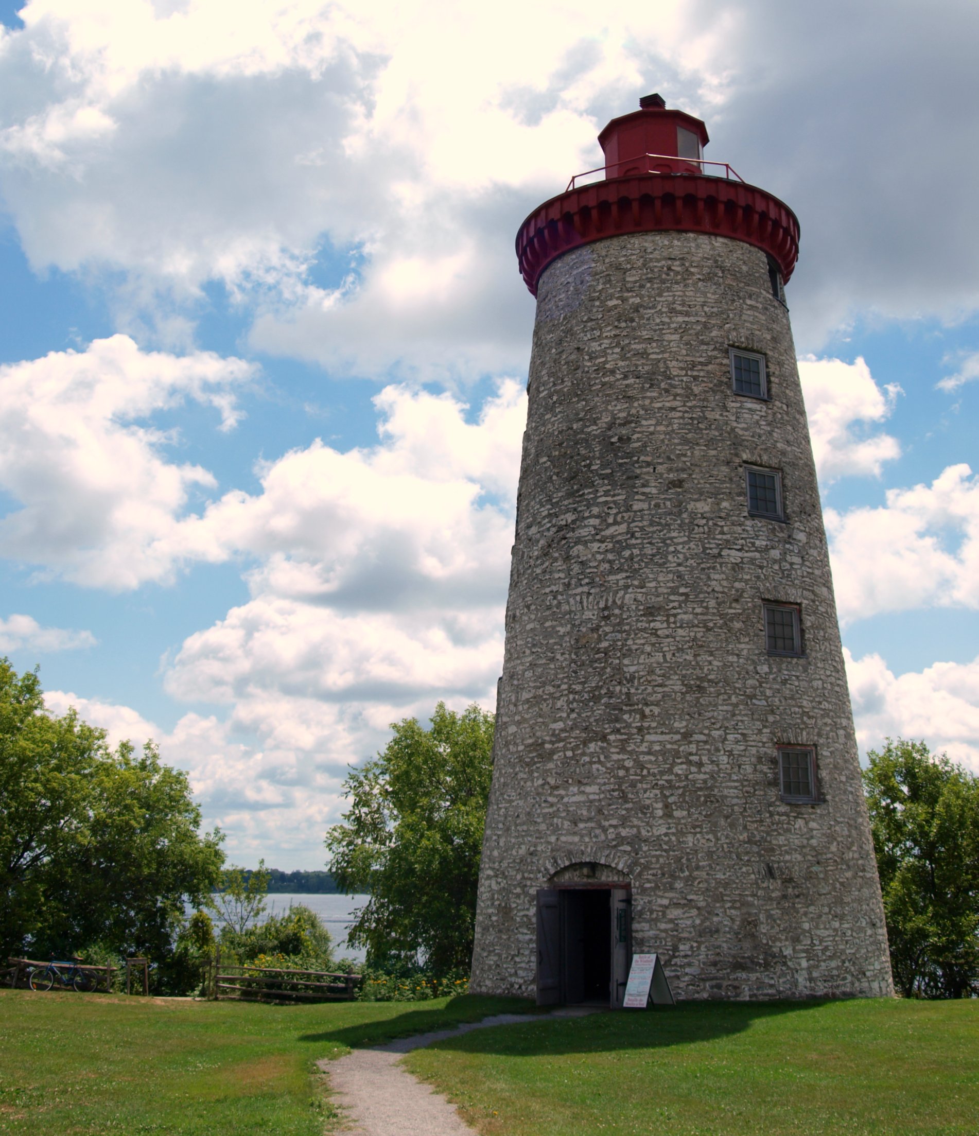
In 1837, the British army and loyal militia crushed the first armed revolt in Upper and Lower Canada. Many rebels fled to the US. The exiles joined with American sympathizers to form a secret paramilitary organization called the Hunter's Lodge. Early on the morning of November 12, 1838, 190 Hunters landed at Windmill Point. Most were Americans. Contrary to their expectations, the local population did not rally to their side. By November 13, over 2000 local militiamen and British soldiers surrounded the rebel position. After a bitter and bloody skirmish, the government forces drove the rebels into the windmill and surrounding stone buildings but they could not attack these building without large cannons. November 14 and 15 were uneventful. The hunters were counting on help from the United States that never came lol. November 16 was decisive. British gunboats patrolled the river while their field guns arrived by land. In the afternoon, they bombarded the rebels for two hours. The Hunters were low on ammunition, food and water. There were no medical supplies to ease the pain of their wounded. By nightfall, they ran out of both resources and hope and surrendered unconditionally. Twenty rebels were killed and another twenty were wounded in the battle, while 15 soldiers were killed and 55 were wounded. The captured rebels were tried. Eleven were hung, 60 deported to Australia and the rest released. The Rebellion was an expression of deep dissatisfaction. It profoundly transformed political life in Canada and forced the British to review the way they administered the country. Thirty years later, Confederation was born. |
| Date | |
| Source | The Battle Unfolds |
| Author | Michael from Calgary, AB, Canada |
| Camera location | | View this and other nearby images on: OpenStreetMap |
|---|
.jpg¶ms=044.721254_N_-075.487285_E_globe:Earth_type:camera_source:Flickr_&language=en)
Licensing
[edit].jpg&action=edit§ion=2)
- You are free:
- to share – to copy, distribute and transmit the work
- to remix – to adapt the work
- Under the following conditions:
- attribution – You must give appropriate credit, provide a link to the license, and indicate if changes were made. You may do so in any reasonable manner, but not in any way that suggests the licensor endorses you or your use.
| This image was originally posted to Flickr by MSVG at https://flickr.com/photos/13907834@N00/5994783011. It was reviewed on 3 May 2018 by FlickreviewR 2 and was confirmed to be licensed under the terms of the cc-by-2.0. |
File history
Click on a date/time to view the file as it appeared at that time.
| Date/Time | Thumbnail | Dimensions | User | Comment | |
|---|---|---|---|---|---|
| current | 22:49, 2 May 2018 | | 1,902 × 2,207 (583 KB) | Mindmatrix (talk | contribs) | Transferred from Flickr via #flickr2commons |
You cannot overwrite this file.
File usage on Commons
There are no pages that use this file.
.jpg&oldid=726992288)