File:The Blue Marble (remastered).jpg
Alkuperäinen tiedosto (3 000 × 3 000 kuvapistettä, 5,69 MiB, MIME-tyyppi: image/jpeg)
Kuvatekstit
Kuvatekstit
Yhteenveto[muokkaa]
| Sininen marmorikuula
|
|||
|---|---|---|---|
| Valokuvaaja |
NASA/Apollo 17 crew; taken by either Harrison Schmitt or Ron Evans |
||
| Otsikko |
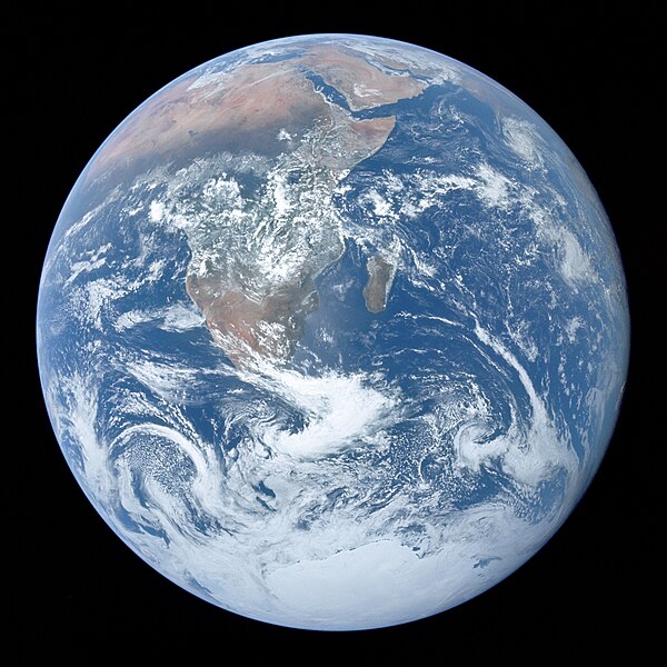
The Blue Marble |
||
| Osa kohdetta |
Apollo 17 |
||
| Kohteen tyyppi |
valokuva |
||
| Genre |
tähtivalokuvaus |
||
| Kuvaus |
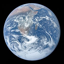
Full disk view of the Earth taken on December 7, 1972, by the crew of the Apollo 17 spacecraft en route to the Moon at a distance of about 29,400 kilometres (18,300 mi). It shows Africa, Antarctica, and the Arabian Peninsula. |
||
| Päiväys |
7. joulukuuta 1972 date QS:P571,+1972-12-07T00:00:00Z/11 |
||
| Tekniikka | 1 photograph: Hasselblad 500EL, Zeiss Planar 80 mm f/2.8 and 70mm Kodak Ektachrome film of type SO-368 | ||
| Kokoelma |
|
||
| Lisätietoja |
The end of most film magazines used on the Apollo missions include a photograph, presumably taken on earth, of a "KODAK Color Control Patch" on a chart containing mission and camera data. This color chart was used to calibrate the above photograph to better approximate real-world colors. Earth disk center rough coordinates: 26°19’49”S 37°25’13”E |
||
| Lähteet | https://tothemoon.ser.asu.edu/gallery/Apollo/17/Hasselblad%20500EL%2070%20mm | ||
| Lähde | http://tothemoon.ser.asu.edu/gallery/Apollo/17/Hasselblad%20500EL%2070%20mm https://www.flickr.com/photos/projectapolloarchive/21081863984/ | ||
| Muut versiot |
[muokkaa] Other versions:
Derivative works:
|
||
| Kohteen sijainti | 26° 19′ 49″ S, 37° 25′ 13″ E | Tämä ja muut kuvat kartalla: OpenStreetMap |
|---|
Lisenssi[muokkaa]
| Public domainPublic domainfalsefalse |
| Tämä teos on ilman tekijänoikeuden suojaa, koska National Aeronautics and Space Administration (NASA) loi sen. Koska Nasa on Yhdysvaltain liittovaltion organisaatio, sen luomat teokset ovat ilman tekijänoikeuden suojaa. ([1][2]) |  | |
 |
Varoitukset:
|
Tiedoston historia
Päiväystä napsauttamalla näet, millainen tiedosto oli kyseisellä hetkellä.
| Päiväys | Pienoiskuva | Koko | Käyttäjä | Kommentti | |
|---|---|---|---|---|---|
| nykyinen | 26. helmikuuta 2022 kello 14.12 |  | 3 000 × 3 000 (5,69 MiB) | CactiStaccingCrane (keskustelu | muokkaukset) | cropped by 2 pixels to get a perfect 3000 by 3000 |
| 16. helmikuuta 2022 kello 00.59 |  | 3 000 × 3 002 (5,3 MiB) | Aaron1a12 (keskustelu | muokkaukset) | Added slight tilt as published by NASA | |
| 15. helmikuuta 2022 kello 23.22 | 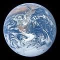 | 3 000 × 3 002 (4,91 MiB) | Aaron1a12 (keskustelu | muokkaukset) | EV lowered | |
| 4. helmikuuta 2022 kello 21.36 |  | 3 000 × 3 002 (5,23 MiB) | Aaron1a12 (keskustelu | muokkaukset) | Uploaded a work by The Crew of Apollo 17 from NASA/JSC/ASU with UploadWizard |
Et voi tallentaa uutta tiedostoa tämän tilalle.
Tiedoston käyttö
Seuraavat 16 sivua käyttävät tätä tiedostoa:
- Earth
- Polar climate
- File:1972 Events montage 16-grid version.jpg
- File:Blue Marble 2022.jpg
- File:Blue Marble Comparison.png
- File:Earth 17.jpg
- File:La Terre vue de l'Apollo 17.jpg
- File:The Blue Marble.jpg
- File:The Blue Marble (remastered).jpg
- File:The Blue Marble 4463x4163.jpg
- File:The Earth seen from Apollo 17.jpg
- File:The Earth seen from Apollo 17 (Original Orientation).jpg
- File:The Earth seen from Apollo 17 (Rescan).jpg (tiedosto-ohjaus)
- File:The Earth seen from Apollo 17 (cropped).jpg
- Template:Other versions/The Blue Marble
- Category:The Blue Marble
Tiedoston järjestelmänlaajuinen käyttö
Seuraavat muut wikit käyttävät tätä tiedostoa:
- Käyttö kohteessa ab.wikipedia.org
- Käyttö kohteessa ace.wikipedia.org
- Käyttö kohteessa ady.wikipedia.org
- Käyttö kohteessa af.wikipedia.org
- Käyttö kohteessa als.wikipedia.org
- Käyttö kohteessa am.wikipedia.org
- Käyttö kohteessa ang.wikipedia.org
- Käyttö kohteessa anp.wikipedia.org
- Käyttö kohteessa an.wikipedia.org
- Käyttö kohteessa arc.wikipedia.org
- Käyttö kohteessa ar.wikipedia.org
- Käyttö kohteessa ar.wikiquote.org
- Käyttö kohteessa ary.wikipedia.org
- Käyttö kohteessa arz.wikipedia.org
- Käyttö kohteessa as.wikipedia.org
- Käyttö kohteessa avk.wikipedia.org
- Käyttö kohteessa av.wikipedia.org
- Käyttö kohteessa awa.wikipedia.org
- Käyttö kohteessa ay.wikipedia.org
- Käyttö kohteessa azb.wikipedia.org
- Käyttö kohteessa az.wikipedia.org
- Käyttö kohteessa az.wikiquote.org
Näytä lisää tämän tiedoston järjestelmänlaajuista käyttöä.
Metatieto
Tämä tiedosto sisältää esimerkiksi kuvanlukijan, digikameran tai kuvankäsittelyohjelman lisäämiä lisätietoja. Kaikki tiedot eivät enää välttämättä vastaa todellisuutta, jos kuvaa on muokattu sen alkuperäisen luonnin jälkeen.
| Suunta | Normaali |
|---|---|
| Kuvan resoluutio leveyssuunnassa | 300 dpi |
| Kuvan resoluutio korkeussuunnassa | 300 dpi |
| Väriavaruus | sRGB |
Rakenteinen tieto
Kohteet, joita tässä tiedostossa esitetään
esittää
image/jpeg
3 000 pikseli
3 000 pikseli
7. joulukuu 1972
5 969 721 tavu
6ffb103228140aac1c7977b004b7d93a
964dc6dc213994404a37486cc306a12a690804ab
e156f6b91e809d853ebf95e50546cf9767119b2f7ae66057514d1c9b
e42f2650cd861c9f79c8ac6342adf465a11385a5f2d92b9db8b23962e85b06bc
286f6c0809d0f86e425e0e827b9dddfa47f3a90285cf747b790dd87d8bddcd27068e896cdfddb3eafd40f94c07758ef8
ea79d861354ed3d6845d470a165073b5679f1b05b2d7e14fc7bf900185d0132955db7d48456fc4c5a3c03447460c4f448f25ab39c2ff28f1b8a8eeb02c7b9e2c
26°S, 37°E
26°19'49.001"S, 37°25'13.001"E
- Files from NASA with known IDs
- Artworks with digital representation of missing same main subject
- Artworks with digital representation of different depicts
- Photographs with Wikidata item
- Photographs with Wikidata item missing institution
- Photographs with Wikidata item missing medium
- Artworks digital representation of 2D work
- Files with coordinates missing SDC location of creation
- PD NASA
- Pages with maps
