File:The Crown, Corporation Street (4363622934).jpg
Original file (3,648 × 2,736 pixels, file size: 2.42 MB, MIME type: image/jpeg)
Captions
Captions
Summary[edit]
.jpg&action=edit§ion=1)
| Description |
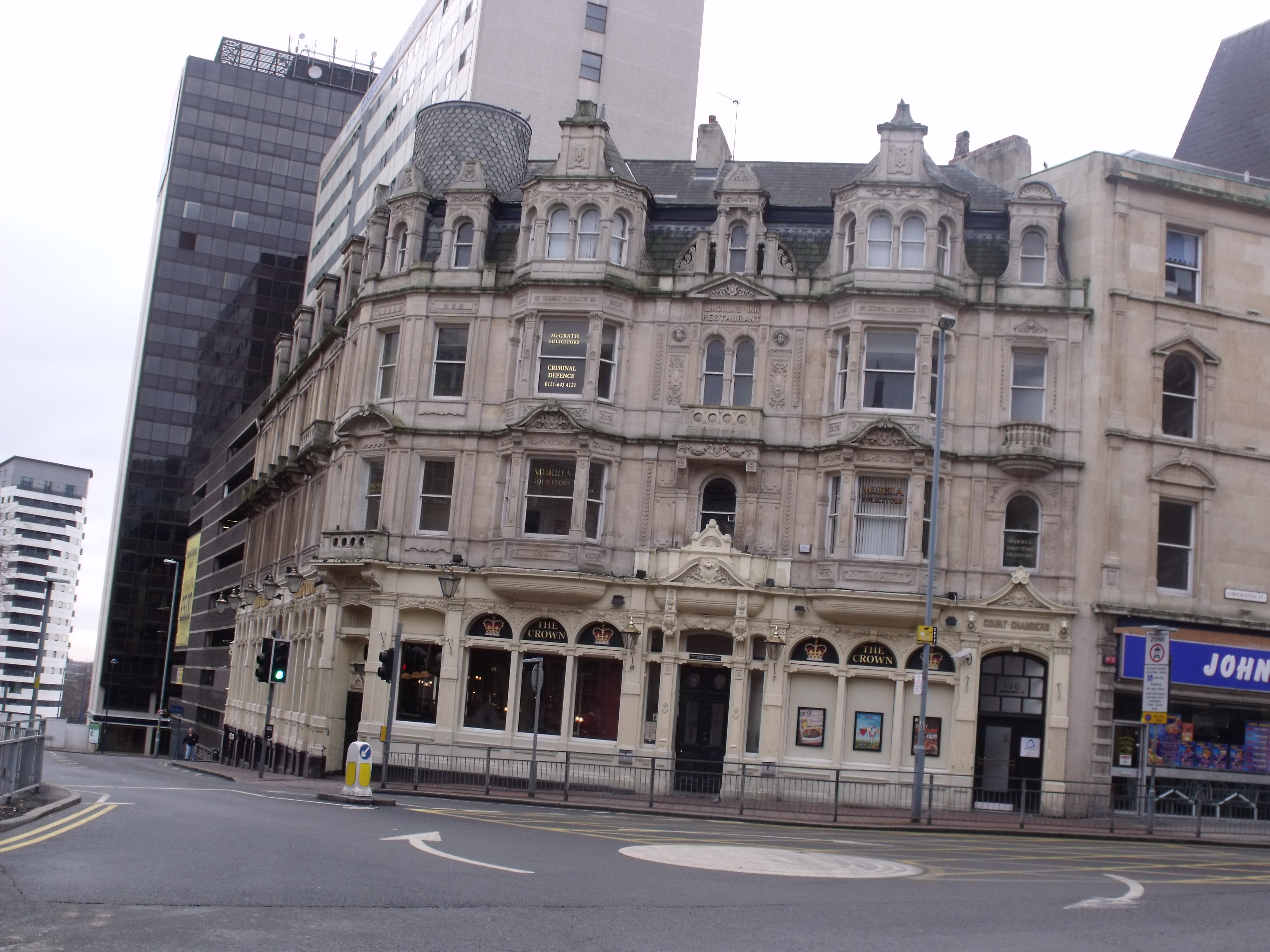
New shot of The Crown on Corporation Street. This time took it as I left Newton Street. It came out better than the old shot. It is on the corner of Corporation Street and James Watt Street. Back in the 1960s it was known as the Crown Restaurant. Built in 1888 by the architect Charles J Hodson who was also responsible for rebuilding the ground floor of the Roebuck (now Village Inn) on Hurst Street. Above information from Old Birmingham Inns and Pubs - Vintage Images Calendar 2010. Pevsner describe it as being very French with tall canted bays. Roy Thornton, author of Victorian Buildings of Birmingham assumes that it was by W H Ward in 1882. But my other sources say Charles J Hodson in 1888 (so Roy probably assumed wrong). He also says that the building at 180 (and possibly 182) Corporation Street was owned by Ind Coope & Co Ltd and housed the Central Restaurant and Court Chambers. The named changed to County Restaurant after a few years. And obviously it must have also been Lincolns Inn Restuarant. Today it is The Crown public house on the ground floor. The first floor currently occupied by Murria Solicitors. Second floor occupied by McGrath Solicitors. Who deal in Criminal Defence. Entrance to Court Chambers on the right. To the right of that is John's (or Big John's as it is known). It used to be John's Fish Bar. Came back round here to take the Gazette Buildings, and while I was here re-took this pub. I think those pair of solicitors also occupy all of the upper floors of the Gazette Buildings. |
| Date | |
| Source | The Crown, Corporation Street |
| Author | Elliott Brown from Birmingham, United Kingdom |
| Camera location | | View this and other nearby images on: OpenStreetMap |
|---|
.jpg¶ms=052.482825_N_-001.893500_E_globe:Earth_type:camera_source:Flickr_&language=en)
Licensing[edit]
.jpg&action=edit§ion=2)
- You are free:
- to share – to copy, distribute and transmit the work
- to remix – to adapt the work
- Under the following conditions:
- attribution – You must give appropriate credit, provide a link to the license, and indicate if changes were made. You may do so in any reasonable manner, but not in any way that suggests the licensor endorses you or your use.
| This image was originally posted to Flickr by ell brown at https://flickr.com/photos/39415781@N06/4363622934. It was reviewed on 5 March 2021 by FlickreviewR 2 and was confirmed to be licensed under the terms of the cc-by-2.0. |
File history
Click on a date/time to view the file as it appeared at that time.
| Date/Time | Thumbnail | Dimensions | User | Comment | |
|---|---|---|---|---|---|
| current | 16:42, 5 March 2021 | | 3,648 × 2,736 (2.42 MB) | Matlin (talk | contribs) | Transferred from Flickr via #flickr2commons |
You cannot overwrite this file.
File usage on Commons
There are no pages that use this file.
.jpg&oldid=725533930)