File:The Pacific Crest Trail (PCT) in southern Oregon (23145698444).jpg
Original file (5,184 × 2,912 pixels, file size: 8.47 MB, MIME type: image/jpeg)
Captions
Captions
Summary
[edit]_in_southern_Oregon_(23145698444).jpg&action=edit§ion=1)
| Description |
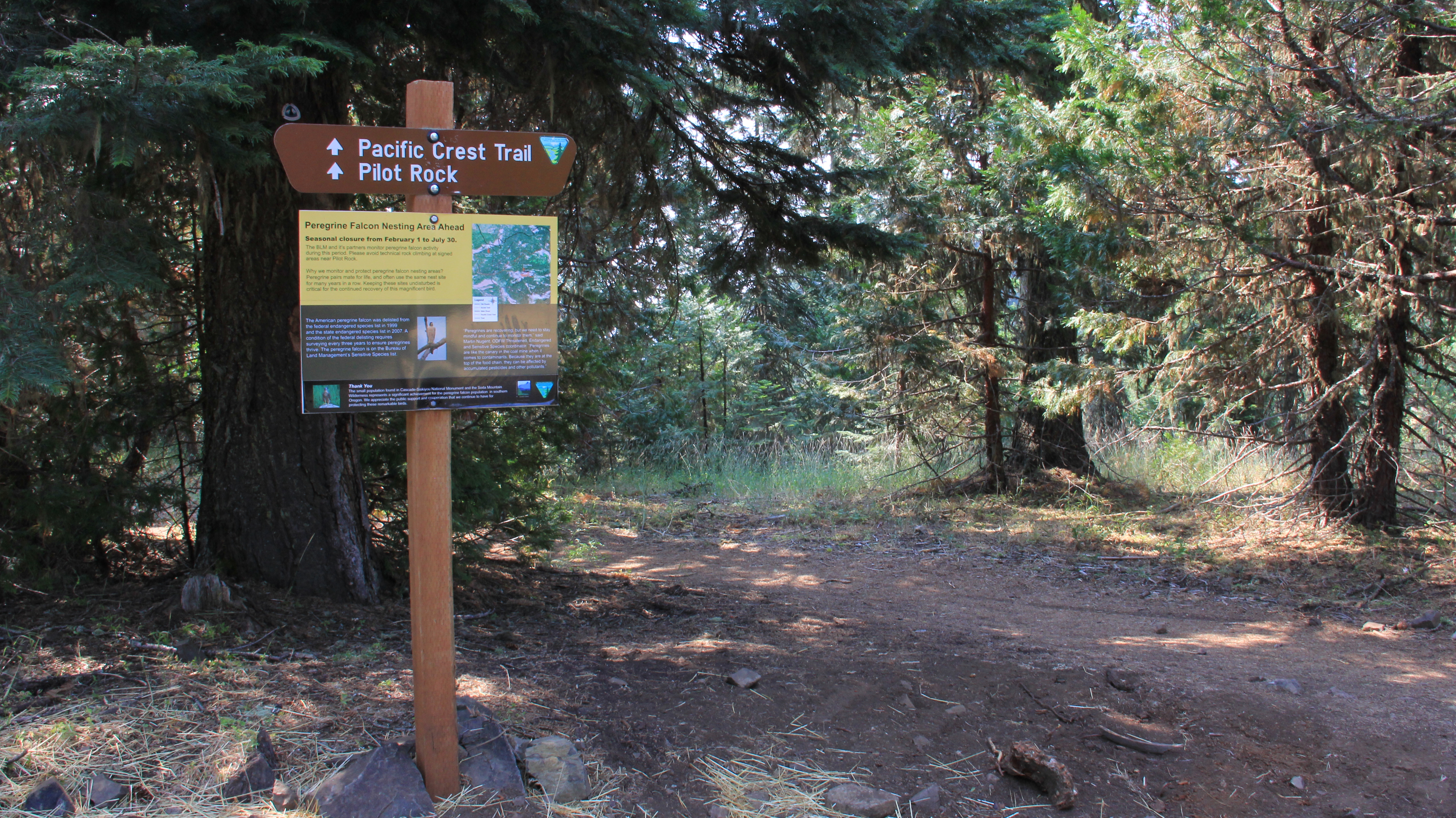
The BLM manages about 864,000 acres in its Medford district and some of that land includes portions of the famous Pacific Crest Trail, or PCT. The 43-mile stretch of PCT in southern Oregon includes countless scenic views and well-known recreation points: Mount Shasta; Pilot Rock, Hyatt Lake; Soda Mountain Wilderness; and the Cascade-Siskiyou National Monument, to name a few. Hikers will also be able to experience a variety of natural environments, from wildflower meadows to old growth forests and rocky bluffs. This photo was captured in the summer of 2015. How to access the PCT on southern Oregon public lands managed by the BLM: <a href="http://www.blm.gov/or/resources/recreation/csnm/csnm-pct.php" rel="nofollow">www.blm.gov/or/resources/recreation/csnm/csnm-pct.php</a> |
| Date | |
| Source | The Pacific Crest Trail (PCT) in southern Oregon |
| Author | Bureau of Land Management Oregon and Washington from Portland, America |
Licensing
[edit]_in_southern_Oregon_(23145698444).jpg&action=edit§ion=2)
- You are free:
- to share – to copy, distribute and transmit the work
- to remix – to adapt the work
- Under the following conditions:
- attribution – You must give appropriate credit, provide a link to the license, and indicate if changes were made. You may do so in any reasonable manner, but not in any way that suggests the licensor endorses you or your use.
| This image was originally posted to Flickr by BLMOregon at https://flickr.com/photos/50169152@N06/23145698444. It was reviewed on 13 May 2018 by FlickreviewR 2 and was confirmed to be licensed under the terms of the cc-by-2.0. |
| This image is a work of a Bureau of Land Management* employee, taken or made as part of that person's official duties. As a work of the U.S. federal government, the image is in the public domain in the United States. *or predecessor organization |
File history
Click on a date/time to view the file as it appeared at that time.
| Date/Time | Thumbnail | Dimensions | User | Comment | |
|---|---|---|---|---|---|
| current | 20:01, 13 May 2018 | | 5,184 × 2,912 (8.47 MB) | OceanAtoll (talk | contribs) | Transferred from Flickr via #flickr2commons |
You cannot overwrite this file.
File usage on Commons
There are no pages that use this file.
_in_southern_Oregon_(23145698444).jpg&oldid=819748177)