File:The War of the Rebellion Map plate CLV.jpg
Jump to navigation
Jump to search

Size of this preview: 800 × 499 pixels. Other resolutions: 320 × 200 pixels | 640 × 399 pixels | 1,024 × 639 pixels | 1,280 × 798 pixels | 2,195 × 1,369 pixels.
Original file (2,195 × 1,369 pixels, file size: 950 KB, MIME type: image/jpeg)
Captions
Captions
Add a one-line explanation of what this file represents
Summary
[edit]
| Description |
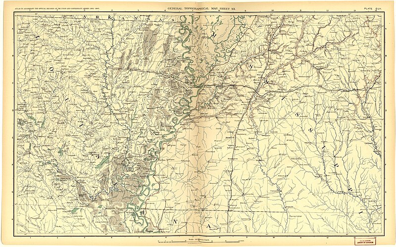
English: Found also in the House Miscellaneous documents of the 52d to the 56th Congress. Each number has special index. Inserted in each volume: Additions and corrections ... Washington, Govt. Print. Off., 1902. Series 1, v. 1-53, series 3, v. 1-5, and series 4, v. 1-3 include "Alternate designations of organizations mentioned." Vol. 54-55 of series 1 [serial no. 112-113] "have not been published, and no material for them is in hand." cf. General index, p. xi. Series 2, v. 1 [serial no. 114] with imprint 1894, was not issued until 1898. Edited in the War Records Office, 1880-July 1899; in the Record and Pension Office, July 1899-1901. Robert N. Scott compiled and edited v. 1-18, 1880-87, and also collected the greater part of the material for v. 19-36, 1887-91. After his death in 1887 the work was continued by Henry M. Lazelle, 1887-89, and by a board of publication, 1889-99, consisting of George B. Davis, 1889-97, Leslie J. Perry, 1889-99, Joseph W. Kirkley, 1889-99, and Fred C. Ainsworth, 1898-99; from 1899-1901 edited by Fred C. Ainsworth and Joesph W. Kirkley. Supplemented by: "Atlas to accompany the official records of the Union and Confederate armies. Pub. under te direction of the ... secretaries of war, by Maj. George B. Davis ... Mr. Leslie J. Perry ... Mr. Joseph W. Kirkley ... board of publicaton. Comp. by Capt. Calvin D. Cowles ..." (3 v. CLXXV (i.e. 178) fold. pl. (incl. illus., maps, plans) 48 x 40 cm.) published: Washington, Govt. Print. Off., 1891-95. CALL NUMBER: G1201.S5U6 1891. Plates part colored. Issued in 37 parts. Assigned no. 261 of House Miscellaneous documents, v. 40, 52d Cong., 1st sess. (serial no. 2998). Documnet number does not appear i this copy; in other copies it appears in binder's title but not on t.-p. Inserted: ... Additions and corrections ... Washington, Govt. Print. Off., 1902. 2 p. 23 cm. CONTENTS: pl. 1-135c. Military operations inthe field.--pl. 136-161. General topographical map.--pl. 161-171. Military divisions and departments.--pl. 172-175. Miscellaneous. LC Civil War Maps (2nd ed.), 99 Available also through the Library of Congress Web site as a raster image. |
| Date | |
| Source | https://www.loc.gov/resource/g3701sm.gcw0099000/?sp=183&r=0.084,-0.298,0.908,1.115,0 |
| Author | Washington, Govt. Print. Off., 1880-1901. |
Licensing
[edit]
This work is in the public domain in the United States because it is a work prepared by an officer or employee of the United States Government as part of that person’s official duties under the terms of Title 17, Chapter 1, Section 105 of the US Code.
Note: This only applies to original works of the Federal Government and not to the work of any individual U.S. state, territory, commonwealth, county, municipality, or any other subdivision. This template also does not apply to postage stamp designs published by the United States Postal Service since 1978. (See § 313.6(C)(1) of Compendium of U.S. Copyright Office Practices). It also does not apply to certain US coins; see The US Mint Terms of Use.
|
 | |
| This file has been identified as being free of known restrictions under copyright law, including all related and neighboring rights. | ||
File history
Click on a date/time to view the file as it appeared at that time.
| Date/Time | Thumbnail | Dimensions | User | Comment | |
|---|---|---|---|---|---|
| current | 04:07, 18 August 2018 | | 2,195 × 1,369 (950 KB) | Startbosshogg (talk | contribs) | User created page with UploadWizard |
You cannot overwrite this file.
File usage on Commons
The following 4 pages use this file:
File usage on other wikis
The following other wikis use this file:
- Usage on en.wikipedia.org