File:The empire of King Tsewang Rnam Rgyal 1., and that of King Jamyang Rnam Rgyal., about 1560 and 1600 A.D.jpg
跳转到导航
跳转到搜索
本预览的尺寸:800 × 542像素。 其他分辨率:320 × 217像素 | 640 × 434像素 | 1,024 × 694像素 | 1,280 × 867像素 | 1,768 × 1,198像素。
原始文件 (1,768 × 1,198像素,文件大小:430 KB,MIME类型:image/jpeg)
说明
说明
添加一行文字以描述该文件所表现的内容
The empire of Ladakh during the reigns of Tsewang Namgyal and Jamyang Namgyal
摘要[编辑]
| 描述 |
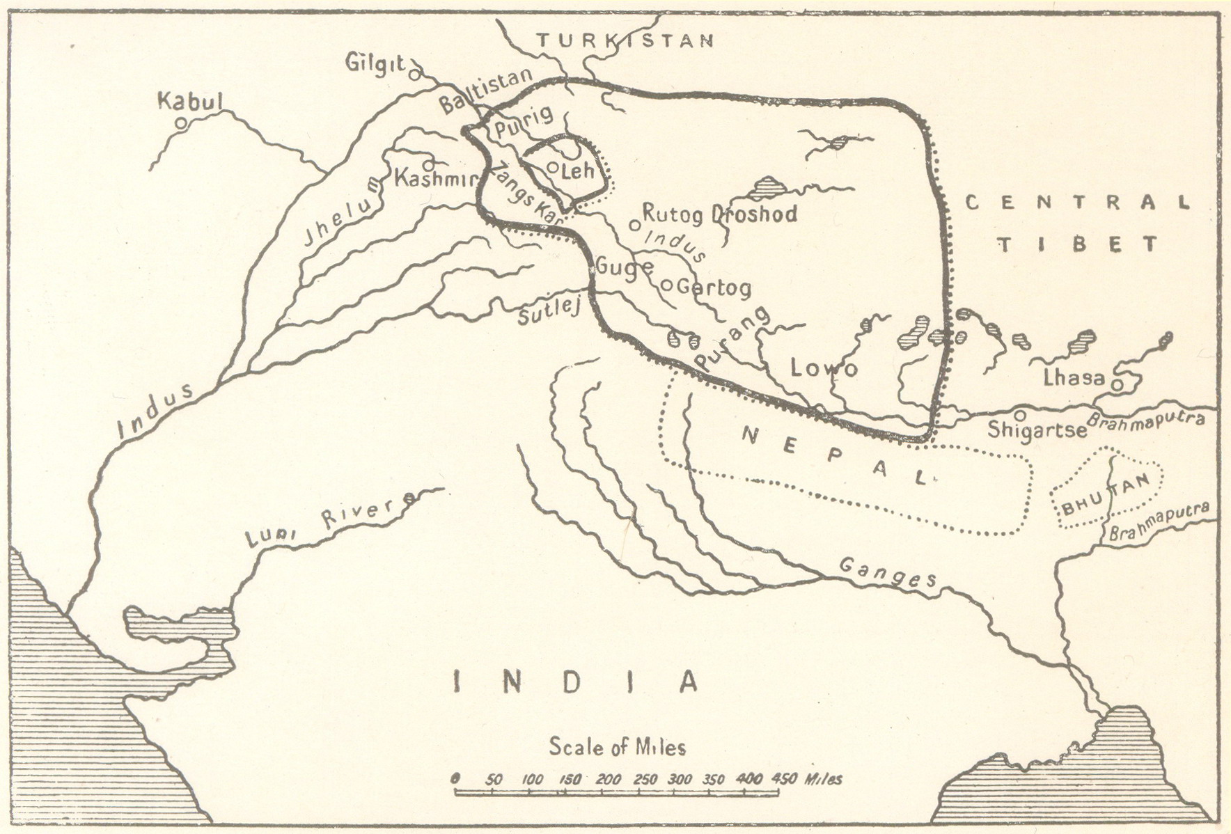
English: The empire of King Tsewang Rnam Rgyal 1., and that of King Jamyang Rnam Rgyal., about 1560 and 1600 A.D. as depicted in A History of Western Tibet by A.H. Francke, 1907 republished as A History of Ladakh with Critical Introduction and Annotations by S.S. Gergan and F.M. Hassnain, depicting not just the Aksai Chin but also inter alia Rudokh and Guge and the area to the west of the ridges which separate the plateau of Tibet from the highlands of Kashmir wherein are the Aling Kangri and Mavang Kangri peaks, to the south of the Pulu Pass at the point where the Kuen Lun Range in Kashmir which runs southeast to northwest and the Altyn Tagh range in Tibet running southwest to northeast, converge forming a "V" shape and culminating near the vicinity of Mayum La, as integral part of Ladakh. |
| 日期 | |
| 来源 | A History of Western Tibet by A.H. Francke, 1907 republished as A History of Ladakh |
| 作者 | A.H. Francke, S.S.Gergan and F.M. Hassnan |
许可协议[编辑]
|
本作品在其来源国以及其他著作权期限是作者逝世后80年或以下的国家和地区属于公有领域。 | |
| 本文件已被确认为免除已知的著作权法限制(包括所有相关权利)。 | |
| 註解 | 該圖片含有註解:在維基媒體共享資源上查看註解 |
文件历史
点击某个日期/时间查看对应时刻的文件。
| 日期/时间 | 缩略图 | 大小 | 用户 | 备注 | |
|---|---|---|---|---|---|
| 当前 | 2014年12月7日 (日) 13:31 | | 1,768 × 1,198(430 KB) | Hohum(留言 | 贡献) | Straightened, cropped. |
| 2011年11月11日 (五) 16:43 |  | 1,888 × 1,536(592 KB) | Hindutashravi(留言 | 贡献) |
您不可以覆盖此文件。
文件用途
没有页面使用本文件。
全域文件用途
以下其他wiki使用此文件:
- bn.wikipedia.org上的用途
- ca.wikipedia.org上的用途
- da.wikipedia.org上的用途
- en.wikipedia.org上的用途
- es.wikipedia.org上的用途
- fr.wikipedia.org上的用途
- hi.wikipedia.org上的用途
- pa.wikipedia.org上的用途
- pnb.wikipedia.org上的用途
- pt.wikipedia.org上的用途
- sl.wikipedia.org上的用途
- ta.wikipedia.org上的用途
- ur.wikipedia.org上的用途
- zh.wikipedia.org上的用途