File:The entrance to the archaeological site of the Areopagus on April 19, 2020.jpg
Jump to navigation
Jump to search

Size of this preview: 800 × 533 pixels. Other resolutions: 320 × 213 pixels | 640 × 427 pixels | 1,024 × 683 pixels | 1,280 × 853 pixels | 2,560 × 1,707 pixels | 6,000 × 4,000 pixels.
Original file (6,000 × 4,000 pixels, file size: 30.81 MB, MIME type: image/jpeg)
Captions
Captions
Add a one-line explanation of what this file represents
Summary
[edit]
| Description |
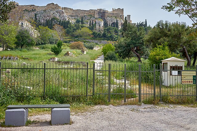
English: "In the southeast of the Ancient Agora in an area with impressive rock foundations, looms the "Eleusinion in the City" ("εν άστει Ελευσίνιο") between the Panathenaic Way on the west and the two branches of the "Street of the Tripods" on the north and south. It was a shrine sacred to the mystery religion of the goddess Demeter and Persephone along with their mortal counterpart Triptolemos. These Eleusinian deities were worshipped here already in the 6th century B.C., in an open-air shrine surrounded by a wall. In the second quarter of the 5th century B.C. the shrine received a small rectangular temple oriented north-south. Of this Ionic tetrastyle amphiprostyle temple, with an inner shrine and shallow pronaos are preserved only the groundwork of three sides. In the 4th century B.C. the need to reinforce the embankment of the temple led to the construction of a strong retaining wall. The area north of the temple embarkment, which is at a lower level acquired a number of rooms in the early Roman period, which have been interpreted as shops or as storerooms for grain for the temple. In the corner at the east are round bases for dedications of the Hellenistic and early Roman periods. In the reorganization of the shrine, in the 2nd century B.C., a colonnade and a propylon were built south of the temple. On the south and farther uphill from the Eleusinian stand a section of the Hadrianic aqueduct (2nd century A.D.) and remains of a round building, ca. 8 meters in diameter, built in the 2nd century B.C., and thought to be a shrine of Pluto." Text: Information board by the entrance to the archaeological site. |
| Date | |
| Source | Own work |
| Author | George E. Koronaios |
| Camera location | | View this and other nearby images on: OpenStreetMap |
|---|
Licensing
[edit]
I, the copyright holder of this work, hereby publish it under the following license:
This file is licensed under the Creative Commons Attribution-Share Alike 4.0 International license.
- You are free:
- to share – to copy, distribute and transmit the work
- to remix – to adapt the work
- Under the following conditions:
- attribution – You must give appropriate credit, provide a link to the license, and indicate if changes were made. You may do so in any reasonable manner, but not in any way that suggests the licensor endorses you or your use.
- share alike – If you remix, transform, or build upon the material, you must distribute your contributions under the same or compatible license as the original.
| Annotations | This image is annotated: View the annotations at Commons |
File history
Click on a date/time to view the file as it appeared at that time.
| Date/Time | Thumbnail | Dimensions | User | Comment | |
|---|---|---|---|---|---|
| current | 15:02, 19 April 2020 | | 6,000 × 4,000 (30.81 MB) | George E. Koronaios (talk | contribs) | Uploaded own work with UploadWizard |
You cannot overwrite this file.
File usage on Commons
There are no pages that use this file.